samedi 23 septembre 2017

Weekly Recap From the Expedition Lead Scientist, week of September 18, 2017


ISS - Expedition 53 Mission patch.

Sept. 23, 2017

(Highlights: Week of September 18, 2017) - Crew members on the International Space Station wrapped up a low-temperature combustion investigation that was sparked by a discovery made during a previous run of experiments aboard the orbiting laboratory, and could help scientists develop new engines and fuels that are more efficient and less harmful to the environment.


Image above: The Zero Boil-OFF Tank (ZBOT) on the International Space Station has a large "ullage" bubble and several smaller bubbles around it. The experimental hardware uses an experimental fluid to test active heat removal and forced jet mixing as alternative means for controlling tank pressure for volatile fluids. Image Credit: NASA.

“Cool flames” were first discovered during the Flammability and Extinction (FLEX) study on the space station in 2013. The Cool Flames investigation followed in an effort to better understand this unique burning behavior. The final run of Cool Flames Investigation led to the dismantling and stowing of the hardware, bringing the operations for the study on the space station to a close. Data from the investigation will now be analyzed by Earth scientists. Some types of fuels initially burn very hot, then appear to go out — but they continue burning at a much lower temperature with no visible flames. These phenomena are called cool flames. The Cool Flames Investigation provides new insight into this phenomenon, as well as new data on fire safety in space.

The Advanced Research Thermal Passive Exchange (ARTE) investigation was also completed. This new heat pipe design reduces the weight of thermal systems while also increasing their efficiency. Scientists want to evaluate the performance of the ARTE heat pipes to keep the overall mass low and save on energy. We won’t have to actively cool some areas with a fan, or actively heat other areas. If successful, this highly conductive pipe could be integrated into future spacecraft, aircraft of supercomputer systems on Earth.


Image above: NASA astronaut Randy Bresnik conducts a study into muscle atrophy on the International Space Station. He conducted an ultrasound on his calf muscle while exercising using a mechanism created by ESA. Image Credit: NASA.

As ARTE completed a heating investigation, the Zero Boil-Off Tank (ZBOT) study was working on better ways to regulate cryogenic fluid or gas. Rocket fuel, spacecraft heating and cooling systems and sensitive scientific instruments rely on very cold cryogenic fluids. Heat from the environment around the cryogenic tanks can cause their pressures to rise, which requires releasing or "boiling off" fluid to release the excess pressure, or actively cooling the tanks in some way. ZBOT uses an experimental fluid to test active heat removal to control tank pressure for volatile fluids.

Cryogenic tanks require complicated storage and flow solutions for fluids that act as both liquid and gas, depending on their temperatures. Results from this investigation into phase change and heat transport will provide data that could improve models used to design lightweight, efficient, and long-duration cryogenic storage in space for fuel tanks and engines, but can also help in the development of storage facilities in laboratories and other industries on Earth.


Image above: ESA astronaut Paolo Nespoli works on packing the SpaceX-Dragon cargo craft, which returned to Earth this week, returning a variety of technological and biological research. Image Credit: NASA.

NASA astronaut Randy Bresnik , ESA (European Space Agency) astronaut Paolo Nespoli and Russian cosmonaut Sergey Ryazanskiy participated in research into muscle atrophy in space with the Myotendinous and Neuromuscular Adaptation to Long-term Spaceflight (Sarcolab-3) study involving the Muscle Atrophy Research & Exercise System (MARES). This investigation studies the adaptation and deterioration of the soleus, or calf muscle, where it joins the Achilles tendon, which links it to the heel and carries loads from the entire body. Muscle fiber samples are taken from crew members before and after flight and analyzed for changes in structural or chemical properties. MRI and ultrasound tests and electrode stimulation are conducted to help assess muscle and tendon changes caused by microgravity exposure.

Space to Ground: Busy Crew: 09/22/2017

Video above: NASA's Space to Ground is a weekly update on what is happening on the International Space Station. Social media users can post with #spacetoground to ask questions or make a comment. Video Credit: NASA.

By understanding the mechanisms behind loss of muscle mass in space, scientists can develop countermeasures that are more effective for the crews -- pharmacological, dietary or exercise-based – and maintain or improve the health and performance of astronauts in orbit. Scientists also can gain insight into certain muscular conditions on Earth. Solutions developed for astronauts could be used for rehabilitation of patients with a variety of muscular conditions.

International Space Station (ISS). Image Credit: NASA

Progress was made on other investigations this week, including: Tropical Cyclone, Combustion Integration Rack (CIR), Long Duration Sorbent Testbed (LDST), Marrow, Actiwatch, Dosetracker, ACME, Fine Motor Skills, FIR LMM, Rodent Research-9, and Lighting Effects.

Related links:

Cool Flames investigation: https://www.nasa.gov/mission_pages/station/research/experiments/1947.html

Advanced Research Thermal Passive Exchange (ARTE): http://www.nasa.gov/mission_pages/station/research/experiments/1911.html

Zero Boil-Off Tank (ZBOT): https://www.nasa.gov/mission_pages/station/research/experiments/1270.html

Sarcolab-3: https://www.nasa.gov/mission_pages/station/research/experiments/738.html

Muscle Atrophy Research & Exercise System (MARES): http://blogs.esa.int/iriss/2015/09/07/the-mares-machine/

Tropical Cyclone: http://www.nasa.gov/mission_pages/station/research/experiments/1973.html

Combustion Integration Rack (CIR): https://www.nasa.gov/mission_pages/station/research/experiments/326.html

Long Duration Sorbent Testbed (LDST): http://www.nasa.gov/mission_pages/station/research/long_duration_sorbent_testbed

Marrow: https://www.nasa.gov/mission_pages/station/research/experiments/1931.html

Dosetracker: https://www.nasa.gov/mission_pages/station/research/experiments/1933.html

ACME: https://www.nasa.gov/mission_pages/station/research/experiments/1908.html

Fine Motor Skills: http://www.nasa.gov/mission_pages/station/research/experiments/1767.html

FIR: https://www.nasa.gov/mission_pages/station/research/experiments/360.html

LMM: https://www.nasa.gov/mission_pages/station/research/experiments/541.html

Rodent Research-9: https://www.nasa.gov/mission_pages/station/research/experiments/2440.html

Lighting Effects: https://www.nasa.gov/mission_pages/station/research/experiments/2279.html

Space Station Research and Technology: https://www.nasa.gov/mission_pages/station/research/index.html

International Space Station (ISS): https://www.nasa.gov/mission_pages/station/main/index.html

Images (mentioned), Video (mentioned), Text, Credits: NASA/Kristine Rainey/John Love, Lead Increment Scientist Expeditions 53 & 54.

Best regards, Orbiter.ch

vendredi 22 septembre 2017

Hubble's Cool Galaxy with a Hot Corona


NASA - Hubble Space Telescope patch.

Sept. 22, 2017


Galaxy NGC 6753, imaged here by the NASA/ESA Hubble Space Telescope, is a whirl of color — the bursts of blue throughout the spiral arms are regions filled with young stars glowing brightly in ultraviolet light, while redder areas are filled with older stars emitting in the cooler near-infrared.

But there is more in this galaxy than meets the Hubble eye.  At 150 million light-years from Earth, astronomers highlighted NGC 6753 as one of only two known spiral galaxies that were both massive enough and close enough to permit detailed observations of their coronas. Galactic coronas are huge, invisible regions of hot gas that surround a galaxy’s visible bulk, forming a spheroidal shape. Coronas are so hot that they can be detected by their X-ray emission, far beyond the optical radius of the galaxy. Because they are so wispy, these coronas are extremely difficult to detect.

Galactic coronas are an example of telltale signs astronomers seek to help them determine how galaxies form. Despite the advances made in past decades, the process of galaxy formation remains an open question in astronomy. Various theories have been suggested, but since galaxies come in all shapes and sizes — including elliptical, spiral, and irregular — no single theory has so far been able to satisfactorily explain the origins of all the galaxies we see throughout the Universe.

Hubble Space Telescope

For images and more information about Hubble, visit:

http://hubblesite.org/
http://www.nasa.gov/hubble
http://www.spacetelescope.org/

Image, Animation, Credits: ESA/Hubble & NASA, Acknowledgement: Judy Schmidt/Text Credits: European Space Agency/NASA/Karl Hille.

Best regards, Orbiter.ch

Soaring Over Jupiter


NASA - JUNO Mission logo.

Sept. 22, 2017


This striking image of Jupiter was captured by NASA’s Juno spacecraft as it performed its eighth flyby of the gas giant planet.

The image was taken on Sept. 1, 2017 at 2:58 p.m. PDT (5:58 p.m. EDT). At the time the image was taken, the spacecraft was 4,707 miles (7,576 kilometers) from the tops of the clouds of the planet at a latitude of about -17.4 degrees.

Citizen scientist Gerald Eichstädt processed this image using data from the JunoCam imager. Points of interest are “Whale's Tail” and "Dan's Spot.”

JunoCam's raw images are available for the public to peruse and process into image products at:

http://www.missionjuno.swri.edu/junocam    

More information about Juno is at:

https://www.nasa.gov/juno and http://missionjuno.swri.edu

Image, Text,  Credits: NASA/Tony Greicius/JPL-Caltech/SwRI/MSSS/Gerald Eichstädt.

Greetings, Orbiter.ch

Positive, Negative or Neutral, It All Matters: NASA Explains Space Radiation


NASA logo.

Sept. 22, 2017

Charged particles may be small, but they matter to astronauts. NASA’s Human Research Program (HRP) is investigating these particles to solve one of its biggest challenges for a human journey to Mars: space radiation and its effects on the human body.

“One of our biggest challenges on a mission to Mars is protecting astronauts from radiation,” said NASA Space Radiation Element Scientist Lisa Simonsen, Ph.D.. “You can’t see it; you can’t feel it.  You don’t know you’re getting bombarded by radiation.”

A common misconception of space radiation is that it’s similar to radiation on Earth. It’s actually quite different. On Earth, radiation coming from the sun and space is mainly absorbed and deflected by our atmosphere and magnetic field.

The main type of radiation people think of on Earth is found in the dentist's office – X-rays. Shielding against X-rays and other types of electromagnetic radiation usually consists of wearing a heavy, lead blanket.


Image above: Galactic cosmic rays (GCRs) are of most concern to NASA. It is challenging to shield against GCRs. They come from exploding stars called supernovae. Image Credit: NASA.

Space radiation, however, is different because it has sufficient energy to collide violently with the nuclei that make up shielding and human tissue. These so-called nuclear collisions cause both the incoming space radiation and shielding nuclei to break-up into many different types of new particles, referred to as secondary radiation.

“In space, there is particle radiation, which is basically everything on the periodic table, hydrogen all the way up through nickel and uranium, moving near the speed of light,” said NASA Research Physicist Tony Slaba, Ph.D. “NASA doesn’t want to use heavy materials like lead for shielding spacecraft because the incoming space radiation will suffer many nuclear collisions with the shielding, leading to the production of additional secondary radiation. The combination of the incoming space radiation and secondary radiation can make the exposure worse for astronauts.”

The HRP is focused on investigating these effects of space radiation on the human body especially those associated with galactic cosmic rays (GCRs).

“There are three main sources of space radiation, but GCRs are of most concern to researchers for a mission to Mars,” said NASA Research Physicist John Norbury, Ph.D. “GCRs that come from exploding stars known as supernovae outside the solar system are the most harmful to the human body.”

Other space radiation sources include the Van Allen Belts where radiation particles are trapped around the Earth and solar particle events (SPEs) which are associated with solar flares and coronal mass ejections and are more likely to occur during times of intense solar activity.

But GCRs are first in mind for the HRP researchers who create countermeasures to protect astronauts from space radiation. The challenge is obtaining adequate data on the GCR exposure and biological consequences. Researchers use NASA’s Space Radiation Laboratory (NSRL) to investigate the effects of ionizing radiation but space radiation is difficult to simulate on Earth. A radiation dose in a lab setting could be more concentrated and given over a shorter timeframe than what an astronaut actually experiences during a year in space.

As NASA prepares for a journey to Mars, it will continue to use, enhance and develop a variety of technologies to protect astronauts. International Space Station dosimeters, Orion’s Hybrid Electronic Radiation Assessor, and the Radiation Assessment Detector can measure and identify high-energy radiation. Protons, neutrons and electrons may be small but they will always matter to NASA.

Positive, Negative or Neutral, It All Matters: NASA Explains Space Radiation

Video above: Charged particles may be small, but they matter to astronauts. NASA’s Human Research Program (HRP) is investigating these particles to solve one of its biggest challenges for a human journey to Mars: space radiation and its effects on the human body. Video Credit: NASA.

NASA's Human Research Program (HRP) is dedicated to discovering the best methods and technologies to support safe, productive human space travel. HRP enables space exploration by reducing the risks to astronaut health and performance using ground research facilities, the International Space Station, and analog environments. This leads to the development and delivery of a program focused on: human health, performance, and habitability standards; countermeasures and risk mitigation solutions; and advanced habitability and medical support technologies. HRP supports innovative, scientific human research by funding more than 300 research grants to respected universities, hospitals and NASA centers to over 200 researchers in more than 30 states.

Related links:

NASA’s Space Radiation Laboratory (NSRL): http://www.nasa.gov/analogs/nsrl

NASA's Human Research Program (HRP): http://www.nasa.gov/hrp

Orion’s Hybrid Electronic Radiation Assessor: https://www.nasa.gov/feature/scientists-and-engineers-evaluate-orion-radiation-protection-plan

Radiation Assessment Detector: https://mars.nasa.gov/msl/mission/instruments/radiationdetectors/rad/

Journey to Mars: https://www.nasa.gov/topics/journeytomars/index.html

Image (mentioned), Video (mentioned), Text, Credits: NASA/Timothy Gushanas/Human Research Strategic Communications/Amy Blanchett/Laurie Abadie.

Greetings, Orbiter.ch

Soyuz rocket carrying Glonass-M Successfully Increased on the Target Orbit


ROSCOSMOS - Glonass Program patch.

09/22/2017

Soyuz 2.1b carrying Glonass-M launch

On September 22, 2017 at 03:03 Moscow time from the State Test Cosmodrome Plesetsk in the Arkhangelsk Region, with the military calculation of the Space Forces of the Military Space Forces, a successful launch of the Soyuz-2.1b medium-range rocket with the Russian navigation satellite Glonass-M was carried out.

The launch was conducted under the general supervision of the commander of the Space Forces, the deputy commander-in-chief of the Air and Space Forces, Colonel General Alexander GOLOVKO.

Glonass-M launched by Soyuz-2.1b

Three minutes after the launch, the Soyuz-2.1b launch vehicle was taken for escorted by the ground-based automated control complex of the Main Test Space Center named after German Titov.

At the estimated time, the GLONASS-M spacecraft was launched into the target orbit by the Fregat upper stage and accepted for control of the ground forces of the Space Forces of the VKS.

A stable telemetry connection is established and maintained with the spacecraft. The on-board systems of the GLONASS-M spacecraft function normally.

Glonass-M navigation satellite

This is the third launch of the Soyuz-2 launch vehicle from the Plesetsk space center in 2017. Flight tests of the Soyuz-2 space rocket complex began at the Plesetsk space center on November 8, Over the past thirteen years, 31 launch of Soyuz-2 carrier rockets from modernization stages 1a, 1b and 1c have been carried out from the northern launch site. In addition, 20 launches of the Soyuz-2 rocket were carried out from the Baikonur cosmodrome.

The spacecraft put into orbit will join the orbital grouping of the Russian Global Navigation Satellite System GLONASS. At present, 25 spacecrafts are part of the GLONASS orbital group, of which the new-generation GLONASS-K spacecraft is being tested, and one GLONASS-M spacecraft is being investigated by the chief designer of the system.

The developers and manufacturers of the Soyuz-2.1b booster rocket, Fregat upper stage, Glonass-M spacecraft are the companies of the ROSKOSMOSA RKC Progress, NGOs Lavochkin and Information Satellite Systems named after Academician MF Reshetnev.

ROSCOSMOS Press Release: https://www.roscosmos.ru/24115/

Images, Video, Text, Credits: ROSCOSMOS/SciNews/Orbiter.ch Aerospace/Roland Berga.

Greetings, Orbiter.ch

jeudi 21 septembre 2017

NASA Measures Hurricane Maria's Torrential Rainfall, Sees Eye Re-open


NASA - EOS Terra Mission patch / NASA - EOS Aqua Mission logo / NASA - Suomi NPP Mission logo.

Sept. 21, 2017

Maria (Atlantic Ocean)

Hurricane Maria has caused catastrophic flooding in Puerto Rico and left a wake of heavy rainfall that NASA measured using a fleet of satellites in space. NASA satellite imagery also saw Maria's eye close up as it tracked across Puerto Rico and re-open after its exit.

Calculating Maria's Rainfall 


Image above: From Sept. 17 to early Sept. 21, 2017 NASA's IMERG estimated that rainfall totals greater than 10 inches (254 mm) were common along Maria's track. IMERG rainfall estimates indicated that more than 20 inches (512 mm) of rain fell over a large part of Puerto Rico. During that period Maria dropped heavy rain in the Leeward Islands, Virgin Islands and Puerto Rico. Image Credit: NASA.

The Global Precipitation Measurement mission or GPM core satellite, a joint mission between NASA and the Japan Aerospace Exploration Agency can measure rainfall from space. That rainfall data, combined with data from other satellites provided a tally of Hurricane Maria's rainfall over the course of several days.

At NASA's Goddard Space Flight Center in Greenbelt, Maryland, NASA's Integrated Multi-satellitE Retrievals for GPM (IMERG) data were used to estimate the total amount of rain that Hurricane Maria dropped from Sept. 17 to early Sept. 21, 2017. During that period Maria dropped heavy rain in the Leeward Islands, Virgin Islands and Puerto Rico. IMERG estimated that rainfall totals greater than 10 inches (254 mm) were common along Maria's track. IMERG rainfall estimates indicated that more than 20 inches (512 mm) of rain fell over a large part of Puerto Rico.

Extreme flooding was reported in the streets of San Juan, the capital of Puerto Rico. The National Weather Service issued flash flood warnings for the entire island. Hurricane Maria has now moved to the northwest of Puerto Rico but is still expected to contribute to rainfall over the island on Friday. Feeder bands of thunderstorms are transporting rain over Puerto Rico and the Dominican Republic even as the hurricane moves toward the Turks and Caicos Islands.

Hurricane Maria's Eye Winks

Hurricane Maria made landfall near Yabucoa, Puerto Rico, around 6:15 a.m. EDT/AST on Sept. 20. Maximum sustained winds in the hurricane were reported to be 149.5 mph (130 knots) as Maria moved toward San Juan, Puerto Rico.


Image above: On Sept. 20 at 10:50 a.m. EDT (14:50 UTC) NASA's Terra satellite provided this visible image as Hurricane Maria was moving over Puerto Rico. The eye had become obscured by clouds. Image Credits: NASA Goddard MODIS Rapid Response Team.

On Sept. 20 at 10:50 a.m. EDT (14:50 UTC) NASA's Terra satellite provided a visible image as Hurricane Maria was moving over Puerto Rico. Maria's eye had become obscured by clouds.

On Sept. 21 at 1:54 a.m. EDT (0554 UTC) the VIIRS instrument aboard NASA-NOAA's Suomi NPP satellite provided a thermal image of Hurricane Maria after it re-emerged eye moved off the coast of Puerto Rico and as just northeast of Hispaniola. The image showed that the eye had become visible again and powerful thunderstorms with very cold cloud tops surrounded it's eye.


Image above: This infrared image of Hurricane Maria was taken from the AIRS instrument aboard NASA's Aqua satellite on Sept. 21 at 2:05 a.m. EDT (0605 UTC). Maria’s eye opened up, and the orange spots indicate that there are clear areas where the sea surface shows through. Powerful thunderstorms (purple) circle the large eye. Image Credits: NASA JPL, Ed Olsen.

Another infrared image of Hurricane Maria was taken from the Atmospheric Infrared Sounder or AIRS instrument aboard NASA's Aqua satellite on Sept. 21 at 2:05 a.m. EDT (0605 UTC). Maria’s eye opened up, and there were clear areas where the sea surface shows through. Powerful thunderstorms circle the large eye where cloud top temperatures of strong thunderstorms in Maria's eyewall as cold as or colder than minus 63 degrees Fahrenheit (minus 53 Celsius).

Warnings and Watches in Effect on Sept. 21

The National Hurricane Center (NHC) said a Hurricane Warning is in effect for the Dominican Republic from Cabo Engano to Puerto Plata, Turks and Caicos Islands and the Southeastern Bahamas. A Tropical Storm Warning is in effect for the Dominican Republic west of Puerto Plata to the northern border of the Dominican Republic and Haiti, Dominican Republic west of Cabo Engano to Andres/Boca Chica. A Tropical Storm Watch is in effect for the Central Bahamas.


Image above: On Sept. 21 at 1:54 a.m. EDT (0554 UTC) the VIIRS instrument aboard NASA-NOAA's Suomi NPP satellite provided this thermal image of Hurricane Maria after it re-emerged eye moved off the coast of Puerto Rico and as just northeast of Hispaniola. Image Credits: NOAA/NASA Goddard Rapid Response Team.

Location and Status of Maria on Sept. 21

At 11 a.m. EDT/AST (1500 UTC), the large eye of Hurricane Maria was located near 20.2 north latitude and 69.1 degrees west longitude. That's about 105 miles (175 km) east-northeast of Puerto Plata, Dominican Republic and about 155 miles (255 km) southeast of Grand Turk Island. Maria is moving toward the northwest near 9 mph (15 kph), and this general motion is expected to continue through tonight. The minimum central pressure based on aircraft data is 960 millibars.

Data from an Air Force Reserve reconnaissance aircraft indicate that maximum sustained winds remain near 115 mph (185 kph) with higher gusts. Maria is a category 3 hurricane on the Saffir-Simpson Hurricane Wind Scale. Some strengthening is possible during the next day or so. Hurricane-force winds extend outward up to 60 miles (95 km) from the center and tropical-storm-force winds extend outward up to 150 miles (240 km).


NASA Measures Hurricane Maria's Track of Torrential Rainfall


Video above: From Sept. 17 to early Sept. 21, 2017 NASA's IMERG estimated that rainfall totals greater than 10 inches (254 mm) were common along Maria's track. IMERG rainfall estimates indicated that more than 20 inches (512 mm) of rain fell over a large part of Puerto Rico. During that period Maria dropped heavy rain in the Leeward Islands, Virgin Islands and Puerto Rico. Video Credits: NASA/JAXA, Hal Pierce.

The NHC said "A turn toward the north-northwest is forecast early Friday, with that motion continuing through early Saturday. On the forecast track, Maria's eye will continue to pass offshore of the northern coast of the Dominican Republic today, and then move near or just east of the Turks and Caicos Islands and southeastern Bahamas tonight and on Friday, Sept. 22.

For forecast updates on Maria, visit: http://www.nhc.noaa.gov/

Suomi NPP (National Polar-orbiting Partnership): http://www.nasa.gov/mission_pages/NPP/main/index.html

Aqua Satellite: https://www.nasa.gov/mission_pages/aqua/index.html

NASA's Integrated Multi-satellitE Retrievals for GPM (IMERG): https://pmm.nasa.gov/category/keywords/imerg

Terra Satellite: http://www.nasa.gov/mission_pages/terra/index.html

Images (mentioned), Video (mentioned), Text, Credits: NASA’s Goddard Space Flight Center, by Rob Gutro.

Greetings, Orbiter.ch

Spacewalk VR Training, Muscle and Bone Research Today


ISS - Expedition 53 Mission patch.

September 21, 2017

International Space Station (ISS). Image Credit: NASA

The Expedition 53 crew is getting ready for a trio of spacewalks next month while helping scientists understand what living in space does to the human body.

NASA astronauts Randy Bresnik and Mark Vande Hei trained for a spacewalk emergency today wearing virtual reality gear. The spacewalkers practiced maneuvering specialized jet packs attached to their spacesuits in the unlikely event they become untethered from the station.


Image above: NASA astronaut Joe Acaba is seen during a spacewalk in March 2009. He was working on the Starboard-1 truss structure while space shuttle Discovery was docked to the station during STS-119. Image Credit: NASA.

The duo will go on a pair of spacewalks on Oct. 5 and 10. NASA astronaut Joe Acaba will join Bresnik Oct. 18 for the third and final spacewalk. The three spacewalkers will replace and lubricate one of two end effectors on the tip of the Canadarm2 robotic arm. They will also replace a pair of cameras located on the station’s truss structure.

More muscle and bone research continued today as cosmonaut Sergey Ryazanskiy joined Italian astronaut Paolo Nespoli for the Sarcolab-3 study. The research observes leg muscle and tendon changes caused by microgravity using an ultrasound scan and other sensors during an exercise session. Bresnik collected his breath sample to help document any bone marrow and blood cell changes his body may be experiencing in space.

Related links:

Sarcolab-3: https://www.nasa.gov/mission_pages/station/research/experiments/738.html

Bone marrow: https://www.nasa.gov/mission_pages/station/research/experiments/1931.html

Expedition 53: https://www.nasa.gov/mission_pages/station/expeditions/expedition53/index.html

Space Station Research and Technology: https://www.nasa.gov/mission_pages/station/research/index.html

International Space Station (ISS): https://www.nasa.gov/mission_pages/station/main/index.html

Images (mentioned), Text, Credits: NASA/Mark Garcia.

Best regards, Orbiter.ch

Thar be rovers


ESA - Mars Express Mission patch.

Sept. 21, 2017

(Click on the image for enlarge)

In the week of 18 September 2017, the low-resolution webcam on ESA’s Mars Express captured some impressive images from between 3000 km to 5000 km altitude.

The image series is being used to calibrate the camera now that it has been promoted to a ‘full’ science instrument (Mars webcam goes pro).

This week, the images provided reasonably good definition for many craters on the surface, including several that are occupied by NASA rovers.

In the composite image above, moving from lower left to upper right, three craters are circled.

The first shows Gale crater, which is occupied by NASA’s Curiosity rover. The second circle, to the right in the middle, shows Gusev Crater, home of the retired Spirit rover. The last circle, at top right of the middle image, also indicates the location of Gale crater and Curiosity.

ESA’s Mars Express

In addition to studies into Mars’ atmosphere, clouds, dust and atmospheric structures and for tracking variations in the polar ice cap, all of the webcam images are published in a public gallery in Flickr, and are automatically posted via Twitter, sometimes within a couple hours of acquisition at Mars.

https://twitter.com/esamarswebcam
http://www.flickr.com/photos/esa_marswebcam/

Mars webcam goes pro: http://www.esa.int/spaceinimages/Our_Activities/Operations/Mars_Webcam_goes_pro

Mars Express: http://www.esa.int/Our_Activities/Space_Science/Mars_Express

Mars Webcam: http://blogs.esa.int/vmc

Images, Text, Credits: ESA/CC BY-SA 3.0 IGO.


Greetings, Orbiter.ch

mercredi 20 septembre 2017

Two Stars, Three Dimensions, and Oodles of Energy


NASA - Chandra X-ray Observatory patch.

Sept. 20, 2017


For decades, astronomers have known about irregular outbursts from the double star system V745 Sco, which is located about 25,000 light years from Earth. Astronomers were caught by surprise when previous outbursts from this system were seen in 1937 and 1989. When the system erupted on February 6, 2014, however, scientists were ready to observe the event with a suite of telescopes including NASA’s Chandra X-ray Observatory.

V745 Sco is a binary star system that consists of a red giant star and a white dwarf locked together by gravity. These two stellar objects orbit so closely around one another that the outer layers of the red giant are pulled away by the intense gravitational force of the white dwarf.  This material gradually falls onto the surface of the white dwarf. Over time, enough material may accumulate on the white dwarf to trigger a colossal thermonuclear explosion, causing a dramatic brightening of the binary called a nova. Astronomers saw V745 Sco fade by a factor of a thousand in optical light over the course of about 9 days.

Astronomers observed V745 Sco with Chandra a little over two weeks after the 2014 outburst. Their key finding was it appeared that most of the material ejected by the explosion was moving towards us. To explain this, a team of scientists from the INAF-Osservatorio Astronomico di Palermo, the University of Palermo, and the Harvard-Smithsonian Center for Astrophysics constructed a three-dimensional (3D) computer model of the explosion, and adjusted the model until it explained the observations. In this model they included a large disk of cool gas around the equator of the binary caused by the white dwarf pulling on a wind of gas streaming away from the red giant.

The computer calculations showed that the nova explosion’s blast wave and ejected material were likely concentrated along the north and south poles of the binary system. This shape was caused by the blast wave slamming into the disk of cool gas around the binary. This interaction caused the blast wave and ejected material to slow down along the direction of this disk and produce an expanding ring of hot, X-ray emitting gas. X-rays from the material moving away from us were mostly absorbed and blocked by the material moving towards Earth, explaining why it appeared that most of the material was moving towards us.

In the figure showing the new 3D model of the explosion, the blast wave is yellow, the mass ejected by the explosion is purple, and the disk of cooler material, which is mostly untouched by the effects of the blast wave, is blue. The cavity visible on the left side of the ejected material (see the labeled version) is the result of the debris from the white dwarf’s surface being slowed down as it strikes the red giant. An inset shows an optical image from the Siding Springs Observatory in Australia with V745 Sco in the center.

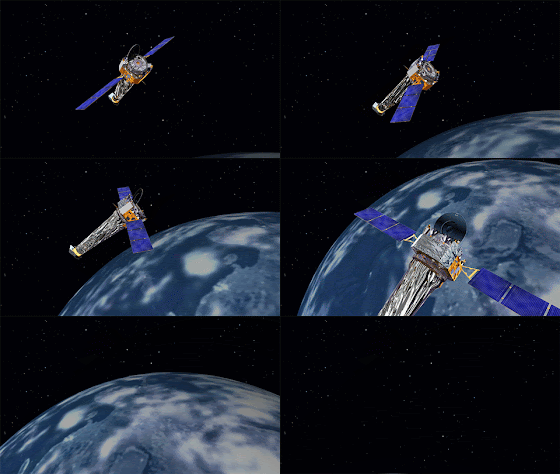
Chandra X-Ray Observatory. Animation Credits: NASA/CXC

An extraordinary amount of energy was released during the explosion, equivalent to about 10 million trillion hydrogen bombs. The authors estimate that material weighing about one tenth of the Earth’s mass was ejected.

While this stellar-sized belch was impressive, the amount of mass ejected was still far smaller than the amount what scientists calculate is needed to trigger the explosion. This means that despite the recurrent explosions, a substantial amount of material is accumulating on the surface of the white dwarf. If enough material accumulates, the white dwarf could undergo a thermonuclear explosion and be completely destroyed. Astronomers use these so-called Type Ia supernovas as cosmic distance markers to measure the expansion of the Universe.

The scientists were also able to determine the chemical composition of the material expelled by the nova. Their analysis of this data implies that the white dwarf is mainly composed of carbon and oxygen.

A paper describing these results was published in the February 1st, 2017 issue of the Monthly Notices of the Royal Astronomical Society and is available online. The authors are Salvatore Orlando from the INAF-Osservatorio Astronomico di Palermo in Italy, Jeremy Drake from the Harvard-Smithsonian Center for Astrophysics in Cambridge, MA and Marco Miceli from the University of Palermo.

NASA's Marshall Space Flight Center in Huntsville, Alabama, manages the Chandra program for NASA's Science Mission Directorate in Washington. The Smithsonian Astrophysical Observatory in Cambridge, Massachusetts, controls Chandra's science and flight operations.

Read More from NASA's Chandra X-ray Observatory: http://chandra.harvard.edu/photo/2017/v745/

Royal Astronomical Society paper: https://arxiv.org/abs/1610.05692

For more Chandra images, multimedia and related materials, visit: http://www.nasa.gov/chandra

Chandra X-Ray Observatory: https://www.nasa.gov/mission_pages/chandra/main/index.html

Image Credits: Illustrated model: NASA/CXC/M.Weiss/Animation (mentioned), Text, Credits: NASA/Lee Mohon.

Best regards, Orbiter.ch

End-of-Summer Arctic Sea Ice Extent Is Eighth Lowest on Record


NASA logo / National Snow and Ice Data Center (NSIDC) logo.

Sept. 20, 2017

Arctic sea ice appeared to have reached its yearly lowest extent on Sept. 13, NASA and the NASA-supported National Snow and Ice Data Center (NSIDC) at the University of Colorado Boulder have reported. Analysis of satellite data by NSIDC and NASA showed that at 1.79 million square miles (4.64 million square kilometers), this year’s Arctic sea ice minimum extent is the eighth lowest in the consistent long-term satellite record, which began in 1978.

Arctic Sea Ice from March to September 2017

Video above: Arctic sea ice appears to have reached a record low wintertime maximum extent for 2017, according to scientists at the NASA-supported National Snow and Ice Data Center (NSIDC) in Boulder, Colorado. Observations indicate that on Sept. 13, 2017 ice extent shrunk to the eighth lowest in the satellite record, at 4.64 million square kilometers, or 1.79 million square miles. Video Credits: NASA's Scientific Visualization Studio/Helen-Nicole Kostis.

Arctic sea ice, the layer of frozen seawater covering much of the Arctic Ocean and neighboring seas, is often referred to as the planet’s air conditioner: its white surface bounces solar energy back to space, cooling the globe. The sea ice cap changes with the season, growing in the autumn and winter and shrinking in the spring and summer. Its minimum summertime extent, which typically occurs in September, has been decreasing, overall, at a rapid pace since the late 1970s due to warming temperatures.

This year, temperatures in the Arctic have been relatively moderate for such high latitudes, even cooler than average in some regions. Still, the 2017 minimum sea ice extent is 610,000 square miles (1.58 million square kilometers) below the 1981-2010 average minimum extent.

“How much ice is left at the end of summer in any given year depends on both the state of the ice cover earlier in the year and the weather conditions affecting the ice,” said Claire Parkinson, senior climate scientist at NASA’s Goddard Space Flight Center in Greenbelt, Maryland. “The weather conditions have not been particularly noteworthy this summer. The fact that we still ended up with low sea ice extents is because the baseline ice conditions today are worse than the baseline 38 years ago.”


Image above: A still image of the Arctic sea ice on Sept. 13, 2017, when the ice reached its annual minimum. In addition, a yellow line marks the 30-year  average minimum sea ice extent computed over the time period from 1981  through 2010. Image Credit: NASA's Scientific Visualization Studio/Helen-Nicole Kostis.

The three years with the lowest Arctic ice extents on record — 2012, 2016 and 2007 — experienced unusual weather conditions, including strong summer storms that hammered the ice cover and sped up its melt. “In all of those cases, the weather conditions contributed to the reduced ice coverage. But if the exact same weather system had occurred three decades ago, it is very unlikely that it would have caused as much damage to the sea ice cover, because back then the ice was thicker and it more completely covered the region, hence making it more able to withstand storms,” Parkinson said.

On the other side of the planet, Antarctica is heading to its maximum yearly sea ice extent, which typically occurs in September or early October. This year’s maximum extent is likely to be among the five lowest in the satellite record — a continuation of the low extents in 2015 and 2016 that represented a dramatic turn of events after a streak of record high maximum extents in 2012, 2013 and 2014. So far, the September Antarctic ice extents this year are comparable to those of a year ago.

“What had been most surprising about the changing sea ice coverage in the past three decades was the fact that the Antarctic sea ice was increasing instead of decreasing,” Parkinson said. “The fact of Arctic sea ice decreases was not as shocking because this was expected with a warming climate, although the overall rate of the decreases was greater than most models had forecast.”

Parkinson said that although it is still too early to talk about a long-term reversal in the behavior of Antarctic sea ice, the decreases witnessed in the past two years provide important data to test the various hypotheses that scientists have put forward to explain why Antarctic sea ice coverage had been increasing, overall, between 1979 and 2015.

Adding the Antarctic and Arctic sea ice extents month by month through the satellite record shows that globally the Earth has been losing sea ice since the late 1970s in each portion of the annual cycle of ice growth and decay. “In fact, this year, every single month from January through August experienced a new monthly record low in global sea ice extents,” Parkinson said.

Related Link: http://nsidc.org/arcticseaicenews/2017/09/arctic-sea-ice-at-minimum-extent-2/

National Snow and Ice Data Center (NSIDC): https://nsidc.org/

Image (mentioned), Video (mentioned), Text, Credits: NASA/Sara Blumberg/Earth Science News Team, by Maria-José Viñas.

Greetings, Orbiter.ch

Detectors: unique superconducting magnets


CERN - European Organization for Nuclear Research logo.

20 Sep 2017


Image above: The enormous toroidal superconducting magnet of ATLAS during its installation. Each of its eight coils, the last of which is being assembled in this photo, is 25 metres long. (Image: ATLAS/CERN).

Even before they were used widely in particle accelerators, superconducting magnets were adopted for the detectors used to analyse collisions. A magnetic field is essential for identifying the particles emerging from collisions: it curves their trajectory allowing physicists to calculate their momentum and to establish whether they have a positive or negative charge. The stronger the field and the larger the volume on which it acts, the higher the resolution of the detector.

As early as the 1960s, physicists saw the potential benefits of using superconducting magnets in their detectors. In the early 1970s, experiments in the United States and at CERN were developing large superconducting magnets capable of generating fields of up to 3.5 Tesla. This development work was all the more daring since the technology was still in its infancy. But contrary to the magnets for accelerators, which need to be produced in their dozens, the magnets in detectors are unique.

One of the trailblazers of these detectors was CERN’s Big European Bubble Chamber (BEBC), which entered service in 1973 and in which the superconducting magnet generated a field of 3.5 Tesla. Its stored energy was almost 800 megajoules, a level of performance that wouldn’t be bettered until the late 1990s.


Image above: The superconducting coil of CMS, the biggest superconducting solenoid magnet ever built, being inserted in its cryostat. (Image: Maximilien Brice/CERN).

In the 1980s, significant progress was made on improving the magnets’ performance and making them more “transparent”, so that they didn’t interact with the particles and change their characteristics. Increasingly larger magnets were constructed and the work culminated in the 2000s with the giant superconducting magnets of the landmark CMS and ATLAS experiments at the Large Hadron Collider (LHC). The first of these is a huge solenoid that generates a field of 4 Tesla and is able to store 2.7 gigajoules, enough energy to melt 18 tonnes of gold. The second is an enormous and completely novel toroidal magnet formed of eight superconducting coils, which also generate a magnetic field of 4 Tesla, surrounding a smaller solenoid.

The next generation of superconducting magnets for detectors, which will be even bigger and more powerful, is being developed in the context of preparations for major accelerator projects at CERN and elsewhere.

This text is published on the occasion of the conference EUCAS 2017 on superconductors and their applications​. It is based on the article entitled “Unique magnets”, which appeared in the September issue of the CERN Courier: http://cerncourier.com/cws/latest/cern

Note:

CERN, the European Organization for Nuclear Research, is one of the world’s largest and most respected centres for scientific research. Its business is fundamental physics, finding out what the Universe is made of and how it works. At CERN, the world’s largest and most complex scientific instruments are used to study the basic constituents of matter — the fundamental particles. By studying what happens when these particles collide, physicists learn about the laws of Nature.

The instruments used at CERN are particle accelerators and detectors. Accelerators boost beams of particles to high energies before they are made to collide with each other or with stationary targets. Detectors observe and record the results of these collisions.

Founded in 1954, the CERN Laboratory sits astride the Franco–Swiss border near Geneva. It was one of Europe’s first joint ventures and now has 22 Member States.

Related links:

Superconducting magnets: http://home.cern/about/engineering/pulling-together-superconducting-electromagnets

Large Hadron Collider (LHC): http://home.cern/topics/large-hadron-collider

CMS: http://home.cern/about/experiments/cms

ATLAS: http://home.cern/about/experiments/atlas

EUCAS 2017: http://eucas2017.org/2017/

For more information about European Organization for Nuclear Research (CERN), Visit: http://home.cern/

Images (mentioned), Text, Credits: CERN/Corinne Pralavorio.

Greetings, Orbiter.ch

Superconductors boost acceleration


CERN - European Organization for Nuclear Research logo.

September 20, 2017


Image above: The new superconducting crab cavities being assembled at CERN. These cavities will be used in the future High-Luminosity LHC to tilt the particle bunches before they collide. (Image: Jules Ordan/CERN).

Thanks to their amazing properties, superconductors have become a vital ally of particle physics. As well as using superconducting magnets to steer particles in the right direction, accelerators use superconducting cavities to accelerate them. During the EUCAS 2017 conference on superconductors and their applications, which is taking place this week in Geneva, many presentations are being made on this subject.

A radiofrequency accelerating cavity is basically a metal chamber in which electromagnetic waves generate an electrical field. As particles pass through the chamber, they receive an electrical impulse. Compared to traditional copper cavities, superconducting cavities generate very strong electrical fields. Those in the Large Hadron Collider (LHC), for example, generate an electrical field of 5 million volts per metre.

The first work on superconducting cavities for particle physics began in the 1960s. But it was not until the 1980s that they were actually used in an accelerator, an electron collider at Cornell University in the United States. Meanwhile, the designers working on the Large Electron-Positron Collider (LEP) at CERN were investigating the technology as a way of doubling the energy level of their machine. The 27-kilometre ring was fitted out with 280 such cavities, allowing the LEP to exceed 200 GeV in the 1990s. The LHC is equipped with similar cavities. The brand new XFEL synchrotron at the DESY laboratory in Germany is made up of no fewer than 800 accelerating cavities, which rely heavily on the work carried out in the 1990s by the TESLA collaboration.

Large Hadron Collider (LHC). Animation Credit: CERN

Today, the development of new superconducting cavities continues, particularly at CERN, where so-called “crab cavities” are under development to tilt particle bunches before they collide in the High-Luminosity LHC. These cavities will help to maximise overlapping of the beams in order to increase the probability of collisions each time they meet, otherwise known as luminosity. At Fermilab, the Cornell Laboratory and SLAC in the United States, new coatings are also being studied to improve performance even further.

This text is based on the article entitled “Souped up RF”, which appeared in the September issue of the CERN Courier: http://cerncourier.com/cws/latest/cern

Note:

CERN, the European Organization for Nuclear Research, is one of the world’s largest and most respected centres for scientific research. Its business is fundamental physics, finding out what the Universe is made of and how it works. At CERN, the world’s largest and most complex scientific instruments are used to study the basic constituents of matter — the fundamental particles. By studying what happens when these particles collide, physicists learn about the laws of Nature.

The instruments used at CERN are particle accelerators and detectors. Accelerators boost beams of particles to high energies before they are made to collide with each other or with stationary targets. Detectors observe and record the results of these collisions.

Founded in 1954, the CERN Laboratory sits astride the Franco–Swiss border near Geneva. It was one of Europe’s first joint ventures and now has 22 Member States.

Related links:

Superconducting cavities: http://home.cern/about/engineering/radiofrequency-cavities

EUCAS 2017: http://eucas2017.org/2017/

Large Hadron Collider (LHC): http://home.cern/topics/large-hadron-collider

Large Electron-Positron Collider (LEP): http://home.cern/about/accelerators/large-electron-positron-collider

The brand new XFEL synchrotron: http://home.cern/about/updates/2017/09/european-xfel-worlds-most-powerful-x-ray-source-starts

DESY laboratory: http://www.desy.de/index_eng.html

High-Luminosity LHC: http://home.cern/topics/high-luminosity-lhc

For more information about European Organization for Nuclear Research (CERN), Visit: http://home.cern/

Image (mentioned), Animation (mentioned), Text, Credits: CERN/Corinne Pralavorio.

Greetings, Orbiter.ch

Weekly Recap From the Expedition Lead Scientist, week of September 11, 2017


ISS - Expedition 53 Mission patch.

Sept. 20, 2017

(Highlights: Week of September 11, 2017) - NASA astronauts Mark Vande Hei, Joe Acaba and Russian cosmonaut Alexander Misurkin launched to the International Space Station on Sept. 12, where they joined Expedition 53 Commander Randy Bresnik of NASA and Flight Engineers Sergey Ryazanskiy of Roscosmos and Paolo Nespoli of ESA (European Space Agency) to continue scientific research aboard the orbiting laboratory.

As Hurricane Irma lashed the state of Florida, an investigation in orbit took data points that could improve weather prediction models and help emergency responders and coastal residents better prepare for future storms. The Cyclone Intensity Measurements from the International Space Station (Tropical Cyclone) investigation captures images and data of major storms approaching landfall. The investigation uses a specialized, automated camera and other instruments to acquire data about the storms through one of the portals on the space station.


Image above: Crew members captured this image of the aurora borealis and a lightning storm as the International Space Station flew over Canada. Image Credit: NASA.

Scientists are demonstrating new techniques for accurate real-time measurement of the intensities of strong tropical cyclones by using passive instrumentation from low-Earth orbit. This method requires measurements of the temperature of the top of the eye wall clouds of the storm and the height of these clouds above sea level. Combined with information on sea-level surface temperatures and air pressure, scientists can more accurately predict the wind speed, strength and intensities of cyclones prior to landfall. This information could assist emergency responders and coastal residents to better prepare for oncoming storms.

Nespoli continued a week-long run of the Magnetic Flux Experiment (MAGVECTOR) investigation. This ESA study looks in to how Earth's magnetic field interacts with an electrical conductor through extremely sensitive magnetic sensors placed around and above a conductor.

Earth's magnetic field is constantly flowing around us. Aside from protecting us from solar winds, it also makes a compass work and birds find their destination when migrating. This same force can interact and interfere with equipment and experiments on the space station. Using magnetic sensors placed near an electrical conductor, MAGVECTOR will help scientists gain insight into how the field influences conductors. The results will help protect future station experiments and electric equipment, and could offer insights into how magnetic fields influence electrical conductors -- the backbone of current technology.


Image above: The Soyuz spacecraft carrying three new crew members approaches the International Space Station on Sept. 12. Image Credit: NASA.

Scientists are also testing other methods to keep the computer systems on the space station functional, especially during high radiation events. Some of the computers on the orbiting laboratory are commercial off-the-shelf (COTS) systems that any consumer can purchase. During the High-Performance COTS Computer System on the ISS (Spaceborne Computer) investigation, scientists want to test if using software to lower the power and, by extension, the speed of the computers can protect the systems without expensive, time-consuming or bulky protective shielding.

Radiation is likely to have unanticipated effects on complex computer systems. Radiation-resistant computers can improve the reliability of these systems in space. This investigation can help identify critical failure points and potential software patches to prevent them. Radiation events like solar flares can also pose risks to computing resources on Earth, such as mobile phone towers and traffic monitoring systems. This research could identify solutions to minimize radiation risk for these systems as well.

A collection of life-sciences investigations were prepared to return on the Dragon spacecraft Sept. 17. Among them was the Cardiac Myocytes investigation, using microgravity to examine how stem cells develop into specific cells – heart cells in this case. This study will help us learn how stem cells develop and demonstrate ways to use space as a production facility for medical and regenerative therapies. It could also help reduce the risk of heart failure and other diseases.


Image above: The signal received from a black hole-companion star celestial event as captured by the Neutron Star Interior Composition Explorer investigation on the space station. The cycle of rays received by NICER as the black hole consumes the star resembles a heartbeat from an electrocardiogram. Image Credit: NASA.

Another investigation is returning live cultures from the station that will help an investigation into 3D bioprinted cardiac and vascular cells. The Maturation Study of Biofabricated Myocyte Construct looks in to the results of developing these cells in microgravity, much like they may grow when the cells are first forming. Scientists believe bioprinted cells will grow and organize more efficiently in space compared to identical cells grown on the ground. The eventual goal is to use tissue from a patient to bioprint complex structures in space, establishing a system to print patient specific tissues and organs in space for transplant back on Earth.

The Neutron Star Interior Composition Explorer (NICER) investigation on the space station observed a compelling celestial event. The study captured X-Ray readings of a companion star in the final stages of descending toward a black hole. The black hole is approximately 10 times larger than our sun. The cycle of X-Ray brightness and dimming as the black hole devours the sun resembles a heart-beat on an electrocardiogram. Further study of this particular pairing will help provide more data on the physics of our universe, including identifying neutron stars and using them to help create accurate navigation systems for spacecraft – like a celestial GPS.

Space to Ground: Full Strength: 09/15/2017

Video above: NASA's Space to Ground is a weekly update on what is happening on the International Space Station. Social media users can post with #spacetoground to ask questions or make a comment. Video Credit: NASA.

Progress was made on other investigations this week, including: Combustion Integration Rack (CIR), Long Duration Sorbent Testbed (LDST), Lighting Effects, Lung Tissue, FIR LMM, Fine Motor Skills, ADSEP, Rodent Research-9, ISS Ham, Cool Flames, Advanced Research Thermal Passive Exchange (ARTE), Tangolab, and SABL2.

Related links:

Tropical Cyclone: http://www.nasa.gov/mission_pages/station/research/experiments/1973.html

Magnetic Flux Experiment (MAGVECTOR): http://www.nasa.gov/mission_pages/station/research/experiments/1176.html

Spaceborne Computer: https://www.nasa.gov/mission_pages/station/research/experiments/2304.html

Cardiac Myocytes: https://www.nasa.gov/mission_pages/station/research/experiments/2404.html

Neutron Star Interior Composition Explorer (NICER): https://www.nasa.gov/mission_pages/station/research/experiments/1966.html

Combustion Integration Rack (CIR): https://www.nasa.gov/mission_pages/station/research/experiments/326.html

Long Duration Sorbent Testbed (LDST): http://www.nasa.gov/mission_pages/station/research/long_duration_sorbent_testbed

Lighting Effects: https://www.nasa.gov/mission_pages/station/research/experiments/2279.html

Lung Tissue: https://www.nasa.gov/mission_pages/station/research/experiments/2399.html

FIR: https://www.nasa.gov/mission_pages/station/research/experiments/360.html

LMM: https://www.nasa.gov/mission_pages/station/research/experiments/541.html

Fine Motor Skills: http://www.nasa.gov/mission_pages/station/research/experiments/1767.html

ADSEP: https://www.nasa.gov/mission_pages/station/research/experiments/378.html

Rodent Research-9: https://www.nasa.gov/mission_pages/station/research/experiments/2440.html

ISS Ham: https://www.nasa.gov/mission_pages/station/research/experiments/346.html

Cool Flames: https://www.nasa.gov/mission_pages/station/research/experiments/1947.html

Advanced Research Thermal Passive Exchange (ARTE): https://www.nasa.gov/mission_pages/station/research/experiments/1911.html

SABL2: https://www.nasa.gov/mission_pages/station/research/experiments/1283.html

Space Station Research and Technology: https://www.nasa.gov/mission_pages/station/research/index.html

International Space Station (ISS): https://www.nasa.gov/mission_pages/station/main/index.html

Images (mentioned), Video (mentioned), Text, Credits: NASA/Kristine Rainey/John Love, Lead Increment Scientist Expeditions 53 & 54.

Best regards, Orbiter.ch

NASA Finds Very Heavy Rainfall in Hurricane Maria


NASA - Suomi NPP Mission logo / NOAA & NASA - GOES Mission logo / NASA & JAXA - GPM Mission patch.

Sept. 20, 2017

Maria (Atlantic Ocean)

NASA looked into Hurricane Maria and found that powerful convective storms within the hurricane were dropping heavy rainfall. Maria brought that heavy rainfall to Puerto Rico and made landfall on Sept. 20 at 6:15 a.m. EDT.


Satellite Analyzes Rainfall in Hurricanes Maria, Jose


Video above: On Sept. 18, 2017, the Global Precipitation Measurement mission, or GPM, core satellite found rain falling at a rate of more than 6.44 inches (163.7 mm) per hour in powerful storms that reached above 9.7 miles (15.7 km). Shades of green to red represent liquid precipitation extending down to the ground. GPM is a joint mission of NASA and the Japan Aerospace Exploration Agency. Video Credits: NASA/JAXA/NASA Goddard's Scientific Visualization Studio.

The Global Precipitation Measurement mission, or GPM, core observatory satellite collected data on rainfall rates as it passed above Hurricane Maria earlier on Sept. 19 at 9:51 p.m. AST/EDT (Sept. 20 0151 UTC). The rainfall analysis was derived from GPM's Microwave Imager (GMI) and Dual-Frequency Precipitation Radar (DPR) data received by the satellite. GPM's radar (DPR Ku band) found that some extreme storms within the hurricane's feeder bands were dropping rain at a rate of greater than 5.4 inches (137 mm) per hour. 

GPM is a joint mission between NASA and the Japan Aerospace Exploration Agency (JAXA).


Image above: NASA-NOAA’s Suomi NPP satellite VIIRS instrument captured this thermal image on Sept. 20, 2017, at 2:12 a.m. EDT (0612 UTC). At the time, Maria’s eye was just east of the American Virgin Islands, and its northwestern quadrant stretched over Puerto Rico. Image Credits: NASA Goddard Rapid Response Team.

NASA-NOAA’s Suomi NPP satellite VIIRS instrument captured a thermal image on Sept. 20 at 2:12 a.m. EDT (0612 UTC). The image showed very cold cloud top temperatures in the powerful thunderstorms in Maria’s eyewall. At the time, Maria’s eye was just east of the American Virgin Islands, and its northwestern quadrant stretched over Puerto Rico.

Landfall in Puerto Rico

The National Hurricane Center noted: “Geostationary satellite images and surface observations indicate that the center of Hurricane Maria made landfall near Yabucoa,

Puerto Rico, around 6:15 a.m. EDT/AST. Maximum sustained winds in the hurricane were reported to be 149.5 mph (130 knots) as Maria moved toward San Juan, Puerto Rico. A sustained wind 60 mph (96 kph) with a wind gust to 113 mph (182 kph) was reported at Yabucoa Harbor, Puerto Rico.”


Image above: On Sept. 19, 2017, at 9:51 p.m. AST/EDT GPM's radar found that some extreme storms within the Hurricane Maria's feeder bands were dropping rain at a rate of greater than 5.4 inches (137 mm) per hour. Image Credits: NASA/JAXA, Hal Pierce.

A National Ocean Service tide gauge at Yabucoa Harbor, Puerto Rico, recently reported a water level of 4.3 feet above Mean Higher High Water (MHHW).

Maria Engulfs Puerto Rico in Satellite Imagery

A visible light image of Hurricane Maria was taken from NOAA’s GOES East satellite on Sept. 20 at 10:45 a.m. EDT (1445) as the Category 4 hurricane was moving across Puerto Rico. The island was totally covered by Maria’s clouds. Maria’s eastern quadrant also covered the western half of Hispaniola.

NOAA manages the GOES Series of satellites and images and animations are created at the NASA/NOAA GOES Project at NASA’s Goddard Space Flight Center in Greenbelt, Maryland.

Warnings and Watches

A Hurricane Warning is in effect for the U.S. Virgin Islands, British Virgin Islands, Puerto Rico, Culebra, and Vieques, Dominican Republic from Cabo Engano to Puerto Plata, Turks and Caicos Islands and the Southeastern Bahamas.


Image above: This visible light image of Hurricane Maria was taken from NOAA’s GOES East satellite on Sept. 20, 2017, at 10:45 a.m. EDT (1445) as the Category 4 hurricane was moving across Puerto Rico. Image Credits: NASA/NOAA GOES Project.

A Tropical Storm Warning is in effect for Dominican Republic west of Puerto Plata to the northern border of the Dominican Republic and Haiti, Dominican Republic west of Cabo Engano to Punta Palenque. A Hurricane Watch is in effect for the Dominican Republic from Isla Saona to Cabo Engano.

Status on Sept. 20, 2017

At 11 a.m. EDT (1500 UTC), the center of Hurricane Maria was located inland over Puerto Rico near 18.4 degrees north latitude and 66.5 degrees west longitude. Maria is moving toward the northwest near 12 mph (19 kph), and this general motion with a gradual decrease in forward speed is expected through early Friday, Sept. 22.  

Maximum sustained winds are near 140 mph (220 kph) with higher gusts. Maria is a Category 4 hurricane on the Saffir-Simpson Hurricane Wind Scale. Little change in strength is forecast during the next 48 hours, and Maria is expected to remain a dangerous major hurricane through Friday. The estimated minimum central pressure is 930 millibars.

On the forecast track, the center will pass offshore of the northeastern coast of the Dominican Republic tonight and Thursday and then move near the Turks and Caicos Islands and southeastern Bahamas Thursday night and Friday.

For updated forecasts, visit: http://www.nhc.noaa.gov/

GOES (Geostationary Environmental Operational Satellites): http://www.nasa.gov/goes/

Suomi NPP (National Polar-orbiting Partnership): http://www.nasa.gov/mission_pages/NPP/main/index.html

GPM (Global Precipitation Measurement): http://www.nasa.gov/mission_pages/GPM/main/index.html

Images (mentioned), Video (mentioned), Text, Credits: NASA’s Goddard Space Flight Center/Harold F. Pierce/Rob Gutro.

Greetings, Orbiter.ch