samedi 18 janvier 2014

The correction of the orbit of the International Space Station


ISS - International Space Station patch.

18/01/2014

January 18, 2014 the correction of the orbit of the International Space Station.

According to calculations by the ballistic and navigation support Mission Control Center FSUE TsNIIMash engines cargo spacecraft Progress M-21M were included in the 09 4:00 Moscow time and worked 528 seconds. As a result, ISS received a velocity increment of 1.18 m/s. The average height of its orbit increased by 2.8 km and reached 417.25 km.

Progress-M reboost ISS

According to the service ballistic and navigation support MCC after the ISS orbit maneuver parameters were as follows:

- The minimum height - 415.29 km
- Maximum height - 436.72 km
- Period - 92.855 min
- Inclination - 51,67°.

ROSCOSMOS Press Release: http://www.federalspace.ru/20139/

Image, Text, Credits: Roscosmos press service and DRM TsNIIMash / NASA / Translation: Orbiter.ch Aerospace.

Greetings, Orbiter.ch

vendredi 17 janvier 2014

NASA Searches for Climate Change Clues in the Gateway to the Stratosphere


NASA - ATTREX Mission patch.


Jan. 17, 2014

NASA's uncrewed Global Hawk research aircraft is in the western Pacific region on a mission to track changes in the upper atmosphere and help researchers understand how these changes affect Earth's climate.

Deployed from NASA's Dryden Flight Research Center in Edwards, Calif., the Global Hawk landed at Andersen Air Force Base in Guam Thursday at approximately 5 p.m. EST and will begin science flights Tuesday, Jan. 21. Its mission, the Airborne Tropical Tropopause Experiment (ATTREX), is a multi-year NASA airborne science campaign.

ATTREX will measure the moisture levels and chemical composition of upper regions of the lowest layer of Earth's atmosphere, a region where even small changes can significantly impact climate. Scientists will use the data to better understand physical processes occurring in this part of the atmosphere and help make more accurate climate predictions.

"We conducted flights in 2013 that studied how the atmosphere works and how humans are affecting it," said Eric Jensen, ATTREX principal investigator at NASA’s Ames Research Center in Moffett Field, Calif. "This year, we plan to sample the western Pacific region which is critical for establishing the humidity of the air entering the stratosphere."


Image above: NASA's Global Hawk 872 on a checkout flight from Dryden Flight Research Center, Edwards, Calif., in preparation for the 2014 ATTREX mission over the western Pacific Ocean. Image Credit: NASA/Tom Miller.

Studies show even slight changes in the chemistry and amount of water vapor in the stratosphere, the same region that is home to the ozone layer, which protects life on Earth from the damaging effects of ultraviolet radiation, can affect climate significantly by absorbing thermal radiation rising from the surface. Predictions of stratospheric humidity changes are uncertain because of gaps in the understanding of the physical processes occurring in the tropical tropopause layer.

ATTREX is studying moisture and chemical composition from altitudes of 55,000 feet to 65,000 feet in the tropical tropopause, which is the transition layer between the troposphere, or the lowest part of the atmosphere, and the stratosphere, which extends up to 11 miles above Earth's surface. Scientists consider the tropical tropopause to be the gateway for water vapor, ozone and other gases that enter the stratosphere. For this mission, the Global Hawk carries instruments that will sample the tropopause near the equator over the Pacific Ocean.

ATTREX scientists installed 13 research instruments on NASA's Global Hawk 872. Some of these instruments capture air samples while others use remote sensing to analyze clouds, temperature, water vapor, gases and solar radiation.

"Better understanding of the exchange between the troposphere and stratosphere and how that impacts composition and chemistry of the upper atmosphere helps us better understand how, and to what degree, the upper atmosphere affects Earth’s climate," Jensen said.

 NASA Deploys ATTREX To Guam to Study Climate Change

In 2013, for the first time, ATTREX instruments sampled the tropopause region in the Northern Hemisphere during winter, when the region is coldest and extremely dry air enters the stratosphere. Preparations for this mission started in 2011 with engineering test flights to ensure the aircraft and its research instruments operated well in the extremely cold temperatures encountered at high altitudes over the tropics, which can reach minus 115 degrees Fahrenheit. ATTREX conducted six science flights totaling more than 150 hours last year.

Jensen and Project Manager Dave Jordan of Ames lead the ATTREX mission. It includes investigators from Ames and three other NASA facilities: Langley Research Center in Hampton, Va., Goddard Space Flight Center in Greenbelt, Md., and the Jet Propulsion Laboratory in Pasadena, Calif. The team also includes investigators from the National Oceanic and Atmospheric Administration, the National Center for Atmospheric Research, universities and private industry.

ATTREX is one of the first research missions of NASA's new Earth Venture project. These small and targeted science investigations complement NASA's broader science research satellite missions. The Earth Venture missions are part of NASA's Earth System Science Pathfinder Program managed by Langley.

For more information about the ATTREX mission, visit: http://espo.nasa.gov/missions/attrex

An ATTREX press kit is available at http://www.nasa.gov/centers/ames/events/2013/attrex.html

Image (mentioned), Video, Text, Credits: NASA / Steve Cole / Ames Research Center / Rachel Hoover / Dryden Flight Research Center / Beth Hagenauer.

Best regards, Orbiter.ch

mercredi 15 janvier 2014

Expedition 38 Preparing for Mission’s Fourth Spacewalk


ISS - Expedition 38 Mission patch.


Jan. 15, 2014

Expedition 38 is working new science delivered aboard Cygnus including ongoing international and commercial research. The crew is also preparing for its fourth spacewalk in five weeks.

Japanese astronaut Koichi Wakata worked on science experiments for students and a commercial organization. Wakata first videotaped a demonstration of the difference between gravity on Earth and microgravity on International Space Station. Later he worked on NanoRacks commercial research gear in the Kibo laboratory on an experiment delivered Sunday aboard the Cygnus resupply craft.

After spending his morning exercising, Flight Engineer Rick Mastracchio spent the rest of the afternoon with maintenance work on the Waste and Hygiene Compartment. He replaced urine hydraulic components in the Harmony node’s bathroom.


Image above: Cosmonauts Oleg Kotov and Sergey Ryazanskiy work outside the station's Russian segment during a Dec. 27 spacewalk.

NASA astronaut Mike Hopkins set up the Space Linear Acceleration Mass Measurement Device (SLAMMD) to measure his body mass. Afterward, he continued work with a vaccine experiment using the commercial generic bioprocessing apparatus to help prevent infections on Earth and in space.

Read about the SLAMMD: http://www.nasa.gov/mission_pages/station/research/experiments/640.html

Commander Oleg Kotov and Flight Engineer Sergey Ryazanskiy are preparing for a spacewalk to complete unfinished work from a previous spacewalk. The cosmonaut duo is scheduled to exit the Pirs docking compartment in their Orlan spacesuits Jan. 27 at 9:10 a.m. EST.


Image above: Astronaut works inside the Destiny laboratory to replace gear on the Combustion Integrated Rack.

During the previous spacewalk that took place Dec. 27, Kotov and Ryazanskiy installed then removed two cameras that experienced telemetry and connectivity issues. The extra work postponed the jettisoning of experiment gear and the installation of a payload boom.

Read about the Dec. 27 Russian spacewalk: http://www.orbiterchspacenews.blogspot.ch/2013/12/station-cosmonauts-complete-spacewalk.html

Cosmonaut and veteran station resident Mikhail Tyurin reconfigured communications gear inside the Rassvet mini-research module. He spent the rest of the afternoon setting up sensors to check temperatures and air flows, checking electronics gear and downloading science data collected for the Obstanovka experiment.

Read more about Obstanovka: http://www.energia.ru/en/iss/researches/study/05.html

The six-member Expedition 38 crew teamed up for an emergency drill Wednesday morning reviewing escape paths, safety gear and communication procedures. Afterward, the crew called down to Mission Control to discuss the results of the drill.

Images, Text, Credits: NASA / NASA TV.

Greetings, Orbiter.ch

The experts behind Gaia's arrival at nothingness


ESA - Gaia Mission patch.

15 January 2014

With a final, modest, thruster burn yesterday afternoon, ESA’s billion-star surveyor finalised its entry into orbit around ‘L2’, a virtual point far out in space. But how do you orbit nothing? And who can show you how to get there, anyway?

Just after 15:30 GMT (16:30 CET) yesterday, Gaia made a short thruster burn, nudging the galactic survey craft onto its planned scientific orbit. The job had been mostly completed last week, after an almost two-hour firing took Gaia into a squiggly path about the L2 Lagrange point, 1.5 million km from Earth.

Gaia mapping the stars of the Milky Way

But this apparently simple manoeuvre belies an astonishing fact: the L2 point consists of precisely nothing. It’s simply a point in space.

Nothing there

“Lagrange points are special – it’s true there’s nothing there,” says Markus Landgraf, a mission analyst at ESOC, ESA’s operations centre in Darmstadt, Germany.

“They are points where the gravitational forces between two masses, like the Sun and Earth, add up to compensate for the centrifugal force of Earth’s motion around the Sun, and they provide uniquely advantageous observation opportunities for studying the Sun or our Galaxy.” 

As seen from this Lagrange point (there are a total of five such points in the Sun–Earth system), the Sun, Earth and Moon will always be close together in the sky, so Gaia can use its sunshield to protect its instruments from the light and heat from these three celestial bodies simultaneously.

Gaia follows a Lissajous orbit

This also helps the satellite to stay cool and enjoy a clear view of the Universe from the other side.

L2 provides a moderate radiation environment, which helps extend the life of the instrument detectors in space.

However, orbits around L2 are fundamentally unstable.

“We'll have to conduct stationkeeping burns every month to keep Gaia around L2, otherwise perturbations would cause it to ‘fall off’ the point,” says Gaia Operations Manager David Milligan.

For those used to seeing images of the International Space Station orbiting Earth, or Mars Express orbiting the Red Planet, it seems intuitive that spacecraft have to orbit something. How do you get a spacecraft to orbit around a point of nothingness?

ESA flight dynamics experts

To maintain this orbit for Gaia’s planned 5-year mission requires extremely careful work by ESA’s flight dynamics team – the experts who determine and predict trajectories, prepare orbit manoeuvres and determine satellite attitudes.

The flight dynamics experts use a range of software tools, developed and refined during decades of support to missions around Earth and across the Solar System.

To plan the orbit, the team applies mathematical models to generate an initial guess for the target orbit and how to get there. This guess must account for the requirements and constraints of the launcher and the needed telecommunications links.

Flight dynamics at ESA

Next, those initial guesses are fed into simulation software to see if the results would violate any of the constraints. Often, no solution is possible.

“That is where expertise and experience are indispensable to reconsider the assumptions and then start all over,” says Frank Dreger, Head of Flight Dynamics.

“There's no commercial source for this sort of software or expertise – it’s been built up over many years at ESOC and represents a capability that is rare in the world and unique in Europe.”

More about:

Gaia overview: http://www.esa.int/Our_Activities/Space_Science/Gaia/Gaia_overview

Gaia factsheet: http://www.esa.int/Our_Activities/Space_Science/Gaia/Gaia_factsheet

Frequently asked questions: http://www.esa.int/Our_Activities/Space_Science/Gaia/Frequently_Asked_Questions_about_Gaia

Gaia brochure: http://www.esa.int/About_Us/ESA_Publications/ESA_BR-296_Gaia_ESA_s_galactic_census

Images, Text, Credits: ESA/ATG medialab; background: ESO/S. Brunier/J. Mai.

Greetings, Orbiter.ch

First Planet Found Around Solar Twin in Star Cluster


ESO - European Southern Observatory logo.

15 January 2014

Six-year search with HARPS finds three new planets in Messier 67

Artist's impression of an exoplanet orbiting a star in the cluster Messier 67

Astronomers have used ESO's HARPS planet hunter in Chile, along with other telescopes around the world, to discover three planets orbiting stars in the cluster Messier 67. Although more than one thousand planets outside the Solar System are now confirmed, only a handful have been found in star clusters. Remarkably one of these new exoplanets is orbiting a star that is a rare solar twin — a star that is almost identical to the Sun in all respects.

Planets orbiting stars outside the Solar System are now known to be very common. These exoplanets have been found orbiting stars of widely varied ages and chemical compositions and are scattered across the sky. But, up to now, very few planets have been found inside star clusters [1]. This is particularly odd as it is known that most stars are born in such clusters. Astronomers have wondered if there might be something different about planet formation in star clusters to explain this strange paucity.

 The star cluster Messier 67 in the constellation of Cancer

Anna Brucalassi (Max Planck Institute for Extraterrestrial Physics, Garching, Germany), lead author of the new study, and her team wanted to find out more. “In the Messier 67 star cluster the stars are all about the same age and composition as the Sun. This makes it a perfect laboratory to study how many planets form in such a crowded environment, and whether they form mostly around more massive or less massive stars.”

The team used the HARPS planet-finding instrument on ESO's 3.6-metre telescope at the La Silla Observatory. These results were supplemented with observations from several other observatories around the world [2]. They carefully monitored 88 selected stars in Messier 67 [3] over a period of six years to look for the tiny telltale motions of the stars towards and away from Earth that reveal the presence of orbiting planets.

Wide-field view of the open star cluster Messier 67

This cluster lies about 2500 light-years away in the constellation of Cancer (The Crab) and contains about 500 stars. Many of the cluster stars are fainter than those normally targeted for exoplanet searches and trying to detect the weak signal from possible planets pushed HARPS to the limit.

Three planets were discovered, two orbiting stars similar to the Sun and one orbiting a more massive and evolved red giant star. The first two planets both have about one third the mass of Jupiter and orbit their host stars in seven and five days respectively. The third planet takes 122 days to orbit its host and is more massive than Jupiter [4].

Zooming in on the star cluster Messier 67

The first of these planets proved to be orbiting a remarkable star — it is one of the most similar solar twins identified so far and is almost identical to the Sun (eso1337) [5]. It is the first solar twin in a cluster that has been found to have a planet.

Two of the three planets are “hot Jupiters” — planets comparable to Jupiter in size, but much closer to their parent stars and hence much hotter. All three are closer to their host stars than the habitable zone where liquid water could exist.

Flying through the star cluster Messier 67

“These new results show that planets in open star clusters are about as common as they are around isolated stars — but they are not easy to detect,” adds Luca Pasquini (ESO, Garching, Germany), co-author of the new paper [6]. “The new results are in contrast to earlier work that failed to find cluster planets, but agrees with some other more recent observations. We are continuing to observe this cluster to find how stars with and without planets differ in mass and chemical makeup.”

Panning across the star cluster Messier 67

Notes:

[1] Star clusters come in two main types. Open clusters are groups of stars that have formed together from a single cloud of gas and dust in the recent past. They are mostly found in the spiral arms of a galaxy like the Milky Way. On the other hand globular clusters are much bigger spherical collections of much older stars that orbit around the centre of a galaxy. Despite careful searches, no planets have been found in a globular cluster and less than six in open clusters. Exoplanets have also been found in the past two years in the clusters NGC 6811 and Messier 44, and even more recently one has also been detected in the bright and nearby Hyades cluster.

[2] This work also used observations from the SOPHIE instrument at the Observatoire de Haute-Provence in France, the Swiss 1.2-metre Leonhard Euler Telescope at ESO's La Silla Observatory in Chile and the Hobby Eberly Telescope in Texas, USA.

[3] Most open clusters dissipate after a few tens of million years. However, clusters that form with a higher density of stars can stay together for much longer. Messier 67 is an example of such a long-lived older cluster and is one of the oldest and best-studied of such clusters close to the Earth.

[4] Mass estimates for planets observed using the radial velocity method are lower estimates: if the planet's orbit is highly inclined it could have a higher mass and create the same observed effects.

[5] Solar twins, solar analogues and solar-type stars are categories of stars according to their similarity to the Sun. Solar twins are the most similar to the Sun, as they have very similar masses, temperatures, and chemical abundances. Solar twins are very rare, but the other classes, where the similarity is less precise, are much more common.

[6] This detection rate of 3 planets in a sample of 88 stars in Messier 67 is close to the average frequency of planets around stars that are not members of clusters.

More information:

This research was presented in a paper entitled “Three planetary companions around M67 stars“, by A. Brucalassi et al., to appear in the journal Astronomy & Astrophysics.

The team is composed of A. Brucalassi (Max-Planck-Institut für extraterrestrische Physik, Garching, Germany [MPE]; Sternwarte, Munich, Germany), L. Pasquini (ESO, Garching, Germany), R. Saglia (MPE; Sternwarte), M.T. Ruiz (Universidad de Chile, Santiago, Chile), P. Bonifacio (GEPI, Observatoire de Paris, CNRS, Univ. Paris Diderot, France), L. R. Bedin (INAF - Osservatorio Astronomico di Padova, Padova, Italy), K. Biazzo (INAF - Osservatorio Astronomico di Catania, Catania, Italy), C. Melo (ESO, Santiago, Chile), C. Lovis (Observatoire de Geneve, Switzerland) and S. Randich (INAF - Osservatorio Astrofisico di Arcetri, Florence, Italy).

ESO is the foremost intergovernmental astronomy organisation in Europe and the world's most productive ground-based astronomical observatory by far. It is supported by 15 countries: Austria, Belgium, Brazil, the Czech Republic, Denmark, France, Finland, Germany, Italy, the Netherlands, Portugal, Spain, Sweden, Switzerland and the United Kingdom. ESO carries out an ambitious programme focused on the design, construction and operation of powerful ground-based observing facilities enabling astronomers to make important scientific discoveries. ESO also plays a leading role in promoting and organising cooperation in astronomical research. ESO operates three unique world-class observing sites in Chile: La Silla, Paranal and Chajnantor. At Paranal, ESO operates the Very Large Telescope, the world's most advanced visible-light astronomical observatory and two survey telescopes. VISTA works in the infrared and is the world's largest survey telescope and the VLT Survey Telescope is the largest telescope designed to exclusively survey the skies in visible light. ESO is the European partner of a revolutionary astronomical telescope ALMA, the largest astronomical project in existence. ESO is currently planning the 39-metre European Extremely Large optical/near-infrared Telescope, the E-ELT, which will become “the world's biggest eye on the sky”.

Links:

Video: ESOcast 62: Three planets found in star cluster: http://www.eso.org/public/videos/eso1402a/

Research paper: A&A letter: http://www.eso.org/public/archives/releases/sciencepapers/eso1402/eso1402a.pdf

Photos of the ESO 3.6-metre telescope: http://www.eso.org/public/images/archive/search/?adv=&subject_name=3.6

Images, Text, Credits: ESO/L. Calçada/IAU and Sky & Telescope/Digitized Sky Survey 2/Acknowledgement: Davide De Martin/Videos: ESO/L. Calçada/N. Risinger/Digitized Sky Survey 2/N. Risinger (skysurvey.org)/Music: movetwo.

Best regards, Orbiter.ch

mardi 14 janvier 2014

Ten years imaging Mars


ESA - Mars Express Mission patch.

Jan. 14, 2014

Ten years ago, on 14 January 2004, Mars Express took its very first images of Mars in colour and in 3D.

To mark the occasion, the team produced a fly-through movie of the ancient flood plain Kasei Valles. The movie is based on the 67-image mosaic released as part of the ten-years-since-launch celebrations in June 2013.

The floodwaters of Mars

The scene spans 987 km in the north–south direction, 19–36°N, and 1550 km in the east–west direction (280–310°E). It covers 1.55 million square kilometres, an area equivalent to the size of Mongolia.

Kasei Valles is one of the largest outflow channel systems on Mars, created during dramatic flood events. From source to sink, it extends some 3000 km and descends 3 km.

Kasei Valles splits into two main branches that hug a broad island of fractured terrain – Sacra Mensa – rising 2 km above the channels that swerve around it. While weaker materials succumbed to the erosive power of the fast-flowing water, this hardier outcrop has stood the test of time.

Artist's view of the Mars Express spacecraft

Slightly further downstream, the flood waters did their best to erase the 100 km-wide Sharonov crater, crumpling its walls to the south. Around Sharonov many small streamlined islands form teardrop shapes rising from the riverbed as water swept around these natural obstacles.

The Planetary Science and Remote Sensing Group at Freie Universität Berlin produced the movie. The processing of the High Resolution Stereo Camera image data was carried out at the DLR German Aerospace Center.

For more information about Mars Express Mission, visit: http://www.esa.int/Our_Activities/Space_Science/Mars_Express

Image, Video, Text, Credits: ESA / DLR / FU Berlin (G. Neukum).

Best regards, Orbiter.ch

Venus mountains create wave trains


ESA - Venus Express Mission patch.

14 January 2014

The planet Venus is blanketed by high-level clouds. At visible wavelengths, individual cloud features are difficult to see, but observations made by instruments on ESA's Venus Express orbiter have revealed many small-scale wave trains. Analysis shows that the waves are mostly found at high northern latitudes, particularly above Ishtar Terra, a continent-sized region that includes the highest mountains on the planet.

Wave trains on Venus. Credit: ESA/Venus Express/VMC/A. Piccialli et al., 2014

Venus is a world of contrasts. On the surface, the temperature reaches 450°C (723.15 K), hot enough to melt lead, while winds in the dense atmosphere blow at a sluggish 3-4 km/h. At the cloud tops, temperatures are a frigid -70°C (203.15 K), but wind speeds reach 300-400 km/h, much faster than hurricanes on Earth.

It might be expected, therefore, that there is little connection between the baking atmosphere close to the ground and the upper atmosphere, some 60-70 km above. However, spacecraft observations over several decades indicate that the relationship more resembles an 'ocean-like' lower atmosphere, topped by an opaque cloud layer which acts like the surface of the ocean. Ripples and air currents visible at the cloud tops provide hints about processes and influences far below.

Early evidence of atmospheric waves being generated by air flowing over major topographic features came in 1985, when two Soviet Vega balloons flying at an altitude of 54 km experienced a bumpy ride above the southern uplands of Aphrodite Terra.

Almost three decades later, observations made by instruments on board Venus Express provide new evidence that confirms the upward propagation of atmospheric waves from the surface to the main cloud deck and above.

These so-called gravity waves can only exist in a stably stratified atmosphere. They can be triggered, for example, by convection (the rise of lighter, warmer air) from below or by horizontal flow passing over an obstacle, such as a mountain. This is the same process that creates ripples on the surface of a river when it flows over a submerged boulder.

Gravity waves are very important since they can transport energy and momentum by propagating both vertically and horizontally through the atmosphere. They are a common feature in the upper atmospheres of terrestrial planets. On Earth, gravity waves frequently reveal their presence through cloud formations, such as in the case of waves on the lee side of mountains. They often take the form of wave trains - a series of waves travelling in the same direction and spaced at regular intervals.

Gravity waves detected with VeRa. Credit: ESA/Venus Express/VeRa/S. Tellmann et al., 2012

Evidence for this wave formation process in the atmosphere of Venus was first reported in November 2012, when an international team, led by Silvia Tellmann of the Rheinisches Institut für Umweltforschung, University of Cologne, Germany, used the Venus Express Radio Science Experiment (VeRa) to obtain atmospheric profiles above the planet's limb at altitudes of 40-90 km.

By studying changes in the frequencies of the radio signals as they were reflected and bent during their passage through the Venus atmosphere en route to Earth, the team obtained more than 500 atmospheric profiles between the spacecraft's arrival at Venus in 2006 and July 2011. The data enabled them to calculate pressure and temperature at different altitudes and locations above the planet.

These side views of the upper atmosphere made it possible to study the dependence of small-scale, vertical temperature variations on local time and latitude. Temperature differences of a few degrees Celsius and vertical wavelengths of 1-4 km were extracted from the data, revealing numerous gravity waves. These were evident as quasi-periodic disturbances on the atmospheric temperature profiles, often hundreds of kilometres across.

The waves were found to be more common at latitudes 60-75 degrees, with the greatest activity on the lee side of mountains in the northern hemisphere.

"We believe that these waves are at least partly associated with atmospheric flow over Ishtar Terra, an upland region which includes the highest mountains on Venus," said Silvia Tellmann. "We don't yet fully understand how such topographic forcing can extend to high levels, but it seems likely to be one of the key processes for the generation of gravity waves at high northern latitudes on Venus. The waves may form when a stable air flow passes over the mountains."

This result has now been confirmed by a separate analysis of waves seen at the cloud tops of Venus in images taken by the Visible Monitoring Camera (VMC) on Venus Express. The new study, published in the January 2014 issue of Icarus, was carried out by an international team led by Arianna Piccialli, a postdoctoral research fellow at the Laboratoire Atmospheres, Milieux, Observations Spatiales (LATMOS-UVSQ), Guyancourt, France. She was based at ESA's ESTEC facility in the Netherlands when the research was undertaken.

High resolution images of Venus' northern hemisphere obtained with the VMC during more than 1500 orbits made it possible to conduct for the first time a detailed study of small-scale features at the cloud tops, 62-70 km above the surface. A systematic visual search in the images was undertaken, and wave patterns were observed in more than 300 images.


Image above: Distribution of different wave types on Venus. Credit: ESA/Venus Express/VMC/A. Piccialli et al., 2014.

 Four types of waves - long, medium, short and irregular - were identified in VMC images, based on their size and shape. Long waves appeared as narrow straight features extending more than a few hundreds of kilometres and with wavelengths (separation of crests) between 7 and 17 km. Medium type waves exhibited irregular wave fronts extending for more than 100 km and with wavelengths of 8 - 21 km. Short waves had a width of several tens of kilometres and extended to a few hundreds of kilometres, with wavelengths of 3 -16 km. Irregular wave fields appeared to be the result of wave interference.

The waves were often identified in images taken at several different wavelengths (ultraviolet – 365 nm; visible – 513 nm; and near-infrared – 965 nm and 1000 nm). As was the case with the waves detected by VeRa, they were mostly found at high latitudes (60-80 degrees N) in a region of high cloud known as 'the cold collar', and they were concentrated above the continent-sized highland of Ishtar Terra.

Artist's impression of Venus Express. Image Credit: ESA

"The elliptical orbit of Venus Express, with pericentre (nearest point to the planet) above northern high latitudes, meant that we could obtain images with a spatial resolution of a few hundreds of metres per pixel in this region," said Arianna Piccialli.

 "Unfortunately, this only enabled us to obtain small snapshots of cloud features. Furthermore, the high speed (9 km/s) of the spacecraft close to pericentre did not allow us to measure the speed of the waves, due to the short time interval between image pairs.

"By themselves, these constraints do not allow us to establish with absolute confidence the nature of these waves. However, by comparing the morphology and properties of the wave features observed in VMC images to those seen by previous observations – such as the VeRa data - it is reasonable to assume that the waves studied here are gravity waves associated with air flow over the uplands of Ishtar Terra."

"This is an exciting result because it strengthens the case that topography is likely to be a significant influence on the atmospheric circulation of Venus," said Håkan Svedhem, ESA's project scientist for Venus Express.

"This influence has been predicted by models but never observed in such detail until now. Understanding the mechanisms of surface influence on atmospheric processes is crucial for understanding the maintenance of the remarkably rapid circulation of the atmosphere at Venus' cloud tops.

"Such results show the versatility of Venus Express, which has made it possible to study the same phenomenon by using two independent and quite different techniques - imaging and radio occultation. It also confirms, once again, that ESA satellites are providing data of crucial importance for understanding our planetary neighbours."

Background Information:

The results described in this article are reported in High latitude gravity waves at the Venus cloud tops as observed by the Venus Monitoring Camera on board Venus Express, by Arianna Piccialli et al., published in Icarus, 227, 94-111, 2014; doi:10.1016/j.icarus.2013.09.012; and Small-scale temperature fluctuations seen by the VeRa Radio Science Experiment on Venus Express, by Silvia Tellmann et al., published in Icarus, 221, 471-480, 2012; doi:10.1016/j.icarus.2012.08.023.

http://dx.doi.org/10.1016/j.icarus.2013.09.012

http://dx.doi.org/10.1016/j.icarus.2012.08.023

Venus Express is Europe's first mission to Venus. It was launched from Baikonur Cosmodrome on 9 November 2005 on a Soyuz-Fregat launcher, and was inserted into Venus orbit on 11 April 2006. Venus Express orbits the planet in a 24 h period polar orbit. Its payload includes a combination of spectrometers, spectro-imagers, and imagers covering a wavelength range from ultraviolet to thermal infrared, a plasma analyser and a magnetometer.

The Venus Monitoring Camera (VMC; principal investigator W. Markiewicz, MPI-Ae, Katlenburg-Lindau, Germany) is a wide-angle multi-channel camera that takes images in the near infrared, ultraviolet and visible wavelengths. The Venus Express Radio Science Experiment (VeRa; principal investigator B. Häusler, Universität der Bundeswehr, München, Germany) uses the powerful radio link between the spacecraft and Earth to investigate the conditions prevalent in the ionosphere and atmosphere of Venus.

For more information about Venus Express Mission, visit: http://www.esa.int/Our_Activities/Space_Science/Venus_Express

Images (mentioned), Text, Credit: ESA.

Greetings, Orbiter.ch

lundi 13 janvier 2014

Internet Radio Provides Musical Space-Weather Reports from NASA's LRO Mission


NASA - Lunar Reconnaissance Orbiter (LRO) patch.

Jan. 13, 2014


Image above: The Cosmic Ray Telescope for the Effects of Radiation, or CRaTER, on NASA's Lunar Reconnaissance Orbiter has six detectors to monitor the energetic charged particles from galactic cosmic rays and solar events. Image Credit: NASA/GSFC.

The latest tool for checking space weather is an internet radio station fed by data from NASA's Lunar Reconnaissance Orbiter, or LRO.

The radio station essentially operates in real time, receiving measurements of how much radiation the spacecraft is experiencing and converting those into a constant stream of music. The radiation levels determine which instrument is featured, the musical key being used and the pitches played.

"Our minds love music, so this offers a pleasurable way to interface with the data," said the leader of the music project, Marty Quinn of the University of New Hampshire, Durham. "It also provides accessibility for people with visual impairments."

The radiation levels are determined by LRO's Cosmic Ray Telescope for the Effects of Radiation, or CRaTER. Equipped with six detectors, CRaTER monitors the energetic charged particles from galactic cosmic rays and solar events.

The instrument makes two kinds of crucial measurements. One type studies the interaction of radiation in space with a material that is like human tissue; this is helping scientists assess the effects that exposure would have on people and organisms. The other type looks at radiation hitting the moon and the products generated by that interaction, which provides a way to explore the composition of the regolith on the moon.

"CRaTER has discovered wide-ranging and fundamental aspects of such radiation," said Nathan Schwadron, the principal investigator for CRaTER. "For example, we have discovered that tissue-equivalent plastics and other lightweight materials can provide even more effective protection than standard shielding, such as aluminum."


Image above: An internet radio station converts radiation measurements from NASA's Lunar Reconnaissance Orbiter into a musical space-weather report. Image Credit: University of New Hampshire.

Each detector on CRaTER reports the number of particles registered every second. These counts are relayed to CRaTER Live Radio, where software converts the numbers into pitches in a four-octave scale. Six pitches are played every second, one for each detector. Higher, tinkly pitches indicate less activity, whereas lower, somber-sounding pitches indicate more activity.

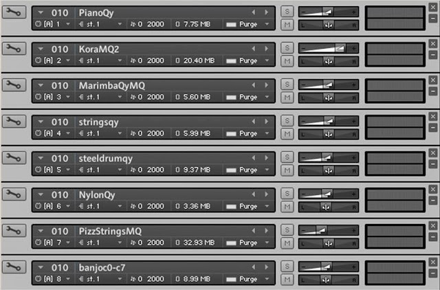
The software selects the primary instrument and a musical key based on recent activity. At the lowest radiation levels, the main instrument will be a piano, playing pitches from one of the major scales. But as the peak radiation level climbs, one of the minor scales will be selected instead, and the piano will be replaced by one of seven other instruments.

For example, when CRaTER picked up elevated radiation counts caused by the solar flare on Jan. 7, 2014, the primary instrument changed to a marimba, which is two instruments up from the piano. A steel drum or guitar instead of a marimba would mean the radiation level had ramped up more. A banjo would mean the peak had climbed to the top of the normal operating range.

If the counts climb beyond the top of the normal operating range – as might happen during a very big event – the software would switch into a second operating range. The piano would again represent the bottom of this range, and the banjo would represent the top. To indicate which range is current, a violin and a cello play sustained notes in the background. If those sustained notes are played at the highest pitches on the scale, the normal operating range is in effect; if those notes drop by even one pitch, the second range is being used.

The radio station is one of CRaTER's official data products and is available online and through an app. The data feed from LRO is live, with one caveat. Whenever the spacecraft moves behind the moon, it cannot line up with data-collecting antennas on Earth, so there is a blackout period of about an hour. During that time, the station reuses the previous hour's data. To indicate that the music is not live, the sound of the bongo drum in the background is changed, and the chiming of the triangle is muted.

The most familiar example of data sonification – conversion into sound – is a simple one: The Geiger counter produces a click every time it detects a radioactive particle.

In the past few decades, scientists in many fields have experimented with sonification, hoping to capitalize on humans' ability to hear small changes instantly, even against a noisy background. Music has the added advantage of making it easy to process many changes at once through variations in pitch, rhythm, tempo, scale, loudness and instrumentation.

"Music makes it easy for people to take in the data, and it seems to be a natural fit for space missions," said LRO's project scientist, John Keller of NASA's Goddard Space Flight Center in Greenbelt, Md.

Sonification has been used to present data from several NASA spacecraft, especially Voyagers 1 and 2 and Kepler. Quinn previously worked on sonification for other NASA missions, including Mars Odyssey, the Solar TErrestrial RElations Observatory, the Advanced Composition Explorer and the Interstellar Boundary Explorer.

LRO is managed by NASA Goddard for the Science Mission Directorate at NASA Headquarters in Washington.

Related Links:

NASA's Lunar Reconnaissance Orbiter: http://www.nasa.gov/lro

CRaTER Live Radio and links to the app: http://prediccs.sr.unh.edu/craterweb/craterliveradio.html

Images (mentioned), Text, Credits: NASA's Goddard Space Flight Center / Elizabeth Zubritsky.

Greetings, Orbiter.ch

Taking Earth’s temperature


ESA - EPS METOP Mission logo / ESA - Sentinel-3 Mission patch.

13 January 2014

Like thermometers in the sky, satellite instruments can measure the temperatures of Earth’s surfaces. ESA’s new GlobTemperature project is merging these data from a variety of spaceborne sensors to provide scientists with a one-stop shop for land, lake and ice temperature data.

Information on land surface temperature is a key parameter for studying the Earth system. It plays an important role in physical processes such as atmospheric convection and surface evaporation, biological processes like vegetation sensitivity to stress and to fire, and chemical processes such as emissions of gases from the surface to the atmosphere.

Long-term trends in surface temperature can also be an indicator of climate change.

Land surface temperature

Meteorologists and climate scientists rely heavily on air temperature measurements made using thermometers installed at ground-based weather stations despite the availability of satellite-derived measurements. This is mainly due to the complexity of the data from different satellite instruments, utilising both infrared and microwave data, and the variety of formats in which the data are made available.

It is also difficult to convert the satellite measurements of the temperature of the solid land surface to the commonly used air temperature. An example of this is the difference in temperature between hot tarmac and cooler grass on a summer’s day even at the same air temperature.

In addition, satellite data suffer from gaps due to cloud cover or provide limited sampling of the day/night temperature cycle.

Temperature changes

To fill these gaps and better meet users’ needs for land surface temperature data, ESA recently initiated the GlobTemperature project under the Data User Element Programme.

GlobTemperature will merge surface temperature data from a variety of satellites into a common format which will be made available in a single online archive.

The data will come from instruments including SEVIRI on Europe’s MSG mission, AVHRR and IASI on MetOp, as well as American and Japanese instruments and from the upcoming Sentinel-3 mission. Archived data from the (A)ATSR instruments flown on the ERS and Envisat missions will also be included.

The new, global datasets developed under GlobTemperature will provide a more complete representation of day and night temperatures, including estimates of clear-sky versus cloudy sky biases.

Related links:

GlobTemperature: user consultation meeting: http://due.esrin.esa.int/meetings/meetings278.php

Data User Element: http://dup.esrin.esa.it/

Estellus: http://www.estellus.fr/

UK Met Office: http://www.metoffice.gov.uk/

Danish Meteorological Institute: http://www.dmi.dk/dmi/index

Project consortium:

University of Leicester: http://www.le.ac.uk/

University of Reading: http://www.reading.ac.uk/

Instituto Portugues do Mar e da Atmosfera: https://www.ipma.pt/pt/

Karlsruhe Institute of Technology: http://www.kit.edu/english/

ACRI-ST: http://www.acri-st.fr/English/

ESA's Earth Observing missions:

Envisat overview: http://www.esa.int/Our_Activities/Observing_the_Earth/Envisat_overview

MetOp overview: http://www.esa.int/Our_Activities/Observing_the_Earth/MetOp_overview
   
Images, Text, Credits: ESA / University of Leicester.

Cheers, Orbiter.ch

The abstract science of the dynamic Sun


ESA / NASA - SOHO Mission patch.

Jan. 13, 2014


The placid appearance of the Sun's surface belies a hot fireball of plasma in constant turmoil. A granular network invisible to the naked eye pervades the solar disc, with cells of hotter and colder plasma popping up, merging and disappearing within only a few hours.

The boundaries between these constantly moving cells are hectic places. Powerful jets of plasma are often launched along the separation lines whenever the cell pattern changes, which may happen as a result of variations in the configuration of the magnetic field – known as ‘magnetic reconnection’.

To learn more about these reconnection jets and the energetic events that cause them, scientists observe the Sun at different wavelengths using a variety of techniques.

This image, which could be mistaken for a piece of abstract art, shows a series of observations performed with the ESA/NASA Solar and Heliospheric Observatory (SOHO) to study the evolution of reconnection jets on a small patch of the Sun’s surface.

The image shows 60 frames taken with the ultraviolet spectrometer SUMER on SOHO over 10 minutes. The individual frames were taken every 10 seconds, so each row of snapshots corresponds to almost three and a half minutes of observations.

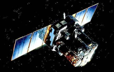
SOHO spacecraft

Each frame shows a spectrum of the light coming from a small patch on the solar disc: the height of each frame measures 84 000 km, which is about a sixteenth of the Sun’s diameter.

The bright red and yellow regions in each frame correspond to boundaries between different cells in the granular pattern of the Sun. In the first few frames of the series, the shape of the central bright region is roughly vertical, a sign that the underlying boundary was in a quiet state.

After only a couple of minutes, however, the situation changed dramatically: towards the end of the first row and at the beginning of the second row, the shape of the bright region appears stretched towards the right. This shift is characteristic of a jet of plasma that is receding from the observed boundary at a speed of about 100 km/s.

The following snapshots report how the same boundary went back to a quiescent state, then underwent the launch of a new jet and became quiet once again. These rapid changes, and the powerful events causing them, indicate the highly dynamic nature of the Sun’s atmosphere.

The data shown in this image were collected on 28 March 1996 and this image was featured in the series of images “The Sun as Art” published on the SOHO website.

Related links:

SOHO - The Sun as Art: http://soho.nascom.nasa.gov/hotshots/2002_08_29

ESA SOHO website: http://sci.esa.int/soho/

Images, Text, Credits: ESA/NASA/SOHO/The SUMER team, Max Planck Institute for Solar System Research, Katlenburg-Lindau, Germany.

Greetings, Orbiter.ch

dimanche 12 janvier 2014

Hubble Sees a Star Set to Explode


NASA - Hubble Space Telescope patch.

Jan. 12, 2014

Hubble Sees a Star Set to Explode

Floating at the center of this new Hubble image is a lidless purple eye, staring back at us through space. This ethereal object, known officially as [SBW2007] 1 but sometimes nicknamed SBW1, is a nebula with a giant star at its center. The star was originally twenty times more massive than our sun, and is now encased in a swirling ring of purple gas, the remains of the distant era when it cast off its outer layers via violent pulsations and winds.

But the star is not just any star; scientists say that it is destined to go supernova. Twenty-six years ago, another star with striking similarities went supernova — SN 1987A. Early Hubble images of SN 1987A show eerie similarities to SBW1. Both stars had identical rings of the same size and age, which were travelling at similar speeds; both were located in similar HII regions; and they had the same brightness. In this way SBW1 is a snapshot of SN1987a's appearance before it exploded, and unsurprisingly, astronomers love studying them together.

At a distance of more than 20 000 light-years it will be safe to watch when the supernova goes off. If we are very lucky it may happen in our own lifetimes.

Notes for editors:

The Hubble Space Telescope is a project of international cooperation between ESA and NASA.

Links:

ESA Hubble website: http://www.spacetelescope.org

NASA Hubble Website: http://hubblesite.org

Image, Text, Credits: ESA / NASA, acknowledgement: Nick Rose.

Greetings, Orbiter.ch

Cygnus Arrives at Station on Orbital-1 Mission


Orbital - Orb-1 Mission patch.

Jan. 12, 2014

Orbital Sciences Corp. Cygnus commercial cargo craft has arrived at the International Space Station on its first resupply mission. NASA astronaut Mike Hopkins was at the controls of the Canadarm2 inside the cupola when he grappled Cygnus at 6:08 a.m. EST Sunday.


Image above: The Cygnus resupply craft is attached to the Canadarm2 while being guided to the Harmony node for installation. Image Credit: NASA TV.

Check out NASA’s Orbital Sciences web page: http://www.nasa.gov/mission_pages/station/structure/launch/orbital.html

Check out Orbital Sciences Commercial Orbital Transportation Services home page: http://www.orbital.com/HumanSpaceExplorationSystems/COTS/

Cygnus Arrives at ISS

Japanese astronaut Koichi Wakata commanded the station’s robotic arm to guide Cygnus to the Earth-facing port of the Harmony node and berthed it at 8:05 a.m. Expedition 38 Flight Engineer Rick Mastracchio then led the effort to get Cygnus bolted and latched to Harmony’s common berthing mechanism.

After the new commercial cargo craft is attached to Harmony, Wakata will begin leak checks in the vestibule, or the area between the docked vehicle and the space station. Hopkins will join Mastracchio for the hatch opening activities on Monday before entering the vehicle to begin five weeks of cargo transfer activities.


Image above: Orbital Sciences' Cygnus commercial resupply craft is on its final approach before being captured. Image Credit: NASA TV.

All three astronauts monitored the approach and rendezvous of Cygnus from inside the cupola. The trio was at the robotics workstation looking out the cupola’s seven windows, observing video display monitors and checking real-time data.

The Antares rocket carrying the Cygnus resupply craft launched Thursday at 1:07 p.m. from Wallops Flight Facility in Virginia and reached orbit 10 minutes later. Cygnus arrived on time at the station despite solar flux activity delaying its launch one day. The increased radiation from the solar flares could potentially have affected the spacecraft’s avionics. Flight controllers reported the six station residents were safe during the solar event that occurred Tuesday.

Read about Thursday’s Orbital-1 launch: http://www.orbiterchspacenews.blogspot.ch/2014/01/new-science-nasa-cargo-launches-to.html

Mission controllers from Orbital Sciences guided Cygnus toward the station during its three-day trip. Once Cygnus came within range of the station Houston and Japanese mission controllers began joint operations with Orbital Sciences. NASA tracked the vehicle during its final approach. The Japan Aerospace Exploration Agency supported Cygnus’ final rendezvous with the station using the Kibo laboratory’s rendezvous gear.


Image above: Orbital Sciences Corp. launched its Cygnus cargo spacecraft aboard its Antares rocket at 1:07 p.m. EST Thursday, Jan. 9, 2014, from the Mid-Atlantic Regional Spaceport Pad 0A at NASA’s Wallops Flight Facility in Virginia. Image Credit: NASA.

The Cygnus cargo vehicle consists of two modules. The service module provides attitude control, propulsion, navigation, electrical power and contains the solar arrays. The pressurized cargo module, which comprises the majority of the vehicle, provides the space for delivering cargo and logistics. However, there is no capacity for the recovery of cargo as the vehicle is intended for a destructive reentry over the Pacific Ocean Feb. 19. It will be unberthed and released from the station Feb. 18.

Orbital Sciences conducted a demonstration mission in September when its first Cygnus commercial resupply craft arrived at the station Sept. 29. The Cygnus delivered 1,300 pounds of non-critical gear, then was reloaded with trash and left the station Oct. 22 for a fiery destruction over the Pacific Ocean.

Read about Orbital Sciences' demonstration mission: http://orbiterchspacenews.blogspot.ch/2013/10/canadarm2-releases-cygnus-after.html

For more information about the International Space Station (ISS), visit: http://www.nasa.gov/mission_pages/station/main/index.html

Images (mentioned), Video,Text, Credit: NASA / NASA TV.

Best regards, Orbiter.ch