jeudi 10 décembre 2020

Solar Orbiter: turning pictures into physics


ESA & NASA - Solar Orbiter Mission patch.


Dec. 10, 2020

Solar Orbiter’s latest results show that the mission is making the first direct connections between events at the solar surface and what’s happening in interplanetary space around the spacecraft. It is also giving us new insights into solar ‘campfires’, space weather and disintegrating comets.

Solar Orbiter

“I could not be more pleased with the performance of Solar Orbiter and the various teams that keep it and its instruments operating,” says Daniel Müller, ESA Solar Orbiter Project Scientist.

“It has been a real team effort under difficult circumstances this year, and now we are beginning to see those efforts really paying off.”

Solar Orbiter’s ten scientific instruments are split into two groups. There are six remote sensing telescopes, and four in-situ instruments. The remote sensing instruments look at the Sun and its extended atmosphere, the corona. The in-situ instruments measure the particles around the spacecraft, which have been released by the Sun and are known as the solar wind, along with its magnetic and electric fields. Tracing the origin of those particles and fields back to the solar surface is one of the key objectives of Solar Orbiter.

During Solar Orbiter’s first close pass of the Sun, which took place on 15 June and saw the spacecraft approach to 77 million kilometres, both remote sensing and in-situ instruments were recording data.

Footprint of the solar wind

Footprints of the solar wind

Solar Orbiter data have made it possible to calculate the source region of the solar wind that hits the spacecraft, and identify this ‘footprint’ in the remote sensing images. In an example studied in June 2020, the footprint is seen at the edge of a region called a ‘coronal hole’, where the Sun’s magnetic field reaches out into space, allowing the solar wind to flow.

Even though the work is preliminary, it is still beyond anything that has been possible so far.

“We’ve never been able to do mapping this accurate before,” says Tim Horbury, Imperial College, London, and Chair of the Solar Orbiter In-Situ Working Group.

Campfire physics

Solar Orbiter also has new information about the Sun’s ‘campfires’ that captured the world’s attention earlier this year.

The mission’s first images showed a multitude of what appeared to be tiny solar eruptions bursting across the surface of the Sun. The scientists called them campfires because the exact energy associated with these events is not yet known. Without the energy, it is not yet clear whether they are the same phenomenon as other smaller-scale eruptive events that have been seen by other missions. What makes it all so tantalising is that small-scale ‘nano-flares' have long been thought to exist on the Sun but we’ve never had the means to see events this small before.

“The campfires could be the nano-flares that we are after with Solar Orbiter,” says Frédéric Auchère, Institut d’Astrophysique Spatiale, Orsay, France, and Chair of the Solar Orbiter Remote-Sensing Working Group.

Solar Orbiter spots ‘campfires’ on the Sun (annotated)

This is important because the nano-flares are theorised to be responsible for heating the corona, the outer atmosphere of the Sun. The fact that the corona is at about a million degrees Celsius whereas the surface is only about 5000 degrees is still one of the most puzzling issues in solar physics today. Investigating this mystery is one of the key scientific objectives of Solar Orbiter.

To explore the idea, researchers have been analysing data by Solar Orbiter’s SPICE (Spectral Imaging of the Coronal Environment) instrument. SPICE is designed to reveal the velocity of the gas at the solar surface. It has shown that there are indeed small-scale events in which the gas is moving with significant velocity but looking for a correlation to the campfires has not yet been done.

“Right now, we only have commissioning data, taken when the teams were still learning the behaviours of their instruments in space, and the results are very preliminary. But clearly, we do see very interesting things,” says Frédéric. “Solar Orbiter is all about discovery, and that is very exciting.”

Surfing a comet’s tail

As well as progress towards the planned scientific objectives of Solar Orbiter, there has also been serendipitous science from the spacecraft too.

Shortly after Solar Orbiter was launched, it was noticed that it would fly downstream of Comet ATLAS, passing through its two tails. Although Solar Orbiter was not designed for such an encounter, and was not due to be taking science data at this time, mission experts worked to ensure that all the in-situ instruments did record the unique encounter.

But Nature had one more trick to play: the comet disintegrated before the spacecraft got close. So, instead of the hoped-for strong signals from the tails, it was entirely possible that the spacecraft would see nothing at all.

That was not the case. Solar Orbiter did see signatures in the data from comet ATLAS, but not the kind of things that scientists would normally expect. Instead of a strong, single tail-crossing, the spacecraft detected numerous episodes of waves in the magnetic data. It also detected dust in patches too. This was probably released from the insides of the comet as it split into many small pieces.

“This is the first time we've essentially traveled through the wake of a comet that's disintegrated,” says Tim. “There's a lot of really interesting data there, and it’s another example of the kind of high-quality fortuitous science we can do with Solar Orbiter.”

An orbit’s worth of particle data

Stealth space weather

Solar Orbiter has been measuring the solar wind for much of its time in space, recording a number of particle ejections from the Sun. Then, on 19 April, a particularly interesting coronal mass ejection swept across Solar Orbiter.

A coronal mass ejection, or CME, is a large space weather event, in which billions of tonnes of particles can be ejected from the Sun’s outer atmosphere. During this particular CME, which burst from the Sun on 14 April, Solar Orbiter was about twenty percent of the way from the Earth to the Sun.

Multipoint detections of a coronal mass ejection

Solar Orbiter wasn’t the only spacecraft that observed this event. ESA’s BepiColombo Mercury mission happened to be flying by the Earth at the time. There was also a NASA solar spacecraft called STEREO situated about ninety degrees away from the direct Sun-Earth line, and looking directly across the area of space that the CME travelled through. It watched the CME impact Solar Orbiter and then BepiColombo and Earth. Combining the measurements from all the different spacecraft allowed researchers to really study the way that the coronal mass ejection evolved as it travelled through space.

This is known as multipoint science and thanks to the number of spacecraft now in the inner solar system, it will become an increasingly powerful tool in our quest to understand the solar wind and space weather.

“We can look at it remotely, we can measure it in-situ and we can see how a CME changes as it travels towards the Earth,” says Tim.

Perhaps just as intriguing as the spacecraft that saw the event, were those that didn’t. The ESA-NASA SOHO spacecraft, which is situated in front of Earth and constantly watches the Sun for eruptions such as this, barely registered it. This puts the 19 April event in a rare class of space weather events, termed a stealth CME. Studying these more elusive events will help us understand space weather more completely.

Solar Orbiter Venus flyby

In the coming years, the opportunities for multipoint science will increase. On 27 December, Solar Orbiter will complete its first Venus flyby. This event will use the planet’s gravity to swing the spacecraft closer to the Sun, putting Solar Orbiter in an even better position for joint measurements with NASA’s Parker Solar Probe, which will also complete two Venus flybys in 2021.

The Sun’s mysteries

As Parker makes in-situ measurements from inside the solar atmosphere, Solar Orbiter will take images of the same region. Together, the two spacecraft will give both the details and the bigger picture.

“2021 is going to be an exciting time for Solar Orbiter,” says Teresa Nieves-Chinchilla, NASA Solar Orbiter Project Scientist. “By the end of the year, all the instruments will be working together in full-fledged science mode, and we will be preparing to get even closer to the Sun.”

In 2022, Solar Orbiter will close to within 48 million kilometres of the Sun’s surface, more than 20 million kilometres closer than it will go in 2021.

Related links:

Solar Orbiter: https://www.esa.int/Science_Exploration/Space_Science/Solar_Orbiter

Sun’s ‘campfires’: http://www.esa.int/Science_Exploration/Space_Science/Solar_Orbiter/Solar_Orbiter_s_first_images_reveal_campfires_on_the_Sun

Images, Animation, Videos, Text, Credits: Solar Orbiter/EUI Team/ESA & NASA; CSL, IAS, MPS, PMOD/WRC, ROB, UCL/MSSL, LFO/IO; Imperial College/EPD (ESA & NASA)/ATG medialab.

Best regards, Orbiter.ch

ESA welcomes announcement of next astronauts to the Moon


ESA - European Space Agency patch.


Dec. 10, 2020

Yesterday NASA announced the names of the 18 astronauts that will support the Artemis Programme and may be assigned to lunar missions.

Artemis banner

The Artemis team is a group of astronauts that will help pave the way for the next lunar missions including sending the first woman and next man to walk on the Moon in 2024.

NASA’s administrator Jim Bridenstine said: “We are excited to share this next step in exploration – naming the Artemis Team of astronauts who will lead the way, which includes the first woman and next man to walk on the lunar surface.”

Orion and European Service Module orbiting the Moon

Artemis astronauts will fly in Orion, the next-generation deep space human spacecraft. While enroute to the Moon and during their return to Earth the European Service Module will keep the astronauts alive, providing water, air, electricity and a comfortable temperature. The European Service Module is the powerhouse of Orion and a critical element to the Artemis programme and ESA is the first international agency to have agreed its astronauts to fly on Orion.

Gateway with Orion

ESA’s director of Human and Robotic Exploration David Parker says: “We welcome these 18 Artemis astronauts and look forward for ESA astronauts to fly to the Gateway in the future with their NASA colleagues.

Moving third European Service Module structure

“We extend an open invitation to the Artemis team to visit the integration hall of Orion’s European Service Module in Bremen, Germany, to get a first-hand view of the hardware that will propel them to our natural satellite and keep them comfortable in deep space to fulfil humankind’s lunar missions and beyond.”

Gateway

Only 12 humans have walked on the lunar surface, all were men, all were from the USA, and most were test pilots. Future Moon explorers will be much more diverse with a variety of professional backgrounds and flight experiences. The missions will be more sustainable, they will no longer be one-shot affairs as space agencies seek more sustained presence.

Gateway with Orion

The Artemis astronauts will not only work on the Moon but also around it on the Gateway, running science and communicating discoveries to all on Earth. ESA is building key modules for the Gateway that will provide refuelling and communications and a habitat for the astronauts. ESA is also exploring designs for new spacecraft, focusing on science and resupply missions.

“ESA and NASA are going to the Moon and beyond as partners and we look forward to working with the Artemis team and taking part in humankind’s greatest adventure of exploration,” concludes David Parker.

NASA related article:

NASA Names Artemis Team of Astronauts Eligible for Early Moon Missions
https://www.nasa.gov/press-release/nasa-names-artemis-team-of-astronauts-eligible-for-early-moon-missions

Related links:

Artemis team: https://www.nasa.gov/specials/artemis-team/

Human and Robotic Exploration: https://www.esa.int/Science_Exploration/Human_and_Robotic_Exploration

Images, Text, Credits: ESA/NASA/ATG Medialab/Airbus.

Greetings, Orbiter.ch

Starship SN8 Takes Flight


SpaceX logo.


Dec. 10, 2020

Starship liftoff

On Wednesday, December 9, Starship serial number 8 (SN8) lifted off from our Cameron County launch pad and successfully ascended, transitioned propellant, and performed its landing flip maneuver with precise flap control to reach its landing point. Low pressure in the fuel header tank during the landing burn led to high touchdown velocity resulting in a hard (and exciting!) landing, the spaceship exploded on impact with the ground.

SpaceX Starship - SN8 - High-Altitude Flight Test

Video above: SpaceX conducted the first attempt of a high-altitude suborbital flight test of Starship serial number 8 (SN8) from the company’s site in Cameron County, Texas, on 9 December 2020. The target altitude for the test was 12.5 kilometres. Video Credits: SpaceX/SciNews.

Starship descent

Thank you to all the locals supporting our efforts in Cameron County and beyond. Congratulations to the entire Starship and SpaceX teams on today’s test! Serial number 9 (SN9) is up next – Mars, here we come!

Starship explosion during hard landing

SpaceX’s Starship spacecraft and Super Heavy rocket (collectively referred to as Starship) represent a fully reusable transportation system designed to carry both crew and cargo to Earth orbit, the Moon, Mars and beyond. Starship will be the world’s most powerful launch vehicle ever developed, with the ability to carry in excess of 100 metric tonnes to Earth orbit.

Related articles:

Starship High-Altitude Flight Test Delayed
https://orbiterchspacenews.blogspot.com/2020/12/starship-high-altitude-flight-test.html

SpaceX Starship is About to Flight its Highest Altitude Test
https://orbiterchspacenews.blogspot.com/2020/12/spacex-starship-is-about-to-flight-its.html

Related link:

SpaceX: https://www.spacex.com/

Images, Video, Text, Credits: SpaceX/BocaChicaGal/Orbiter.ch Aerospace/Roland Berga.

Best regards, Orbiter.ch

CASC - Long March-11 launches GECAM


CASC - China Aerospace Science and Technology Corporation logo.


Dec. 10, 2020

Long March-11 launches GECAM satellites

A Long March-11 launch vehicle launched the GECAM satellite from the Xichang Satellite Launch Center, Sichuan Province, southwest China, on 9 December 2020, at 20:14 UTC (10 December, 04:14 local time).

Long March-11 launches GECAM

The GECAM mission (Gravitational Wave High-energy Electromagnetic Counterpart All-sky Monitor) consists of two satellites into orbit on opposite sides of Earth that will detect electromagnetic counterparts of gravitational waves, high-energy radiation from fast radio bursts, various gamma-ray bursts, and magnetar flares.

GECAM or Gravitational Wave High-energy Electromagnetic Counterpart All-sky Monitor

The GECAM mission consists of two small satellites to detect the electromagnetic counterparts of gravitational waves and other astrophysical signals, aiding in the study of neutron stars and black holes.

For more information about China Aerospace Science and Technology Corporation (CASC), visit: http://english.spacechina.com/n16421/index.html

For more information about China National Space Administration (CNSA), visit: http://www.cnsa.gov.cn/

Images, Video, Text, Credits: China Central Television (CCTV)/SciNews/Orbiter.ch Aerospace/Roland Berga.

Greetings, Orbiter.ch

Sea-level monitoring satellite first results surpass expectations


ESA & NASA - Sentinel-6 Mission patch.


Dec. 10, 2020

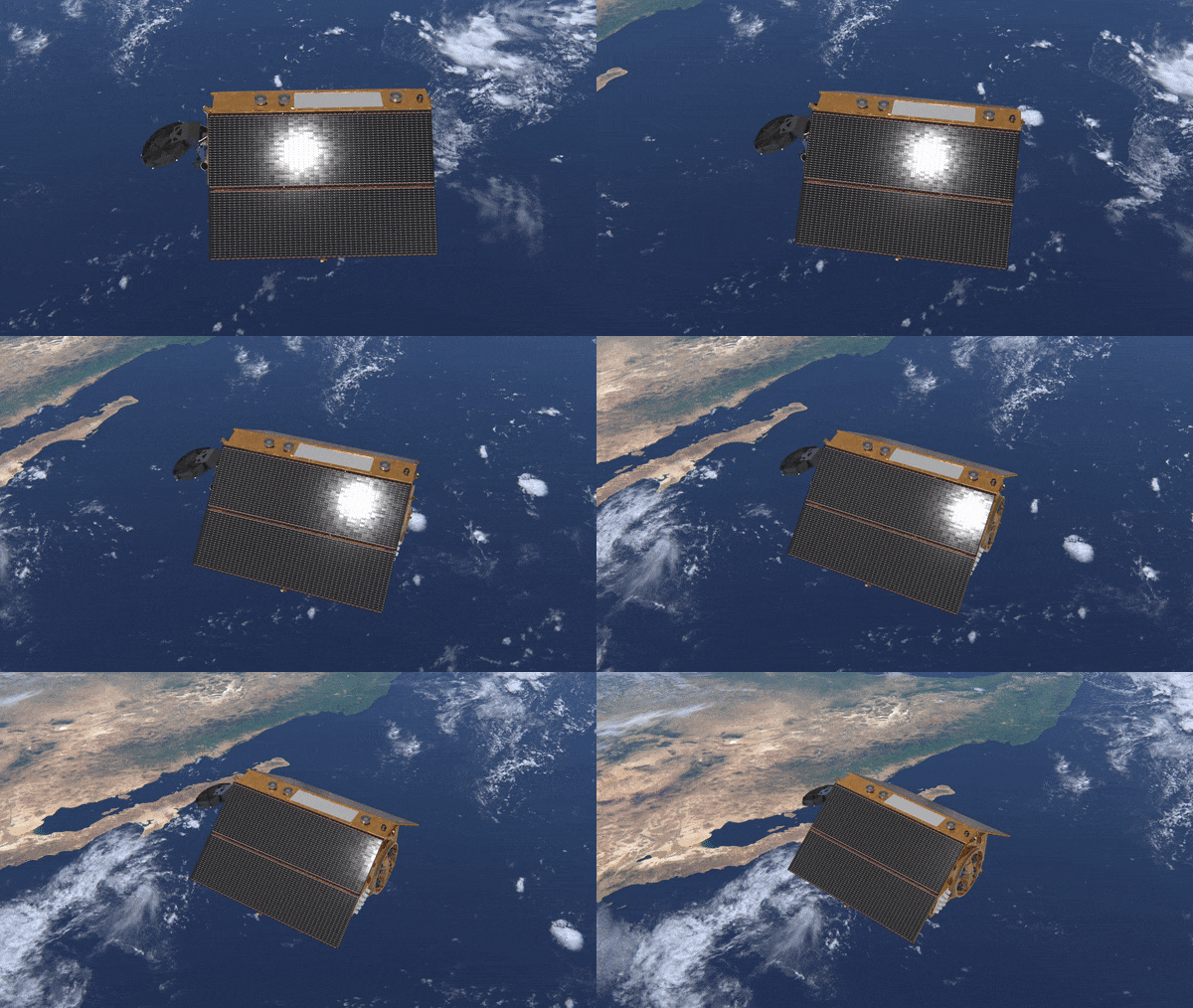
Launched less than three weeks ago, the Copernicus Sentinel-6 Michael Freilich satellite has not only returned its first data, but results also show that it is functioning far better than expected. Thanks to its new, sophisticated, altimetry technology, Sentinel-6 is poised to deliver exceptionally precise data on sea-level height to monitor the worrying trend of sea-level rise.

Sentinel-6 Michael Freilich

Sentinel-6 Michael Freilich was lofted into orbit on 21 November from California. After it had sent back its first signal showing that it was alive and well in space, ESA’s Operations Centre in Germany took care of the satellite’s first few days in orbit before handing it over to Eumetsat for commissioning, and eventual routine operations and distribution of data.

The satellite carries Europe’s latest radar altimetry technology to extend the long-term record of sea-surface height measurements that began in the early 1990s.

On 30 November, flight operators switched on Sentinel-6’s Poseidon-4 altimeter instrument, which was developed by ESA. Analysing its initial data, specialists were astonished by the quality. These first data were presented today, by way of three main images, at the European Space Week.


 First sea-level height results from Copernicus Sentinel-6

The first image (at the top and repeated to the left) shows some preliminary results of sea-surface height. The data are overlaid on a map showing similar products from all of the Copernicus altimetry missions: Jason-3, Sentinel-3A and Sentinel-3B. The background image is a map of sea-level anomalies from satellite altimeter data provided by the Copernicus Marine Environment Monitoring Service for 4 December 2020. The Sentinel-6 data products were generated on 5 December.

The image below shows a comparison between data processed on board the satellite and downlinked (blue line), compared to full raw data processed on the ground (red line). By removing the trailing edge of the data before being transmitted to Earth, the data rate is reduced by 50%. High fidelity low-noise data are thanks to Sentinel-6’s Poseidon-4 digital instrument architecture, which is a first. (Click on image for more information).

Copernicus Sentinel-6 first waveform results

ESA’s mission scientist for Copernicus Sentinel-6, Craig Donlon, explained, “We can already see that the satellite is delivering incredible data, thanks to the digital architecture of Posiedon-4 and the inclusion of simultaneous high-resolution synthetic aperture radar processing and conventional low-resolution mode into altimetry for the first time. This gives us the opportunity to make measurements with much finer synthetic aperture radar techniques that can be compared to Jason-3 to understand the improvement of the climate record.”

“Importantly, we can also see that there is very little noise in the data, so we have extremely clean data to work with.”

The set of images below of Russia’s Ozero Nayval Lagoon and surrounding rivers show multiple views from Copernicus satellites. The first is a ‘camera-like’ image from Sentinel-2; the second is a radar image from Sentinel-1; and next is from Sentinel-6 in its conventional ‘low-resolution’ mode, which does not reveal a lot of information. However, by processing the altimetry data using fully-focussed synthetic aperture techniques usually used for imaging radar data, the resulting image reveals exceptional detail, highlighting the power of the instrument (click on image for more information).

Images above: The images of Russia’s Ozero Nayval Lagoon and surrounding rivers show multiple views from Copernicus satellites.

Director of ESA’s Earth Observation Programmes, Josef Aschbacher, said, “We are delighted with these first results and proud to see our ESA-developed radar altimeter is working so well. Nevertheless, Copernicus Sentinel-6 is a mission that has been built in cooperation with the European Commission, Eumetsat, NASA, NOAA and CNES – with all parties playing essential roles that make this mission the success we are seeing today.”

Another surprising result suggests that the satellites position in space can be better understood than previously thought. A radar altimeter derives the height of the satellite above Earth by measuring how long a transmitted radar pulse takes to reflect from Earth’s surface. Sentinel-6 therefore carries a package of positioning instruments, including a system that can make use of both GPS and Galileo signals. Remarkably, the addition of Galileo measurements brings an improvement in orbit determination quality – which adds to the overall performance of the mission.

More about Copernicus Sentinel-6

Rising seas are at the top of the list of major concerns linked to climate change. Monitoring sea-surface height is critical to understanding the changes taking place so that decision-makers have the evidence to implement appropriate policies to help curb climate change and so that authorities can take action to protect vulnerable communities.

Sea-level monitoring satellite lifts off

The first sea-surface height ‘reference’ measurements were supplied by the French–US Topex-Poseidon satellite, which was followed by three successive Jason missions. They show that since 1993 the global sea level has risen, on average, by just over 3 mm every year. Even more worryingly, over the last few years the global ocean has risen, on average, by 4.8 mm a year.

While the Copernicus Sentinel-6’s role is to continue this legacy of critical measurements, the satellite carries new digital altimeter technology with dedicated onboard processing that will return even more precise measurements of the height of the sea surface.

Copernicus Sentinel-6 in action

Sentinel-6 brings, for the first time, synthetic aperture radar into the altimetry reference mission time series. To ensure that the multi-satellite data time series remains stable, Sentinel-6 delivers simultaneous conventional low-resolution mode measurements, that are similar to measurements from Jason-3, as well as the improved performance of the synthetic aperture radar processing that yields high-resolution along-track measurements. A 12-month tandem flight, where Sentinel-6 flies just 30 seconds behind Jason-3, will be used to compare measurements from the two independent satellites in order to extend the sea-level climate record with confidence.

Related links:

European Space Week: https://www.euspaceweek.eu/event/8a96010d-1675-4d4e-815d-4ae1a7a0ca89/summary?environment=production-eu&5S%2CM3%2C8a96010d-1675-4d4e-815d-4ae1a7a0ca89=

Sentinel-6: https://www.esa.int/Applications/Observing_the_Earth/Copernicus/Sentinel-6

Copernicus: https://www.esa.int/Applications/Observing_the_Earth/Copernicus

Animation, Images, Video, Text, Credits: ESA/S. Corvaja/Contains modified Copernicus Sentinel data (2020), processed by Eumetsat/Contains modified Copernicus Sentinel data (2020), processed by ESA/isardSAT, CC BY-SA 3.0 IGO/Contains modified Copernicus Sentinel data (2020), processed by ESA/Aresys, CC BY-SA 3.0 IGO.

Greetings, Orbiter.ch

mercredi 9 décembre 2020

ESA signs contracts for reusable Space Rider up to maiden flight


ESA - Space Rider patch.


Dec. 9, 2020

ESA has given industry the go-ahead to build Space Rider space and ground segments.

Space Rider

Launched on a Vega-C rocket, this spacecraft will serve as an uncrewed robotic laboratory in low Earth orbit, returning to Earth with its payloads and being reused on future missions.

Space Rider offers routine access to and return from space for a wide range of European space and non-space applications, including in-orbit research and technology demonstrations.

The Space Rider programme achieved major success at Space19+ attracting ten participating States and exceeding funding expectations, enabling ESA to begin negotiations with industry and sign contracts up to completion.

Space Rider mission

ESA signed two contracts with industry on 9 December at Palazzo Chigi in Rome, Italy in the presence of Italian government representatives. The first contract is for delivery of the Space Rider flight model including the reentry module and the AVUM orbital service module, by co-prime contractors: Thales Alenia Space Italy and Avio. The second contract covers the delivery of the ground segment by Italian co-prime contractors: Telespazio and Altec.

Activities are on track for the first flight of Space Rider in the third quarter of 2023 from Europe’s Spaceport in French Guiana.

Scientific experimentation in microgravity for pharmaceutics and biology are key examples of a Space Rider service.

Space Rider animation

Further applications include in-orbit demonstration and validation of a variety of technologies for several applications, such as robotics for exploration, instrumentation for Earth observation, surveillance for Earth disaster monitoring, and satellites inspection.

Space Rider will also provide non-space-based companies with a shortcut into the space arena, bypassing the need to become expert space users.

Space Rider is about the size of two minivans. The reentry module hosts the cargo bay, offering a 1200 litre volume for up to 800 kg of customer payloads seated on a high-technology platform that supplies power along with thermal, control, data-handling and telemetry capability. The reentry module is powered in orbit by Vega-C’s upper stage AVUM+ enhanced with a Life Extension kit serving as service module during missions of at least two months.

Space Rider

Sophisticated avionics of Space Rider distributed along the two modules allow complex manoeuvring for experiments in space. An open cargo bay door gives a field of view to Earth or deep space, and fine pointing capability.

At the end of the mission, a final burn of the Space Rider orbital module will send the reentry module with its user payloads towards the reentry trajectory for a smooth ride back to Earth with a soft precision landing on the ground. After payload recovery and minimal refurbishment, the Space Rider reentry module will be ready to take its next set of payloads on its follow-on mission.

Two Space Rider landing sites are viable: Kourou in French Guiana and Santa Maria in the Azores archipelago (Portugal).

Kourou in French Guiana is considered as the primary landing site because it allows maximum mission performance while Santa Maria is considered as the secondary landing site, suitable for high altitude inclination orbits.

Activities for the preparation of these landing sites will start soon. This is to ensure the timely compliance of the activities with the general planning of the programme.

ESA has also started to share with several potential customers the technical details of the accommodation for payloads on the first flight of Space Rider. The payloads selection will be performed quite soon within the first quarter of 2021.

Contracts signed for Space Rider

“ESA’s Space Rider programme has now moved from being a vision to a reality. It combines reusability, in-orbit operations and transportation, new services, return to Earth with precision landing capability. These are major developments that will extend European knowhow across a wide range of applications” commented Giorgio Tumino, Chief Technical Advisor for Space Transportation and Head of Vega-C and Space Rider developments at ESA.

“Space Rider will complement Vega and Ariane launch services at Europe’s Spaceport and open the door for capturing new market opportunities” he added.

Related links:

Space Rider: http://www.esa.int/Enabling_Support/Space_Transportation/Space_Rider_overview

Space Transportation: https://www.esa.int/Enabling_Support/Space_Transportation

Images, Video, Text, Credits: ESA/Jacky Huart/Thales Alenia Space Italy.

Best regards, Orbiter.ch

Tekniker will lead the project to build the first wind generator for Mars


Tekniker logo.


Dec. 9, 2020

It seeks to take advantage of the environment and environmental conditions to convert wind energy into electricity and use it as an auxiliary energy source

The Tekniker technology center will lead the HORACE project with the aim of building the first wind generator for future use on Mars as a secondary source of energy. The initiative, which will start in January 2021, is funded by the European Space Agency (ESA) and will contribute to the future exploration of the red planet.

Tekinker has explained that one of the main limitations of exploration missions to Mars lies in the extreme environmental conditions of the red planet, whose storms can last up to six continuous months.

Tekniker will manufacture a prototype wind turbine for the red planet. Image Credit: Tekniker

"These meteorological conditions make the development of constant and reliable energy supplies essential both for the exploration of Mars and for the future possibility of installing human colonies on the planet that are energetically sustainable", he pointed out.

In this context, the Basque technology center Tekniker, a member of the Basque Research and Technology Alliance (BRTA), will be in charge of leading and developing the HORACE (Triboelectric Energy Harvesting for Mars Exploration) project. The initiative, which starts in January 2021, is funded by the European Space Agency (ESA) and will have as its main objective the development of the first wind generator for Mars built and tested for use in future space missions.

The project consists of taking advantage of the environment and the environmental conditions of Mars to convert wind energy into electrical energy and use it as an auxiliary energy source for the usual solar panels on expeditions to the red planet, when they do not produce energy due to Martian storms.

Alternative

Specifically, Tekniker, which has extensive experience in space technology and in the design, development and manufacture of complex mechatronic systems, as well as in the areas of materials and tribology, will manufacture a triboelectric generator (TENG) demonstrator, an innovative technology that converts mechanical energy into electricity through the triboelectric effect and electrostatic induction.

It is an alternative to the usual electromagnetic generators (EG), whose use in this type of planetary exploration is limited by its high weight, which entails high launch costs. "The peculiarity of the system is that its operation will be based on a triboelectric generator, instead of the usual electromagnetic ones, with the aim of reducing weight and costs", explains Borja Pozo, researcher and coordinator of the space sector at Tekniker.

Furthermore, Tekniker will design and implement a prototype based on a vertical wind turbine allowing easy integration of the different elements of the system.

Tekniker - Technological and Research Center. Image Credit: Tekniker

Finally, the operation of the prototype will be verified and validated under various atmospheric conditions in the Martian chamber of the University of Aarhus (Denmark). In this way, a low weight and efficient wind turbine demonstrator will be developed, contributing to the space exploration of Mars.

The conclusions of the testing in a laboratory environment will serve to "define and establish a roadmap for the industrialization of the model", including its qualification and possible improvements and limitations. Likewise, the scalability parameters of the system may be established for future developments, such as large power generators.

This project is scheduled to be completed in June 2022 and is aimed at Martian exploration within the lines set by ESA, The Basic Technology Research Program (TRP), The Mars Robotic Exploration Preparation (MREP) and The Human Exploration and Transportation.

Tekniker: https://www.tekniker.es/en

Images (mentioned), Text, Credits: Europapress/Tekniker/Orbiter.ch Aerospace/Roland Berga.

Greetings, Orbiter.ch