NASA & JAXA - Global Precipitation Measurement (GPM) logo.
Oct. 5, 2015
NASA IMERG Measures Historic Rainfall from a Nor'easter and Joaquin
NASA's Integrated Multi-satellite Retrievals for the Global Precipitation Measurement mission (IMERG) data were used to estimate the historic amount of rain that fell in the Carolinas and from Hurricane Joaquin over the Bahamas.
GPM Video of the Rainfall Totals from Joaquin
Video above: NASA/JAXA's GPM satellite measured record rainfall that fell over the Carolinas from September 26 to October 5 from a plume of moisture from Hurricane Joaquin when it was located over the Bahamas and moved to Bermuda. The IMERG showed highest rainfall totals near 1,000 mm (39.3 inches) in a small area of South Carolina and rainfall between 700 and 900 mm (27.5 and 37.4 inches) over a large area of South Carolina. Video Credits: SSAI/NASA/JAXA, Hal Pierce.
Record rainfall fell over the Carolinas from September 26 to October 5 from a plume of moisture from Hurricane Joaquin when it was located over the Bahamas and moved to Bermuda. The IMERG showed highest rainfall totals near 1,000 mm (39.3 inches) in a small area of South Carolina and rainfall between 700 and 900 mm (27.5 and 37.4 inches) over a large area of South Carolina.
The analysis, created at NASA's Goddard Space Flight Center in Greenbelt, Maryland, indicated that major Hurricane Joaquin also dropped over 700 mm (27.5 inches) and a large part of the south and central Bahamas. Hurricane Joaquin has weakened from a category four hurricane in the Bahamas and moved northeast toward Bermuda.
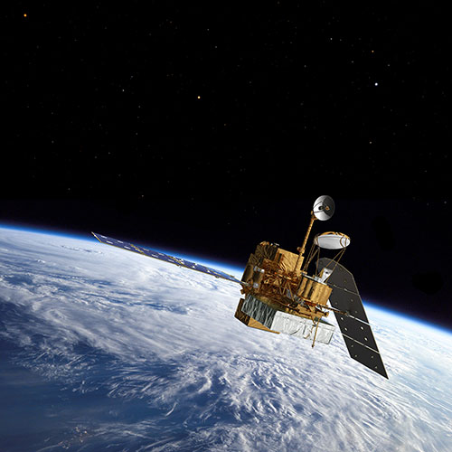
NASA/JAXA's GPM satellite. Image Credits: NASA/JAXA
The South Carolina Department of Transportation noted that hundreds of roads remain closed Monday across the state. On October 5, the National Weather Service (NWS) still carried Flash Flood warnings for portions of Charleston County, Berkeley County and Dorchester County all in southeastern South Carolina. NWS in Charleston, South Carolina said on Oct. 5 at 6:58 a.m. EDT, "low pressure off the northeast South Carolina coast will move slowly offshore through Tuesday [Oct. 6]."
GPM is the Global Precipitation Measurement mission core satellite, managed by both NASA and the Japan Aerospace Exploration Agency.
Related links:
The South Carolina Department of Transportation: http://dbw.scdot.org/RoadConditionsemr/default.aspx
National Weather Service (NWS): http://forecast.weather.gov/showsigwx.php?warnzone=SCZ052&warncounty=SCC015&firewxzone=SCZ052&local_place1=5%20Miles%20WNW%20Mount%20Pleasant%20SC&product1=Flash+Flood+Warning&lat=32.8588&lon=-79.9357#.VhKAKCuTLii
For more information about GPM (Global Precipitation Measurement), visit: http://www.nasa.gov/mission_pages/GPM/main/index.html and http://www.eorc.jaxa.jp/GPM/index_e.htm
Image (mentioned), Video (mentioned), Text, Credits: NASA's Goddard Space Flight Center/Hal Pierce.
Best regards, Orbiter.ch


