


NASA - ISS-RapidScat logo / NASA - Aqua EOS Mission logo.
July 22, 2015
Halola (was 01C - Central Pacific)

Image above: On July 21, the RapidScat instrument observed Halola's strongest winds were on the northern side of the storm near 30 meters per second (108 kph/67 mph). Image Credits: NASA JPL, Doug Tyler.
Typhoon Halola's strongest typhoon-force winds were located on the northern half of the storm, as identified from the RapidScat instrument that flies aboard the International Space Station.
Animation above: A video camera on the International Space Station captured this view of the the ISS-RapidScat instrument in action. Animation Credit: NASA.
RapidScat gathered surface wind data on the Typhoon Halola on July 21at 2 p.m. GMT (10 a.m. EDT). RapidScat data showed that the strongest sustained winds stretched from northwest to northeast of the center at speeds up to 30 meters per second (108 kph/67 mph). Strong winds wrapped around the center of circulation from northwest to east to the southern quadrant, while the weakest winds were on the storm's western side.

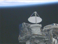
Artist's rendering of NASA's ISS-RapidScat instrument. Image Credit: NASA
On July 14 at 1500 UTC (11 a.m. EDT), Halola had sustained winds near 75 knots (86 mph/138.9 kph). Halola was located near 24.0 North latitude and 137.1 East longitude, about 554 nautical miles (638 miles/1,027 km) east-southeast of Kadena Air Force Base, Okinawa, Japan. Halola was moving to the north at 9 knots (10.3 mph/16.6 kph).
For updated forecasts and local warnings and watches, visit the Japan Meteorological Agency website: http://www.jma.go.jp/en/warn/index.html.
Halola continues to intensify and the Joint Typhoon Warning Center forecast calls for the storm to peak at 95 knots on July 24. After July 24, Halola is expected to begin weakening as the storm approaches Kyushu.
July 21, 2015 - NASA Sees Halola Become a Typhoon Again
The tropical cyclone that developed in the North Central Pacific Ocean and tracked into the Western Pacific Ocean is now on its second go-round as a typhoon. NASA's Aqua satellite flew over Typhoon Halola in the northwestern Pacific Ocean and saw that the storm had again developed an eye.
Halola was at typhoon status on July 14 when Aqua had passed over the storm before. Now, on July 21, Halola regained typhoon status as Aqua again flew overhead.

Image above: When NASA's Aqua satellite passed over Halola on July 21, 2015, at 03:55 UTC, the storm had developed an eye and regained typhoon status.
Image Credits: NASA Goddard's MODIS Rapid Response Team.
When NASA's Aqua satellite passed over Halola on July 21 at 03:55 UTC (11:55 p.m. EDT/July 20) the Moderate Resolution Imaging Spectroradiometer or MODIS instrument gathered visible-light data on the storm. The MODIS image showed the Halola had again developed a 5 nautical mile (5.7 miles/9.2 km) wide eye.
At 1500 UTC (11 a.m. EDT), Halola's maximum sustained winds had increased to 75 knots (86 mph/138.9 kph). It was centered near 23.1 North latitude and 141.2 East longitude, about 116 nautical miles south of Iwo To island, Japan. Halola has tracked west-northwestward at 11 knots (12.6 mph/20.3 kph).

Aqua satellite. Image Credit: NASA
The Joint Typhoon Warning Center (JTWC) expects Halola to peak at 90 knots in the next two days and then begin weakening as it approaches Japan. For the latest watches and warnings from the Japan Meteorological Agency, visit: http://www.jma.go.jp.
By July 24, the JTWC expects Halola to pass the islands of Maimi Diato Jima and Anami Oshima on its way to landfall in southern Japan.
For more information about ISS-RapidScat, visit: http://www.nasa.gov/mission_pages/station/research/experiments/1067.html
For more information about Aqua satellite mission, visit: http://aqua.nasa.gov/
Images (mentioned), Animation (mentioned), Text, Credits: NASA's Goddard Space Flight Center/Rob Gutro.
Cheers, Orbiter.ch