vendredi 2 octobre 2020

SpaceX - Falcon 9 aborted launch with GPS III SV04


SpaceX - Falcon 9 / GPS III SV04 Mission patch.


Oct. 2, 2020

Falcon 9 aborted launch with GPS III SV04

Falcon 9 aborted launch with GPS III SV04

The launch of a SpaceX Falcon 9 rocket with he GPS III Space Vehicle 04 mission (GPS III SV04) was aborted due to an unknown reason from Space Launch Complex 40 (SLC-40) at Cape Canaveral Air Force Station, Florida, on 3 October 2020, at 01:43 UTC (2 October, at 21:43 EDT).

SpaceX: https://www.spacex.com/

Image, Video, Text, Credits: SpaceX/SciNews/Orbiter.ch Aerospace/Roland Berga.

Greetings, Orbiter.ch

Liftoff of Northrop Grumman CRS-14!


Northrop Grumman - Cygnus NG-14 Mission patch.


Oct. 2, 2020

Northrop Grumman’s Antares rocket carrying the Cygnus lifted off

Northrop Grumman’s Antares rocket carrying the Cygnus cargo spacecraft lifted off at 9:16 p.m. EDT from Virginia Space’s Mid-Atlantic Regional Space Port Pad-0A at NASA’s Wallops Flight Facility in Virginia.

NG-14 Antares launches S.S. Kalpana Chawla Cygnus

Cygnus is on its way to the International Space Station with almost 8,000 pounds of cargo. At the time of launch, the station was flying over the Southern Indian Ocean.

S.S. Kalpana Chawla Cygnus (NG-14)

Cygnus Separates From Antares Second Stage

The Cygnus spacecraft has separated from the second stage of the Antares rocket.

Cygnus Safely in Orbit

The Cygnus spacecraft is safely in orbit on its journey with nearly 8,000 pounds of cargo for the International Space Station.

Cygnus cargo spacecraft, commercial resupply for ISS

Live launch coverage has wrapped. Shortly after 11 p.m. EDT, commands will be given to deploy the spacecraft’s solar arrays. Solar array deployment is expected to be complete by midnight.

Related articles:

Launch of Northrop Grumman’s Antares rocket carrying a Cygnus spacecraft Scrubbed
https://orbiterchspacenews.blogspot.com/2020/10/launch-of-northrop-grummans-antares.html

Cygnus Carries Toilet, Cancer Research, VR Camera to Space Station on 14th Mission
https://orbiterchspacenews.blogspot.com/2020/09/cygnus-carries-toilet-cancer-research.html

Related links:

Northrop Grumman: https://www.northropgrumman.com/

International Space Station (ISS): https://www.nasa.gov/mission_pages/station/main/index.html

Images, Video, Text, Credits: Northrop Grumman/NASA Wallops/Patrick Black/NASA/Rob Garner/SciNews/Orbiter.ch Aerospace/Roland Berga.

Best regards, Orbiter.ch

Space Station Science Highlights: Week of September 28, 2020


ISS - Expedition 63 Mission patch.


Oct. 2, 2020

During the week of Sept. 28, crew members aboard the International Space Station conducted scientific investigations, including studies of cardiovascular health and fire safety, and worked on several educational activities. The crew also prepared for arrival of the Northrop Grumman Cygnus space freighter carrying nearly 8,000 pounds supplies and gear including an advanced space toilet and brand-new science experiments.

Now in its 20th year of continuous human presence, the space station provides a platform for long-duration research in microgravity and for learning to live and work in space. Experience gained on the orbiting lab supports Artemis, NASA’s program to go forward to the Moon and on to Mars.

Here are details on some of the microgravity investigations currently taking place:

A better look at arteries


Image above: Hardware for the ECHO investigation set up aboard the space station. ECHO evaluates an ultrasound system controlled from the ground for possible use in future research on changes in blood vessels and the heart that occur in space. Image Credit: NASA.

Multiple studies have revealed that crew members experience stiffening of the arteries during space flight. The Cardiac and Vessel Structure and Function with Long-Duration Space Flight and Recovery (Vascular Echo) is a Canadian Space Agency (CSA) investigation that examines these changes in blood vessels and the heart using several measurements, including ultrasound images. ECHO, a technology demonstration from the European Space Agency (ESA), evaluates a new ultrasound system for future cardiovascular research in space. The ECHO technology is powerful and easy to use. It is operated by controllers on the ground, and crew members need to know only where to place the probe. During the week, crew members worked on installing hard drives for the equipment.

Testing fire safety in space


Image above: This image shows a dome-shaped flame and the burner illuminated in red on the left during a BRE test in an atmosphere of about 30% oxygen. Future crew exploration missions may feature vehicles and habitats at elevated oxygen concentrations, and these conditions present increased fire hazard. Image Credit: NASA.

The Burning Rate Emulator (BRE) fire safety study aims at improving our fundamental understanding of the flammability of certain materials and assesses whether existing flammability test methods are appropriate for low and partial-gravity environments. BRE is conducted in the Combustion Integrated Rack (CIR) as part of the Advanced Combustion via Microgravity Experiments (ACME) project. The crew exchanged a gas chromatograph bottle for conducting the second part of BRE.

Students control robots and cameras in space


Image above: The September 2020 EarthKAM mission produced images of Mexico; Quebec, Canada; and Texas, Nevada, and Missouri in the U.S. This image is of Missouri. Image Credit: EarthKAM.

Educational programs conducted aboard the space station encourage students to study the fields of science, technology, engineering and mathematics and help inspire the next generation of explorers. Crew members worked on two such programs this week: conducting rehearsals for the Japan Aerospace Exploration Agency (JAXA) Kibo Robot Programming Challenge (Robo-Pro Challenge) and activating image collection for the Sally Ride Earth Knowledge Acquired by Middle Schools (Sally Ride EarthKAM). Robo-Pro Challenge lets students create programs to control one of the three Astrobee free-flying robots aboard the space station. Through EarthKAM, students use the internet to control a special digital camera and photograph Earth from space. Images of coastlines, mountain ranges, and other geographic items of interest requested by students are posted online. So far, 223 schools representing almost 21,000 students and 33 countries have signed up to request images for the current EarthKAM mission.

Other investigations on which the crew performed work:

- Radi-N2, a Canadian Space Agency investigation, uses bubble detectors to better characterize the neutron environment on the space station, helping to define the risk it poses to crew members.
https://www.nasa.gov/mission_pages/station/research/experiments/explorer/Investigation.html?#id=874

- JAXA’s Avatar-X demonstrates remote robot technology by controlling from the ground a camera installed near the window of the Japanese Experiment Module.
https://www.nasa.gov/mission_pages/station/research/experiments/explorer/Investigation.html?#id=8232

- ISS Ham Radio gives students an opportunity to talk directly with crew members via ham radio when the space station passes over their schools. This interaction engages and educates students, teachers, parents, and other members of the community in science, technology, engineering and math.
https://www.nasa.gov/mission_pages/station/research/experiments/explorer/Investigation.html?#id=337

- Astrobee tests three self-contained free-flying robots designed to assist astronauts with routine chores, give ground controllers additional eyes and ears, and perform crew monitoring, sampling, and logistics management.
https://www.nasa.gov/mission_pages/station/research/experiments/explorer/Facility.html?#id=1891

- Crew members regularly photograph various features and natural events on Earth using digital handheld cameras for the Crew Earth Observations (CEO) investigation. Photographs are publically available at the Gateway to Astronaut Photography of Earth: https://eol.jsc.nasa.gov/

https://www.nasa.gov/mission_pages/station/research/experiments/explorer/Investigation.html?#id=84 

Space to Ground: Influential People: 10/02/2020

Related links:

Expedition 63: https://www.nasa.gov/mission_pages/station/expeditions/expedition63/index.html

Vascular Echo: https://www.nasa.gov/mission_pages/station/research/experiments/explorer/Investigation.html?#id=1664

Burning Rate Emulator (BRE): https://www.nasa.gov/mission_pages/station/research/experiments/explorer/Investigation.html?#id=7629

Robo-Pro Challenge: https://www.nasa.gov/mission_pages/station/research/experiments/explorer/Investigation.html?#id=7979

Sally Ride EarthKAM: https://www.nasa.gov/mission_pages/station/research/experiments/explorer/Investigation.html?#id=87

Astrobee: https://www.nasa.gov/mission_pages/station/research/experiments/explorer/Facility.html?#id=1891

ISS National Lab: https://www.issnationallab.org/

Spot the Station: https://spotthestation.nasa.gov/

Space Station Research and Technology: https://www.nasa.gov/mission_pages/station/research/overview.html

International Space Station (ISS): https://www.nasa.gov/mission_pages/station/main/index.html

Images (mentioned), Video (NASA), Text, Credits: NASA/Michael Johnson/John Love, ISS Research Planning Integration Scientist Expedition 63.

Best regards, Orbiter.ch

ESA Discovery studies lay path to navigating the Moon


ESA - European Space Agency patch.


October 2, 2020

Just as we navigate our way around Earth's surface using the connection between our phones and navigation satellites high above us, our missions use the very same satellites to navigate their way in space.

SMART-1 in orbit

To pinpoint a location accurately, a receiver – in our phones or on a spacecraft – needs to collect and combine signals from at least four navigation satellites. The receiver determines its distance from each of the satellites by measuring the time that it takes for the signal to travel from the satellite to the receiver.

Navigation satellites orbit 22 000 kilometres above Earth's surface. As they point in the direction of Earth, any spacecraft between them and Earth are served well by their signal. But around ten years ago, engineers started demonstrating that spacecraft outside the orbit of navigation satellites could also navigate in space using 'spill over' signal from the satellites.

Side lobe satnav signals

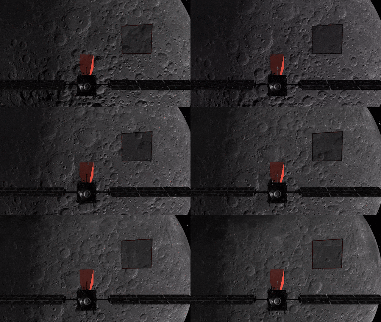
Navigation satellites aim their antennas directly at Earth. Satellites orbiting above the navigation (GPS in this image, but Europe's own navigation system is Galileo) constellation could only hope to detect signals from Earth’s far side. Now spacecraft can make use of signals emitted sideways from navigation antennas, within what is known as ‘side lobes’. Just like a torch, they shine energy to the side as well as directly forward.

Then in 2012 two Discovery & Preparation studies explored a seemingly radical question: could this spill over signal even be used to navigate our way around the Moon, and if so, what kind of receiver would we need to build to be able to use these signals?

The studies were very successful, finding that indeed, the signal from navigation satellites orbiting Earth could be used to navigate the Moon's surface. But with the signal being so weak, they found that a new type of receiver would need to be built, and at the time there was no clear application for this.

Fast-forwarding eight years, and ESA has invested in the development of such a receiver, and is exploring whether it could be demonstrated on the Lunar Pathfinder mission. ESA is collaborating with Surrey Satellite Technology Ltd and Goonhilly Earth Station on this mission, which will provide exciting new opportunities for science and technology demonstration. In particular, it will help lay the groundwork for providing navigation services around the Moon, currently studied through two ESA NAVISP activities and culminating in the Moonlight initiative.

Lunar Ride and Phone Home Service

"We have now accurate simulation results that show that navigation signals may be used at Moon orbit and provide good performances," adds Dr Javier Ventura-Traveset, Head of the Galileo Science Office and in charge of coordinating all GNSS Moon activities for ESA's Navigation Directorate. “And with an innovative receiver in Lunar Pathfinder, we could have the first ever experimental evidence of this. This is exciting!

"Furthermore, we are also studying how existing navigation constellations may be complemented by additional Moon-orbiting satellites, providing additional ranging signals for an optimal navigation service including Moon landing and Moon surface operations. This is being done as part of the ESA NAVISP program and through the ESA Moonlight initiative."

"The Discovery & Preparation studies have been eye-openers and they are currently being followed up by a NAVISP activity aiming to develop the highly sensitive spaceborne navigation receiver planned to fly on board Lunar Pathfinder," notes ESA Radio Navigation Engineer Pietro Giordano. "This technology will enable improved performances and much more cost-effective ways to navigate and operate missions to and around the Moon."

It is thanks to the pioneering Discovery & Preparation studies that ESA was confident enough to invest in the new receiver. This success story demonstrates the importance of investigating in blue sky research where real-world applications are not immediately apparent. Discovery & Preparation specialises in such research and is therefore pivotal in laying the path for ESA’s future activities.

Related links:

ESA NAVISP: https://navisp.esa.int/

Moonlight initiative: https://www.esa.int/ESA_Multimedia/Images/2020/07/Moonlight_logo

Lunar Pathfinder: https://www.esa.int/Science_Exploration/Human_and_Robotic_Exploration/ESA_signs_collaboration_agreement_for_commercial_Lunar_missions

Surrey Satellite Technology Ltd: https://www.sstl.co.uk/

Goonhilly Earth Station: https://www.goonhilly.org/

Discovery and Preparation: https://www.esa.int/Enabling_Support/Preparing_for_the_Future/Discovery_and_Preparation

SMART-1: https://www.esa.int/Enabling_Support/Operations/SMART-1

Images, Animation, Text, Credits: ESA/SSTL.

Greetings, Orbiter.ch

Launch Date Now Oct. 2 for Northrop Grumman’s CRS-14


Northrop Grumman - Cygnus NG-14 Mission patch.


October 2, 2020

Oct. 2 has been set for the launch of Northrop Grumman’s Antares rocket and Cygnus cargo spacecraft from the Mid-Atlantic Regional Spaceport at NASA’s Wallops Flight Facility near Chincoteague Island in Virginia.

The five-minute launch window opens at 9:16 p.m. EDT. Live coverage of the launch will air on NASA TV and at https://www.nasa.gov/live beginning at 8:45 p.m. EDT.

The launch may be visible, weather permitting and depending on other local conditions (such as elevation), to residents up and down the East Coast of the United States.


Image above: A Northrop Grumman Antares rocket carrying a Cygnus resupply spacecraft is seen on the Mid-Atlantic Regional Spaceport’s Pad-0A, Thursday, October 1, 2020, at NASA’s Wallops Flight Facility in Virginia. Northrop Grumman’s 14th contracted cargo resupply mission with NASA to the International Space Station will deliver nearly 8,000 pounds of science and research, crew supplies and vehicle hardware to the orbital laboratory and its crew. The CRS-14 Cygnus spacecraft is named after the first female astronaut of Indian descent, Kalpana Chawla, and is scheduled to launch at 9:38 p.m., Thursday, October 1, 2020 EDT. Photo Credit: NASA Wallops/Patrick Black.

An Oct. 1 attempt was scrubbed at roughly 2 minutes, 40 seconds prior to liftoff mark due to a problem with ground support equipment that has since been resolved.

Cygnus is loaded with nearly 8,000 pounds of cargo for the International Space Station. A liftoff on Oct. 2 would mean a scheduled arrival at the space station on Monday, Oct. 5.

Related article:

Launch of Northrop Grumman’s Antares rocket carrying a Cygnus spacecraft Scrubbed
https://orbiterchspacenews.blogspot.com/2020/10/launch-of-northrop-grummans-antares.html

Related link:

International Space Station (ISS): https://www.nasa.gov/mission_pages/station/main/index.html

Image (mentioned), Text, Credits: NASA/Rob Garner.

Best regards, Orbiter.ch

'Echo Mapping' in Faraway Galaxies Could Measure Vast Cosmic Distances


NASA - NEOWISE Mission logo.


October 2, 2020

Matter swirling around supermassive black holes creates bursts of light that "echo" in nearby dust clouds. These traveling signals could serve as a new cosmic yardstick.


Animation above: A disk of hot material around a supermassive black hole emits a burst of visible light, which travels out to a ring of dust that subsequently emits infrared light. The blue arrows show the light from the disk moving toward the dust and the light from both events traveling toward an observer. Animation Credits: NASA/JPL-Caltech.

When you look up at the night sky, how do you know whether the specks of light that you see are bright and far away, or relatively faint and close by? One way to find out is to compare how much light the object actually emits with how bright it appears. The difference between its true luminosity and its apparent brightness reveals an object's distance from the observer.

Measuring the luminosity of a celestial object is challenging, especially with black holes, which don't emit light. But the supermassive black holes that lie at the center of most galaxies provide a loophole: They often pull lots of matter around them, forming hot disks that can radiate brightly. Measuring the luminosity of a bright disk would allow astronomers to gauge the distance to the black hole and the galaxy it lives in. Distance measurements not only help scientists create a better, three-dimensional map of the universe, they can also provide information about how and when objects formed.

In a new study, astronomers used a technique that some have nicknamed "echo mapping" to measure the luminosity of black hole disks in over 500 galaxies. Published last month in the Astrophysical Journal, the study adds support to the idea that this approach could be used to measure the distances between Earth and these faraway galaxies.

The process of echo mapping, also known as reverberation mapping, starts when the disk of hot plasma (atoms that have lost their electrons) close to the black hole gets brighter, sometimes even releasing short flares of visible light (meaning wavelengths that can be seen by the human eye). That light travels away from the disk and eventually runs into a common feature of most supermassive black hole systems: an enormous cloud of dust in the shape of a doughnut (also known as a torus). Together, the disk and the torus form a sort of bullseye, with the accretion disk wrapped tightly around the black hole, followed by consecutive rings of slightly cooler plasma and gas, and finally the dust torus, which makes up the widest, outermost ring in the bullseye. When the flash of light from the accretion disk reaches the inner wall of the dusty torus, the light gets absorbed, causing the dust to heat up and release infrared light. This brightening of the torus is a direct response to or, one might say an "echo" of the changes happening in the disk.

The distance from the accretion disk to the inside of the dust torus can be vast - billions or trillions of miles. Even light, traveling at 186,000 miles (300,000 kilometers) per second, can take months or years to cross it. If astronomers can observe both the initial flare of visible light in the accretion disk and the subsequent infrared brightening in the torus, they can also measure the time it took the light to travel between those two structures. Because light travels at a standard speed, this information also gives astronomers the distance between the disk and the torus.

Scientists can then use the distance measurement to calculate the disk's luminosity, and, in theory, its distance from Earth. Here's how: The temperature in the part of the disk closest to the black hole can reach tens of thousands of degrees - so high that even atoms are torn apart and dust particles can't form. The heat from the disk also warms the area around it, like a bonfire on a cold night. Traveling away from the black hole, the temperature decreases gradually.

Astronomers know that dust forms when the temperature dips to about 2,200 degrees Fahrenheit (1,200 Celsius); the bigger the bonfire (or the more energy the disk radiates), the farther away from it the dust forms. So measuring the distance between the accretion disk and the torus reveals the energy output of the disk, which is directly proportional to its luminosity.

Near Earth Object Wide Field Infrared Survey Explorer (NEOWISE). Image Credit: NASA

Because the light can take months or years to traverse the space between the disk and the torus, astronomers need data that spans decades. The new study relies on nearly two decades of visible-light observations of black hole accretion disks, captured by several ground-based telescopes. The infrared light emitted by the dust was detected by NASA's Near Earth Object Wide Field Infrared Survey Explorer (NEOWISE), previously named WISE. The spacecraft surveys the entire sky about once every six months, providing astronomers with repeated opportunities to observe galaxies and look for signs of those light "echoes." The study used 14 surveys of the sky by WISE/NEOWISE, collected between 2010 and 2019. In some galaxies, the light took more than 10 years to traverse the distance between the accretion disk and the dust, making them the longest echoes ever measured outside the Milky Way galaxy.

Galaxies Far, Far Away

The idea to use echo mapping to measure the distance from Earth to far away galaxies is not new, but the study makes substantial strides in demonstrating its feasibility. The largest single survey of its kind, the study confirms that echo mapping plays out in the same way in all galaxies, regardless of such variables as a black hole's size, which can vary significantly across the universe. But the technique isn't ready for prime time.

Due to multiple factors, the authors' distance measurements lack precision. Most notably, the authors said, they need to understand more about the structure of the inner regions of the dust doughnut encircling the black hole. That structure could affect such things as which specific wavelengths of infrared light the dust emits when the light first reaches it.

The WISE data doesn't span the entire infrared wavelength range, and a broader dataset could improve the distance measurements. NASA's Nancy Grace Roman Space Telescope, set to launch in the mid-2020s, will provide targeted observations in different infrared wavelength ranges. The agency's upcoming SPHEREx mission (which stands for Spectro-Photometer for the History of the Universe, Epoch of Reionization and Ices Explorer) will survey the entire sky in multiple infrared wavelengths and could also help improve the technique.

"The beauty of the echo mapping technique is that these supermassive black holes aren't going away anytime soon," said Qian Yang, a researcher at the University of Illinois at Urbana-Champaign and lead author of the study, referring to the fact that black hole disks may experience active flaring for thousands or even millions of years. "So we can measure the dust echoes over and over again for the same system to improve the distance measurement."

Luminosity-based distance measurements can already be done with objects known as "standard candles," which have a known luminosity. One example is a type of exploding star called a Type 1a supernovas, which played a critical role in the discovery of dark energy (the name given to the mysterious driving force behind the universe's accelerating expansion). Type 1a supernovas all have about the same luminosity, so astronomers only need to measure their apparent brightness to calculate their distance from Earth.

With other standard candles, astronomers can measure a property of the object to deduce its specific luminosity. Such is the case with echo mapping, where each accretion disk is unique but the technique for measuring the luminosity is the same. There are benefits for astronomers to being able to use multiple standard candles, such as being able to compare distance measurements to confirm their accuracy, and each standard candle has strengths and weaknesses.

"Measuring cosmic distances is a fundamental challenge in astronomy, so the possibility of having an extra trick up one's sleeve is very exciting," said Yue Shen, also a researcher at the University of Illinois at Urbana-Champaign and co-author of the paper.

Launched in 2009, the WISE spacecraft was placed into hibernation in 2011 after completing its primary mission. In Sept. 2013, NASA reactivated the spacecraft with the primary goal of scanning for near-Earth objects, or NEOs, and the mission and spacecraft were renamed NEOWISE. NASA's Jet Propulsion Laboratory in Southern California managed and operated WISE for NASA's Science Mission Directorate. The mission was selected competitively under NASA's Explorers Program managed by the agency's Goddard Space Flight Center in Greenbelt, Maryland. NEOWISE is a project of JPL, a division of Caltech, and the University of Arizona, supported by NASA's Planetary Defense Coordination Office.

Related links:

Astrophysical Journal: https://ui.adsabs.harvard.edu/abs/2020ApJ...900...58Y/abstract

NASA's Near Earth Object Wide Field Infrared Survey Explorer (NEOWISE): https://www.nasa.gov/mission_pages/neowise/main/index.html

NASA's Nancy Grace Roman Space Telescope: https://roman.gsfc.nasa.gov/

SPHEREx mission: https://www.jpl.nasa.gov/missions/spherex/

Animation (mentioned), Image (mentioned), Text, Credits: NASA/JPL/Calla Cofield.

Greetings, Orbiter.ch

AI Is Helping Scientists Discover Fresh Craters on Mars


NASA - Mars Reconnaissance Orbiter (MRO) patch.


October 2, 2020

It's the first time machine learning has been used to find previously unknown craters on the Red Planet.


Image above: The HiRISE camera aboard NASA's Mars Reconnaissance Orbiter took this image of a crater cluster on Mars, the first ever to be discovered AI. The AI first spotted the craters in images taken the orbiter's Context Camera; scientists followed up with this HiRISE image to confirm the craters. Image Credits: NASA/JPL-Caltech/University of Arizona.

Sometime between March 2010 and May 2012, a meteor streaked across the Martian sky and broke into pieces, slamming into the planet's surface. The resulting craters were relatively small - just 13 feet (4 meters) in diameter. The smaller the features, the more difficult they are to spot using Mars orbiters. But in this case - and for the first time - scientists spotted them with a little extra help: artificial intelligence (AI).

It's a milestone for planetary scientists and AI researchers at NASA's Jet Propulsion Laboratory in Southern California, who worked together to develop the machine-learning tool that helped make the discovery. The accomplishment offers hope for both saving time and increasing the volume of findings.

Typically, scientists spend hours each day studying images captured by NASA's Mars Reconnaissance Orbiter (MRO), looking for changing surface phenomena like dust devils, avalanches, and shifting dunes. In the orbiter's 14 years at Mars, scientists have relied on MRO data to find over 1,000 new craters. They're usually first detected with the spacecraft's Context Camera, which takes low-resolution images covering hundreds of miles at a time.

Only the blast marks around an impact will stand out in these images, not the individual craters, so the next step is to take a closer look with the High-Resolution Imaging Science Experiment, or HiRISE. The instrument is so powerful that it can see details as fine as the tracks left by the Curiosity Mars rover. (The HiRISE team allows anyone, including members of the public, to request specific images through its HiWish page.)


Image above: The black speck circled in the lower left corner of this image is a cluster of recently formed craters spotted on Mars using a new machine-learning algorithm. This image was taken by the Context Camera aboard NASA's Mars Reconnaissance Orbiter. Image Credits: NASA/JPL-Caltech/MSSS.

The process takes patience, requiring 40 minutes or so for a researcher to carefully scan a single Context Camera image. To save time, JPL researchers created a tool - called an automated fresh impact crater classifier - as part of a broader JPL effort named COSMIC (Capturing Onboard Summarization to Monitor Image Change) that develops technologies for future generations of Mars orbiters.

Learning the Landscape

To train the crater classifier, researchers fed it 6,830 Context Camera images, including those of locations with previously discovered impacts that already had been confirmed via HiRISE. The tool was also fed images with no fresh impacts in order to show the classifier what not to look for.

Once trained, the classifier was deployed on the Context Camera's entire repository of about 112,000 images. Running on a supercomputer cluster at JPL made up of dozens of high-performance computers that can operate in concert with one another, a process that takes a human 40 minutes takes the AI tool an average of just five seconds.

One challenge was figuring out how to run up to 750 copies of the classifier across the entire cluster simultaneously, said JPL computer scientist Gary Doran. "It wouldn't be possible to process over 112,000 images in a reasonable amount of time without distributing the work across many computers," Doran said. "The strategy is to split the problem into smaller pieces that can be solved in parallel."

Mars Reconnaissance Orbiter (MRO). Image Credits: NASA/JPL

But despite all that computing power, the classifier still requires a human to check its work.

"AI can't do the kind of skilled analysis a scientist can," said JPL computer scientist Kiri Wagstaff. "But tools like this new algorithm can be their assistants. This paves the way for an exciting symbiosis of human and AI 'investigators' working together to accelerate scientific discovery."

On Aug. 26, 2020, HiRISE confirmed that a dark smudge detected by the classifier in a region called Noctis Fossae was in fact the cluster of craters. The team has already submitted more than 20 additional candidates for HiRISE to check out.

While this crater classifier runs on Earth-bound computers, the ultimate goal is to develop similar classifiers tailored for onboard use by future Mars orbiters. Right now, the data being sent back to Earth requires scientists to sift through to find interesting imagery, much like trying to find a needle in a haystack, said Michael Munje, a Georgia Tech graduate student who worked on the classifier as an intern at JPL.

"The hope is that in the future, AI could prioritize orbital imagery that scientists are more likely to be interested in," Munje said.

Ingrid Daubar, a scientist with appointments at JPL and Brown University who was also involved in the work, is hopeful the new tool could offer a more complete picture of how often meteors strike Mars and also reveal small impacts in areas where they haven't been discovered before. The more craters that are found, the more scientists add to the body of knowledge of the size, shape, and frequency of meteor impacts on Mars.

"There are likely many more impacts that we haven't found yet," she said. "This advance shows you just how much you can do with veteran missions like MRO using modern analysis techniques."

For more information about MRO:

https://mars.nasa.gov/mro/

http://www.nasa.gov/mission_pages/MRO/main/index.html

HiWish page: https://www.uahirise.org/hiwish/

JPL, a division of Caltech in Pasadena, California, manages the MRO mission for NASA's Science Mission Directorate in Washington. The University of Arizona, in Tucson, operates HiRISE, which was built by Ball Aerospace & Technologies Corp., in Boulder, Colorado. MARCI and the Context Camera were both built and are operated by Malin Space Science Systems in San Diego.

Images (mentioned), Text, Credits: NASA/Alana Johnson/Grey Hautaluoma/JPL/Andrew Good.

Greetings, Orbiter.ch

jeudi 1 octobre 2020

Launch of Northrop Grumman’s Antares rocket carrying a Cygnus spacecraft Scrubbed


Northrop Grumman - Cygnus NG-14 Mission patch.


Oct. 1, 2020


Tonight’s launch attempt of NASA commercial cargo provider Northrop Grumman’s  14th resupply mission to the International Space Station has been scrubbed.

NG-14: Antares 230+ aborted launch with S.S. Kalpana Chawla Cygnus

The launch of a Northrop Grumman Antares 230+ rocket with the CRS-14 Cygnus spacecraft, dubbed the S.S. Kalpana Chawla, was aborted due to a problem with the ground support equipment, from MARS Pad 0A, at NASA’s Wallops Flight Facility, Wallops Island, Virginia, on 2 October 2020, at 01:43:44 UTC (1 October, at 21:43:44 EDT).

Related article:

U.S. Cargo Poised for Launch; Robotics, Health Checks for Crew
https://orbiterchspacenews.blogspot.com/2020/10/us-cargo-poised-for-launch-robotics.html

Related link:

International Space Station (ISS): https://www.nasa.gov/mission_pages/station/main/index.html

Image, Video, Text, Credits: Northrop Grumman/NASA/SciNews/Orbiter.ch Aerospace/Roland Berga.

Greetings, Orbiter.ch

U.S. Cargo Poised for Launch; Robotics, Health Checks for Crew


ISS - Expedition 63 Mission patch.


October 1, 2020

A U.S. rocket stands at its launch pad ready to launch an advanced space toilet and new science experiments toward the International Space Station tonight. Back on orbit, the Expedition 63 trio worked on robotics, health checks and housecleaning today.

NASA and its commercial partner Northrop Grumman are counting down to tonight’s liftoff of the Cygnus space freighter atop an Antares rocket at 9:38 p.m. EDT from Virginia. Cygnus is packed with nearly 8,000 pounds of crew supplies and station gear due for a robotic capture on Sunday at 6:10 a.m.

NASA TV: https://www.nasa.gov/multimedia/nasatv/index.html#public


Image above: Northrop Grumman’s Antares rocket, with the Cygnus space freighter atop, stands at its launch pad at NASA’s Wallops Flight Facility in Virginia. Image Credit: Northrop Grumman.

Commander Chris Cassidy and Flight Engineer Ivan Vagner will be at the robotics workstation Sunday morning monitoring the approach and rendezvous of Cygnus. Cassidy will then command the Canadarm2 robotic arm to grapple Cygnus when it reaches a point about 10 meters from the station. Afterward, engineers on the ground will take over the Canadarm2 and remotely install Cygnus to the Unity module where it will stay until mid-December.

During Thursday morning, Cassidy installed a new robotic 4K camera that looks outside a Kibo laboratory module window at the Earth below. Called Avatar-X, the camera demonstrates how users on the ground can remotely control the camera to view Earth or practice telemedicine in remote locations.

International Space Station (ISS). Animation Credit: NASA

Next, Cassidy strapped himself into an exercise bike with assistance from Vagner for a periodic health check. Vagner spent the rest of the day on photography inspections and plumbing tasks. Veteran cosmonaut Anatoly Ivanishin took the morning off before spending the afternoon cleaning the ventilation system and researching how multi-cultural crews communicate.

Related links:

Expedition 63: https://www.nasa.gov/mission_pages/station/expeditions/expedition63/index.html

Canadarm2: https://www.nasa.gov/mission_pages/station/structure/elements/mobile-servicing-system.html

Unity module: https://www.nasa.gov/mission_pages/station/structure/elements/unity

Kibo laboratory module: https://www.nasa.gov/mission_pages/station/structure/elements/japan-kibo-laboratory

Avatar-X: https://www.nasa.gov/mission_pages/station/research/experiments/explorer/Investigation.html?#id=8232

Exercise bike: https://www.nasa.gov/mission_pages/station/research/experiments/explorer/Facility.html?#id=821

How multi-cultural crews communicate: https://www.energia.ru/en/iss/researches/human/01.html

Space Station Research and Technology: https://www.nasa.gov/mission_pages/station/research/overview.html

International Space Station (ISS): https://www.nasa.gov/mission_pages/station/main/index.html

Image (mentioned), Animation (mentioned), Text, Credits: NASA/Mark Garcia.

Best regards, Orbiter.ch

NASA Looks to Advance 3D Printing Construction Systems for the Moon and Mars


NASA logo.


Oct. 1, 2020

The process of building landing pads, habitats, and roads on the Moon will likely look different than the common construction site on Earth. Excavation robots, for one, will need to be lightweight yet capable of digging in reduced gravity. A large-scale construction system could be autonomous and equipped to work without astronauts' help.

As part of the Artemis program, NASA has a concept for the core surface elements needed to establish a sustained presence on the Moon, which emphasizes mobility to allow astronauts to explore more and conduct more science. NASA is considering putting in place a lunar terrain vehicle, habitable mobility platform or lunar RV, and surface habitat on the Moon by the end of the decade. The agency is investing in advanced manufacturing – one of five industries of the future to enable space exploration and improve life on Earth – including technologies that could find and use available resources on the Moon and Mars to build out future infrastructure.

Today, NASA is working with ICON, a construction technologies company based in Austin, Texas, on early research and development of a space-based construction system that could support future exploration of the Moon and Mars. The company has 3D printed communities of homes and structures on Earth and participated in NASA’s 3D Printed Habitat Challenge, demonstrating a construction method and technologies that may be adaptable for applications beyond our home planet.


Image above: ICON illustration of a conceptual lunar base with 3D printed infrastructure, including landing pads and habitats. Image Credits: ICON/SEArch+.

“To be successful in our future missions, we have to invest in new, cutting-edge technologies today,” said Niki Werkheiser, NASA’s Game Changing Development program executive. The program is part of the agency’s Space Technology Mission Directorate. “Near-term research and development will help ensure we can expand building capabilities on other worlds when the time comes.”

Another U.S. government agency is interested in the technology and its applications here on Earth. The U.S. Air Force awarded ICON a dual-use Small Business Innovation Research (SBIR) contract to expand 3D printing of livable and workable structures. Part of the contract, which NASA contributed funding to, will explore commonalities between Earth-based and off-Earth applications. ICON will also invest in the effort.

“Joining forces and cost-sharing among multiple government agencies allows us to accelerate the development timeline and bring the core capabilities that we have a common interest in to fruition sooner,” said Werkheiser. “Together, we will help mature technologies that will have benefits for humanity – on Earth and in space.”


Image above: Illustration of a Mars habitat concept developed by the Colorado School of Mines and ICON for NASA's 3D-Printed Habitat Challenge. Image Credits: Logan Architecture.

ICON will work with NASA’s Marshall Space Flight Center in Huntsville, Alabama, under the Moon to Mars Planetary Autonomous Construction Technologies (MMPACT) project to test lunar soil simulant with various processing and printing technologies. NASA is partnering with industry, government, and academic institutions under the MMPACT project.

“We want to increase the technology readiness level and test systems to prove it would be feasible to develop a large-scale 3D printer that could build infrastructure on the Moon or Mars,” said Corky Clinton, associate director of Marshall’s Science and Technology Office. “The team will use what we learn from the tests with the lunar simulant to design, develop, and demonstrate prototype elements for a full-scale additive construction system.”

Based on the progress, NASA could award ICON additional funding and explore the opportunity of an in-situ test on the lunar surface.

“From the very founding of ICON, we’ve been thinking about off-world construction,” said Jason Ballard, co-founder and CEO of ICON. “I am confident that learning to build on other worlds will also provide the necessary breakthroughs to solve housing challenges we face on this world. These are mutually reinforcing endeavors. Sometimes, for the biggest problems, it becomes necessary to look up at the sky and not only down at our feet.”

The SBIR award will build on ICON’s commercial activities and demonstrations during Phase 3 of NASA’s 3D Printed Habitat Challenge. For the challenge, ICON partnered with the Colorado School of Mines in Golden. The team won a prize for 3D printing a structure sample that adequately held a seal when filled with water.

“It is rewarding to see past NASA challenge competitors go on to work with the government in other ways,” said Amy Kaminski, the program executive for prizes and challenges at NASA. “It shows our approach of reaching out to groups outside of the traditional aerospace sector to solve challenges facing us in space and on Earth can result in unique collaborations to further NASA’s technology development efforts.”

To learn more about NASA’s Moon to Mars exploration approach, visit: https://www.nasa.gov/topics/moon-to-mars

To learn more about opportunities to participate in your space program via NASA prizes and challenges, visit: http://www.nasa.gov/solve

Related links:

NASA Space Technology Mission Directorate: https://www.nasa.gov/directorates/spacetech/home/index.html

3D Printed Habitat Challenge: https://www.nasa.gov/directorates/spacetech/centennial_challenges/3DPHab/index.html

3D Printing: https://www.nasa.gov/topics/technology/manufacturing-materials-3d/index.html

Images (mentioned), Text, Credits: NASA/Lee Mohon/Clare Skelly/Marshall Space Flight Center/Molly Porter.

Greetings, Orbiter.ch

Hubble Observes Spectacular Supernova Time-Lapse


ESA - Hubble Space Telescope logo.


October 1, 2020

Hubble Captures Supernova in NGC 2525

The NASA/ESA’s Hubble Space Telescope has tracked the fading light of a supernova in the spiral galaxy NGC 2525, located 70 million light years away. Supernovae like this one can be used as cosmic tape measures, allowing astronomers to calculate the distance to their galaxies. Hubble captured these images as part of one of its major investigations, measuring the expansion rate of the Universe, which can help answer fundamental questions about our Universe’s very nature.

The supernova, formally known as SN2018gv, was first spotted in mid-January 2018. The NASA/ESA’s Hubble Space Telescope began observing the brilliant brightness of the supernova in February 2018 as part of the research program led by lead researcher and Nobel Laureate Adam Riess of the Space Telescope Science Institute (STScI) and Johns Hopkins University, in Baltimore, USA. The Hubble images center on the barred spiral galaxy NGC 2525, which is located in the constellation of Puppis in the Southern Hemisphere.

Galaxy NGC 2525

The supernova is captured by Hubble in exquisite detail within this galaxy in the left portion of the image. It appears as a very bright star located on the outer edge of one of its beautiful swirling spiral arms. This new and unique time-lapse of Hubble images created by the ESA/Hubble team shows the once bright supernova initially outshining the brightest stars in the galaxy, before fading into obscurity during the year of observations. This time-lapse consists of observations taken over the course of one year, from February 2018 to February 2019.

"No Earthly fireworks display can compete with this supernova, captured in its fading glory by the Hubble Space Telescope," shared Riess of this new time-lapse of the supernova explosion in NGC 2525.

Wide-Field View of NGC 2525

Supernovae are powerful explosions which mark the end of a star’s life. The type of supernova seen in these images, known as a Type Ia supernova, originate from a white dwarf in a close binary system accreting material from its companion star. If the white dwarf reaches a critical mass (1.44 times the mass of our Sun), its core becomes hot enough to ignite carbon fusion, triggering a thermonuclear runaway process that fuses large amounts of oxygen and carbon together in a matter of seconds. The energy released tears the star apart in a violent explosion, ejecting matter at speeds up to 6% the speed of light and emitting huge amounts of radiation. Type Ia supernovae consistently reach a peak brightness of 5 billion times brighter than our Sun before fading over time.

Hubble Watches Exploding Star Fade Into Oblivion

Because supernovae of this type produce this fixed brightness, they are useful tools for astronomers, known as ‘standard candles’, which act as cosmic tape measures. Knowing the actual brightness of the supernova and observing its apparent brightness in the sky, astronomers can calculate the distance to these grand spectacles and therefore their galaxies. Riess and his team combined the distance measurements from the supernovae with distances calculated using variable stars known as Cepheid variables. Cepheid variables pulsate in size, causing periodic changes in brightness. As this period is directly related to the star’s brightness, astronomers can calculate the distance to them: allowing them to act as another standard candle in the cosmic distance ladder.

Time-Lapse of Supernova in NGC 2525

Riess and his team are interested in accurately measuring the distance to these galaxies since it helps them better constrain the expansion rate of the Universe, known as the Hubble constant. This value accounts for how fast the Universe is expanding depending on its distance from us, with more distant galaxies moving faster away from us. Since it launched, NASA/ESA’s Hubble Space Telescope has helped dramatically improve the precision of the Hubble constant. Results from the same observing program led by Riess have now reduced the uncertainty of their measurement of the Hubble constant to an unprecedented 1.9% [1]. Further measurements of NGC 2525 will contribute to their goal of reducing the uncertainty down to 1%, pinpointing how fast the Universe is expanding. A more accurate Hubble constant may uncover clues about the invisible dark matter and mysterious dark energy, responsible for accelerating the Universe’s rate of expansion. Together this information can help us understand the history and future fate of our Universe.

Zooming Into NGC 2525

A supermassive black hole is also known to be lurking at the centre of NGC 2525. Nearly every galaxy contains a supermassive black hole, which can range in mass from hundreds of thousands to billions of times the mass of the Sun.

Notes:

[1] This finding is detailed in this ESA/Hubble release from 2019.
More information

The Hubble Space Telescope is a project of international cooperation between ESA and NASA.

These observations were conducted under Hubble observation programme 15145 (PI: A. Riess).

Links:

Images of Hubble: http://www.spacetelescope.org/images/archive/category/spacecraft/

HubbleSite release: https://hubblesite.org/contents/news-releases/2020/news-2020-52

ESa Hubble Site: https://www.spacetelescope.org/

Images, Animation, Text Credits: NASA, ESA, A. Riess and the SH0ES team/Acknowledgement: Mahdi Zamani/ESA/Hubble/Bethany Downer/Space Telescope Science Institute/Adam Riess and the SH0ES team/Acknowledgment: Mahdi Zamani/Digitized Sky Survey 2. Acknowledgement: Davide De Martin/Videos: ESA/Hubble & NASA, M. Kornmesser, M. Zamani, A. Riess and the SH0ES team/Digitized Sky Survey, L. Calçada, Nick Risinger (skysurvey.org). Music: Astral Electronic.

Greetings, Orbiter.ch

Two aborted launches in one day


ULA - United Launch Alliance logo / SpaceX logo.


October 1, 2020


Delta IV Heavy aborted launch with NROL-44

Delta IV Heavy aborted launch with NROL-44, 1 October 2020

The launch of a United Launch Alliance Delta IV Heavy rocket with the NROL-44 mission was aborted from Space Launch Complex-37 (SLC-37), Cape Canaveral Air Force Station, Florida, on 1 October 2020, at 03:54 UTC (30 September, 23:54 EDT).


Falcon 9 aborted launch with Starlink 12

Falcon 9 aborted launch with Starlink 12, 1 October 2020

The launch of a SpaceX Falcon 9 rocket with 60 Starlink satellites (Starlink-12) was aborted was aborted due to a problem with the ground support equipment from Launch Complex 39A (LC-39A) at Kennedy Space Center in Florida, on 1 October 2020, at 13:17 UTC (09:17 EDT).

Related links:

ULA - United Launch Alliance: https://www.ulalaunch.com/

SpaceX: https://www.spacex.com/

Images, Videos, Text, Credits: United Launch Alliance (ULA)/SpaceX/SciNews/Orbiter.ch Aerospace/Roland Berga.

Greetings, Orbiter.ch

The way forward to Mars


ESA & ROSCOSMOS - ExoMars Mission patch.


October 1, 2020

The path that ExoMars 2022 will follow to reach the Red Planet is set. The trajectory that will take the spacecraft from Earth to Mars in 264 days foresees a touchdown on the martian surface on 10 June 2023, at around 17:30 CEST (15:30 UTC).

ExoMars 2022 journey

The weather at Mars, the type of launcher and the laws of physics governing the planets determined a 12-day launch window starting on 20 September 2022.

Efficient orbital transfers, good communications and no large dust storms on the martian horizon make the chosen trajectory the fastest and safest choice.

Choosing the best path

When confronted with how to get to Mars, European and Russian teams have to juggle many factors. The mission analysis team at the European Space Operations Centre (ESOC) in Germany took into account the performance of Russia’s Proton launcher to identify a number of possible trajectories.

10: Taking control and staying in touch

“We had several transfer trajectories to choose from and a spacecraft already built for the trip,” says Mattia Mercolino, ExoMars principal systems engineer. “These variables imposed on us constraints linked to power, temperature thresholds and orientation towards Earth during the first stages of the flight, among others.”

Being able to communicate with the spacecraft also played a major role.

“One of the alternatives had a longer launch window, but a worse connection with the spacecraft during the first days. This choice was too risky, especially when you want to have full control at the beginning of the mission,” explains Tiago Loureiro, ExoMars spacecraft operations manager.

ExoMars timeline

The final trajectory takes a bit longer – one week more – and the launch sequence requires more manoeuvres, but this wasn’t only about earthly constraints. “We needed to understand the challenges unique to our destination. Mars orbital characteristics and dust storms were crucial to our decision,” says Tiago.

Riders on the storm

Dust storms are frequent on Mars, but also difficult to predict. Seasons play a role, with stormy weather more likely to happen during the spring and summer in the southern hemisphere. ExoMars landing site is Oxia Planum, located in the northern hemisphere.

Threatening global-scale dust storms tend to happen approximately every ten years. The most recent one was in 2018.

Oxia Planum close up

Although ExoMars will land outside the dust storm season, a build-up of dust on the solar panels will reduce power supply and could even force a temporary shutdown of ESA’s Rosalind Franklin rover and the Russian surface platform, dubbed Kazachok.

“We went through a number of studies and tests to ensure that all systems would survive with reduced sunlight upon the late afternoon landing, and during surface operations the following weeks,” adds Tiago.

Fly over the ExoMars 2020 landing site

European scientists want to operate the rover on Mars for as long as possible. Rosalind Franklin can cope with regional dust storms for a few days and with layers of fine dust covering its solar panels.

“A global dust storm that blankets the atmosphere for several months would most likely result in the death of the rover,” warns Jorge Vago, ESA’s ExoMars rover project scientist.

“That is why it is so important to achieve most of the mission objectives before the problematic dust season starts,” he adds.

Earth at work

It took the teams at ESOC a few months of work to narrow down the final launch date and trajectory to Mars. “The whole challenge is fantastic – I think I have the best job in the world,” says Tiago.

“Launching a spacecraft, shooting it across the Solar System, hoping it lands in one piece, deploying it, driving it on Mars… And we will do all of this without the luxury of interacting with the spacecraft or the rover in real time,” he explains.

ExoMars carrier module and surface platform

Sending the first European rover to Mars requires true teamwork. Each and every command has been carefully planned together with the Russian partners, involving several control centres and countries.

ESA will control the communications between Rosalind Franklin and the Kazachok surface platform during their first days on Mars. As part of the ExoMars programme, the Trace Gas Orbiter, which has been circling Mars for nearly four years, will serve as a data relay platform to support communications.

A few weeks after landing, and only when the surface platform is safe and able to operate independently, ESA will hand over the control of Kazachok to Roscosmos.

About ExoMars:

The ExoMars programme is a joint endeavour between the Roscosmos State Corporation and ESA. Apart from the 2022 mission, it includes the Trace Gas Orbiter (TGO) launched in 2016. The TGO is already both delivering important scientific results obtained by its own Russian and European science instruments and relaying data from NASA’s Curiosity Mars rover and InSight lander. The module will also relay the data from the ExoMars 2022 mission once it arrives on Mars.

ROSCOSMOS related article:

Аппарат ExoMars-2022 отправлен в Канны
https://www.roscosmos.ru/29325/

Related links:

ExoMars programme: http://www.esa.int/Science_Exploration/Human_and_Robotic_Exploration/Exploration/ExoMars/What_is_ExoMars

Trace Gas Orbiter (TGO): https://www.esa.int/Enabling_Support/Operations/ExoMars_TGO_operations

ExoMars: https://www.esa.int/Science_Exploration/Human_and_Robotic_Exploration/Exploration/ExoMars

Images, Video, Text, Credits: ESA/J. Mai/NASA/JPL/University of Arizona/TU Dortmund/NASA JPL-Caltech.

Best regards, Orbiter.ch

ESO telescope spots galaxies trapped in the web of a supermassive black hole


ESO - European Southern Observatory logo.


October 1, 2020

Artist’s impression of the web of the supermassive black hole

With the help of ESO’s Very Large Telescope (VLT), astronomers have found six galaxies lying around a supermassive black hole when the Universe was less than a billion years old. This is the first time such a close grouping has been seen so soon after the Big Bang and the finding helps us better understand how supermassive black holes, one of which exists at the centre of our Milky Way, formed and grew to their enormous sizes so quickly. It supports the theory that black holes can grow rapidly within large, web-like structures which contain plenty of gas to fuel them.

“This research was mainly driven by the desire to understand some of the most challenging astronomical objects — supermassive black holes in the early Universe. These are extreme systems and to date we have had no good explanation for their existence,” said Marco Mignoli, an astronomer at the National Institute for Astrophysics (INAF) in Bologna, Italy, and lead author of the new research published today in Astronomy & Astrophysics.

Location of the supermassive black hole’s web in the constellation of Sextans

The new observations with ESO’s VLT revealed several galaxies surrounding a supermassive black hole, all lying in a cosmic “spider’s web” of gas extending to over 300 times the size of the Milky Way. “The cosmic web filaments are like spider’s web threads,” explains Mignoli. “The galaxies stand and grow where the filaments cross, and streams of gas — available to fuel both the galaxies and the central supermassive black hole — can flow along the filaments.”

The light from this large web-like structure, with its black hole of one billion solar masses, has travelled to us from a time when the Universe was only 0.9 billion years old. “Our work has placed an important piece in the largely incomplete puzzle that is the formation and growth of such extreme, yet relatively abundant, objects so quickly after the Big Bang,” says co-author Roberto Gilli, also an astronomer at INAF in Bologna, referring to supermassive black holes.

Wide-field view of the sky around the supermassive black hole’s web

The very first black holes, thought to have formed from the collapse of the first stars, must have grown very fast to reach masses of a billion suns within the first 0.9 billion years of the Universe’s life. But astronomers have struggled to explain how sufficiently large amounts of “black hole fuel” could have been available to enable these objects to grow to such enormous sizes in such a short time. The new-found structure offers a likely explanation: the “spider’s web” and the galaxies within it contain enough gas to provide the fuel that the central black hole needs to quickly become a supermassive giant.

But how did such large web-like structures form in the first place? Astronomers think giant halos of mysterious dark matter are key. These large regions of invisible matter are thought to attract huge amounts of gas in the early Universe; together, the gas and the invisible dark matter form the web-like structures where galaxies and black holes can evolve.

Animation of the web of the supermassive black hole

“Our finding lends support to the idea that the most distant and massive black holes form and grow within massive dark matter halos in large-scale structures, and that the absence of earlier detections of such structures was likely due to observational limitations,” says Colin Norman of Johns Hopkins University in Baltimore, US, also a co-author on the study.

The galaxies now detected are some of the faintest that current telescopes can observe. This discovery required observations over several hours using the largest optical telescopes available, including ESO’s VLT. Using the MUSE and FORS2 instruments on the VLT at ESO’s Paranal Observatory in the Chilean Atacama Desert, the team confirmed the link between four of the six galaxies and the black hole. “We believe we have just seen the tip of the iceberg, and that the few galaxies discovered so far around this supermassive black hole are only the brightest ones,” said co-author Barbara Balmaverde, an astronomer at INAF in Torino, Italy.

Zooming in on the web of the supermassive black hole

These results contribute to our understanding of how supermassive black holes and large cosmic structures formed and evolved. ESO’s Extremely Large Telescope, currently under construction in Chile, will be able to build on this research by observing many more fainter galaxies around massive black holes in the early Universe using its powerful instruments.


More information:

This research was presented in the paper “Web of the giant: Spectroscopic confirmation of a large-scale structure around the z = 6.31 quasar SDSS J1030+0524” to appear in Astronomy & Astrophysics (doi: 10.1051/0004-6361/202039045).

The team is composed of M. Mignoli (INAF, Bologna, Italy), R. Gilli (INAF, Bologna, Italy), R. Decarli (INAF, Bologna, Italy), E. Vanzella (INAF, Bologna, Italy), B. Balmaverde (INAF, Pino Torinese, Italy), N. Cappelluti (Department of Physics, University of Miami, Florida, USA), L. Cassarà (INAF, Milano, Italy), A. Comastri (INAF, Bologna, Italy), F. Cusano (INAF, Bologna, Italy), K. Iwasawa (ICCUB, Universitat de Barcelona & ICREA, Barcelona, Spain), S. Marchesi (INAF, Bologna, Italy), I. Prandoni (INAF, Istituto di Radioastronomia, Bologna, Italy), C. Vignali (Dipartimento di Fisica e Astronomia, Università degli Studi di Bologna, Italy & INAF, Bologna, Italy), F. Vito (Scuola Normale Superiore, Pisa, Italy), G. Zamorani (INAF, Bologna, Italy), M. Chiaberge (Space Telescope Science Institute, Maryland, USA), C. Norman (Space Telescope Science Institute & Johns Hopkins University, Maryland, USA).

ESO is the foremost intergovernmental astronomy organisation in Europe and the world’s most productive ground-based astronomical observatory by far. It has 16 Member States: Austria, Belgium, the Czech Republic, Denmark, France, Finland, Germany, Ireland, Italy, the Netherlands, Poland, Portugal, Spain, Sweden, Switzerland and the United Kingdom, along with the host state of Chile and with Australia as a Strategic Partner. ESO carries out an ambitious programme focused on the design, construction and operation of powerful ground-based observing facilities enabling astronomers to make important scientific discoveries. ESO also plays a leading role in promoting and organising cooperation in astronomical research. ESO operates three unique world-class observing sites in Chile: La Silla, Paranal and Chajnantor. At Paranal, ESO operates the Very Large Telescope and its world-leading Very Large Telescope Interferometer as well as two survey telescopes, VISTA working in the infrared and the visible-light VLT Survey Telescope. Also at Paranal ESO will host and operate the Cherenkov Telescope Array South, the world’s largest and most sensitive gamma-ray observatory. ESO is also a major partner in two facilities on Chajnantor, APEX and ALMA, the largest astronomical project in existence. And on Cerro Armazones, close to Paranal, ESO is building the 39-metre Extremely Large Telescope, the ELT, which will become “the world’s biggest eye on the sky”.

Links:

Research paper: https://www.eso.org/public/archives/releases/sciencepapers/eso2016/eso2016a.pdf

Photos of the VLT: http://www.eso.org/public/images/archive/category/paranal/

For scientists: got a story? Pitch your research: http://eso.org/sci/publications/announcements/sciann17277.html

Space Scoop kids version of this press release: http://www.spacescoop.org/en/scoops/2039/help-i-m-trapped/

ESO’s VLT: https://www.eso.org/public/teles-instr/paranal-observatory/vlt/

MUSE: https://www.eso.org/public/teles-instr/paranal-observatory/vlt/vlt-instr/muse/

Images, Text, Credits: ESO/Bárbara Ferreira/L. Calçada/Johns Hopkins University/Colin Norman/INAF Torino/Barbara Balmaverde/INAF Bologna/Roberto Gilli/Marco Mignoli/IAU and Sky & Telescope/Digitized Sky Survey 2. Acknowledgement: Davide De Martin/Videos: ESO/L. Calçada/ESO/Digitized Sky Survey 2/N. Risinger (skysurvey.org). Music: Astral Electronics.

Greetings, Orbiter.ch