samedi 11 juillet 2020

Space Physics and Biology Top Research Schedule Aboard ISS


ISS - Expedition 63 Mission patch.

July 11, 2020

The Expedition 63 crew spent Friday setting up advanced science hardware to explore a wide variety of space phenomena. The International Space Station residents also worked spacesuit maintenance and conducted more eye checks.

NASA Flight Engineer Bob Behnken spent the morning swapping furnaces inside the Materials Science Laboratory (MSL) research rack. Fellow NASA  astronaut Doug Hurley joined Behnken and installed the specialized device, known as the Solidification and Quench Furnace (SQF), in the MSL. The SQF will enable scientists to discover new applications for metals, alloys, polymers and more, or design advanced materials for industrial usage.


Image above: The International Space Station was orbiting off the Atlantic coast of the South American nation of Uruguay with the Progress 75 cargo craft in the left foreground. Image Credit: NASA.

Hurley started his day configuring a laptop computer for the Hyperspectral Imaging Suite (HISUI) from JAXA (Japan Aerospace Exploration Agency). HISUI is located outside the Kibo laboratory module and images Earth in visible and infrared wavelengths providing valuable geological and environmental data.

Behnken then joined Commander Chris Cassidy for another eye exam at the end of the work day. Cassidy was in charge this time using optical coherence tomography to image his crewmate’s retinas. Doctors on the ground monitor the exam in real-time to understand how microgravity affects eye health.

International Space Station (ISS). Animation Credit: NASA

Just before lunchtime, Cassidy dumped water and purged gas from a pair of U.S. spacesuits ahead of two more battery swap spacewalks he and Behnken will embark on July 16 and 21. During the afternoon, the commander researched microfluidics to improve medical diagnostic devices and explored how astronauts visually interpret their microgravity environment.

Roscosmos cosmonauts Anatoly Ivanishin and Ivan Vagner juggled their set of lab upkeep and Russian science today. Vagner investigated how space impacts bone mass and the immune system to prepare for return to Earth’s gravity. Ivanishin charged up laptop computer and camera batteries then spent the afternoon servicing the Zvezda service module’s ventilation system.

Related links:

Expedition 63: https://www.nasa.gov/mission_pages/station/expeditions/expedition63/index.html

Commercial Crew Program: https://www.nasa.gov/exploration/commercial/crew/index.html

Materials Science Laboratory (MSL): https://www.nasa.gov/mission_pages/station/research/experiments/explorer/Facility.html?#id=1854

Hyperspectral Imaging Suite (HISUI): https://www.nasa.gov/mission_pages/station/research/experiments/explorer/Investigation.html?#id=7476

Kibo laboratory module: https://www.nasa.gov/mission_pages/station/structure/elements/japan-kibo-laboratory

Microfluidics: https://www.nasa.gov/mission_pages/station/research/experiments/explorer/Investigation.html?#id=7377

Visually interpret: https://www.nasa.gov/mission_pages/station/research/experiments/explorer/Investigation.html?#id=7484

Bone mass: https://www.energia.ru/en/iss/researches/human/21.html

Immune system: https://www.energia.ru/en/iss/researches/human/22.html

Zvezda service module: https://www.nasa.gov/mission_pages/station/structure/elements/zvezda-service-module.html

Space Station Research and Technology: https://www.nasa.gov/mission_pages/station/research/overview.html

International Space Station (ISS): https://www.nasa.gov/mission_pages/station/main/index.html

Image (mentioned), Animation (mentioned), Text, Credits: NASA/Mark Garcia.

Best regards, Orbiter.ch

CASIC - Kuaizhou-11 first launch failed


CASIC - China Aerospace Science and Industry Corporation logo.

July 11, 2020

Kuaizhou-11 first launch

A Kuaizhou-11 (KZ-11) launch vehicle launched two satellites, Jilin-1 Gaofen-02E (Bilibili Video Satellite) and CentiSpace-1 S2 (Weili-1-02), from the Jiuquan Satellite Launch Center, Gansu Province, northwest China, on 10 July 2020, at 04:17 UTC (12:17 local time).

Kuaizhou-11 first launch

The rocket failed to reach its intended orbit, the causes are under investigation. KZ-11 (快舟十一) is developed by ExPace Technology Corporation, a subsidiary of China Aerospace Science and Industry Corporation (CASIC).

Bilibili, China’s answer to YouTube, will launch a satellite this month in an effort to lure more young viewers to the popular online video sharing and entertainment platform.

Bilibili Video Satellite

A collaboration with Chang Guang Satellite Technology, a company based in Jilin, northeast China that built the satellite, the multimillion-yuan project will collect images and videos of the earth and other celestial bodies for posting on a new online channel.

Related links:

Bilibili: https://www.bilibili.com/

China Aerospace Science and Industry Corporation (CASIC): http://www.cccme.org.cn/shop/tools043/index.aspx

Images, Video, Text, Credits: China Central Television (CCTV)/China Aerospace Science and Industry Corporation (CASIC)/SciNews/Bilibili/Orbiter.ch Aerospace/Roland Berga.

Greetings, Orbiter.ch

vendredi 10 juillet 2020

Space Station Science Highlights: Week of July 6, 2020


ISS - Expedition 63 Mission patch.

July 10, 2020

Crew members aboard the International Space Station conducted scientific investigations during the week of July 6 that included research on the perception of movement in space, durable coatings for spacecraft, and the behavior of water droplets.

Now in its 20th year of continuous human presence, the space station provides a platform for long-duration research in microgravity and for learning to live and work in space. NASA’s Commercial Crew Program, once again launching astronauts on American rockets and spacecraft from American soil, increases the crew time available for science on the orbiting lab.


Image above: NASA astronaut Bob Behnken inside the Bigelow Expandable Aerospace Module (BEAM) during cargo activities in the inflatable space. Image Credit: NASA.

Here are details on some of the microgravity investigations currently taking place:

Getting down moves in microgravity

To control the movement and position of our bodies and evaluate distances between us and other things, humans combine what we see, feel, and hear with information about movement from the inner ear or vestibular system. The Effect of Long Duration Hypogravity on the Perception of Self-Motion (VECTION), an investigation by the Canadian Space Agency (CSA), determines how microgravity may change this ability, which could significantly affect mission activities. The investigation also could help drivers, pilots, and robotic manipulators control vehicles in low-gravity environments. Researchers collect data during multiple time points during and after flight in order to examine how astronauts adapt to and recover from these effects. During the week, crew members set up hardware, performed sessions, and transferred data to investigators on the ground.

Standing up to the space environment


Image above: A set of strips for the Space Test Program - H5 - Innovative Coatings Experiment (STP-H5-ICE) are visible attached to the space station’s ExPRESS (Expedite the Processing of Experiments to Space Station) Logistics Carriers. STP-H5-ICE exposes different paints and coatings to the space environment for approximately two years. Image Credit: NASA.

Radiation and extreme temperatures in space can corrode the paint and coatings that protect spacecraft exteriors, potentially leading to damage of a spacecraft’s hull. Optical coatings provide specialized markings that enable robotic and human navigators to capture and repair spacecraft. Ground-based testing of coatings may not accurately represent the harsh environment of low-Earth orbit. The Space Test Program-H5-Innovative Coatings Experiment (STP-H5 ICE) exposes eight new and two reference coatings to the space environment for two years in order to determine stability and durability. Photographs taken once per quarter document the current state of the materials, and this week crew members took photos from the cupola and the JEM window.

Better showers using less water


Image above: Comet Neowise is visible in the lower center of this image taken from the International Space Station as it orbited above the Mediterranean Sea in between Tunisia and Italy. Image Credit: NASA.

Droplet Formation Studies in Microgravity (Droplet Formation Study) evaluates the size and speed of water droplets from Delta Faucet’s H2Okinetic shower head. Reduced-flow shower devices conserve water, but lower flow rates also reduce their effectiveness and can cause consumers to take longer showers, undermining the goal of using less water. Gravity’s full effects on formation of water droplet size are unknown, and research in microgravity could help improve the technology to create improved devices and conserve water and energy. During the week, crew members installed the investigation in the Microgravity Sciences Glovebox (MSG) in preparation for its future run.

Other investigations on which the crew performed work:

- Capillary forces, the interaction of a liquid with the solid sides of a narrow tube that acts to draw the fluid up the tube, act even in the absence of gravity. Capillary Driven Microfluidics examines capillary flow in small devices to improve understanding of how it works in microgravity. Microfluidic devices could be used to develop more portable, robust, and affordable medical diagnostic tools to protect the health of astronauts on future long-term missions.
https://www.nasa.gov/mission_pages/station/research/experiments/explorer/Investigation.html?#id=7377

- When producing glass, metal alloys, or other materials on Earth, chemical reactions between raw materials and the container used to melt them can cause imperfections and contaminations. The Japan Aerospace Exploration Agency (JAXA) Electrostatic Levitation Furnace (ELF) uses static electricity to cause the materials to float, eliminating the container so that behavior of the materials can be better understood.
https://www.nasa.gov/mission_pages/station/research/experiments/explorer/Investigation.html?#id=1738

- Structure and Response of Spherical Diffusion Flames (s-Flame) studies the structure and dynamics of soot-free and sooty flames. Findings could contribute to development of engines with improved efficiency and reduced emissions on Earth. S-Flame is part of the Advanced Combustion via Microgravity Experiments (ACME) project, a series of independent studies of gaseous flames performed in the station’s Combustion Integrated Rack (CIR).
https://www.nasa.gov/mission_pages/station/research/experiments/explorer/Investigation.html?#id=2063

https://www.nasa.gov/mission_pages/station/research/experiments/explorer/Investigation.html?#id=1651

https://www.nasa.gov/mission_pages/station/research/experiments/explorer/Facility.html?#id=317

- The Integrated Impact of Diet on Human Immune Response, the Gut Microbiota, and Nutritional Status During Adaptation to Spaceflight (Food Physiology) investigation documents the effects of dietary improvements on immune function and the gut microbiome and the ability of those improvements to support adaptation to spaceflight.
https://www.nasa.gov/mission_pages/station/research/experiments/explorer/Investigation.html?#id=7870

Space to Ground: Dragon's Den: 07/10/2020

Related links:

Expedition 63: https://www.nasa.gov/mission_pages/station/expeditions/expedition63/index.html

Commercial Crew Program: https://www.nasa.gov/exploration/commercial/crew/index.html

VECTION: https://www.nasa.gov/mission_pages/station/research/experiments/explorer/Investigation.html?#id=7484

STP-H5 ICE: https://www.nasa.gov/mission_pages/station/research/experiments/explorer/Investigation.html?#id=1749

Droplet Formation Study: https://www.nasa.gov/mission_pages/station/research/experiments/explorer/Investigation.html?#id=7541

Microgravity Sciences Glovebox (MSG): https://www.nasa.gov/mission_pages/station/research/experiments/explorer/Facility.html?#id=341

ISS National Lab: https://www.issnationallab.org/

Spot the Station: https://spotthestation.nasa.gov/

Space Station Research and Technology: https://www.nasa.gov/mission_pages/station/research/overview.html

International Space Station (ISS): https://www.nasa.gov/mission_pages/station/main/index.html

Images (mentioned), Video (NASA), Text, Credits: NASA/Jack Griffin/John Love, Lead Increment Scientist Expedition 63.

Best regards, Orbiter.ch

NASA Tracks Tropical Storm Fay’s Development and Strongest Side


NASA - EOS Aqua Mission logo / NOAA & NASA - Suomi NPP Mission patch.

July 10, 2020

Fay – Atlantic Ocean

NASA used satellite data to create an animation of Fay’s development and progression over the past few days, showing how the storm organized into a tropical storm. Additionally, NASA’s Aqua satellite used infrared light to find the location of the strongest storms in Tropical Storm Fay occurring in the northeastern quadrant of the storm, mostly over the Atlantic Ocean.


Image above: On July 10 at 2:55 a.m. EDT (0655 UTC), the MODIS instrument aboard NASA’s Aqua satellite gathered temperature information about Tropical Storm Fay’s cloud tops. MODIS found powerful thunderstorms where temperatures were as cold as or colder than minus 63 degrees Fahrenheit (minus 53 Celsius) mostly over the western Atlantic Ocean and over parts of coastal Delaware and southern New Jersey. Image Credits: NASA/NRL.

Tropical Storm Fay was officially named as the sixth tropical storm the Atlantic Ocean Hurricane Season by 5 p.m. EDT on July 9. The storm formed just off the North Carolina coast. For several days before that, forecasters were using satellite data to track the storm as it developed.

Artist's view of EOS Aqua satellite. Image Credit: NASA

Animating the Development of Fay

Previously designated as System 98L, the low-pressure area formed off the Georgia coast and moved north. At NASA’s Goddard Space Flight Center in Greenbelt, Md. NASA Worldview was used to create an animation of visible imagery of the storm using data from NASA-NOAA Suomi NPP satellite. The animation showed the development and progression of System 98L into Tropical Storm Fay from July 6 to July 9.

NASA’s Earth Observing System Data and Information System (EOSDIS) Worldview application provides the capability to interactively browse over 700 global, full-resolution satellite imagery layers and then download the underlying data. Many of the available imagery layers are updated within three hours of observation, essentially showing the entire Earth as it looks “right now.” Worldview is a tool that can be used to generate satellite imagery and animations.

Animation of Fay in the Atlantic Ocean

Video above: NASA Worldview was used to create an animation of visible imagery from the NASA-NOAA Suomi NPP satellite was animated and showed the development and progression of System 98L into Tropical Storm Fay from July 6 to July 9. Image Courtesy: NASA Worldview, Earth Observing System Data and Information System (EOSDIS).

Artist's view of Suomi NPP satellite. Image Credits: NOAA/NASA

NASA Analyzing Fay in Infrared Light

On July 10 at 2:55 a.m. EDT (0655 UTC), the Moderate Resolution Imaging Spectroradiometer or MODIS instrument aboard NASA’s Aqua satellite gathered temperature information about Tropical Storm Fay’s cloud tops. MODIS found powerful thunderstorms where temperatures were as cold as or colder than minus 63 degrees Fahrenheit (minus 53 Celsius) mostly over the western Atlantic Ocean and along coastal areas of Delaware and southern New Jersey. Cloud top temperatures that cold indicate strong storms with the potential to generate heavy rainfall.

Warnings and Watches on July 9

At 8 a.m. EDT (1200 UTC), the National Hurricane Center (NHC) noted a Tropical Storm Warning is in effect for Fenwick Island, Delaware to Watch Hill, Rhode Island including Long Island and Long Island Sound, as well as Southern Delaware Bay. A Tropical Storm Warning means that tropical storm conditions are expected somewhere within the warning area.

What to Expect from Fay

The National Hurricane Center noted that in addition to tropical-storm force winds, storm surge and a possibility for isolated tornadoes, Fay is expected to produce heavy rainfall. “Fay is forecast to generate 2 to 4 inches of rain with isolated maxima of 7 inches along and near the track from the lower Maryland Eastern Shore and Delaware northward into New Jersey, eastern Pennsylvania, southeast New York, and southern New England. These rains may result in flash flooding where the heaviest amounts occur.”

Fay’s Status on July 9

At that time the NHC reported the center of Tropical Storm Fay was located by an Air Force Reserve Hurricane Hunter aircraft near latitude 37.6 degrees north and longitude 74.7 degrees west. Fay was centered about 55 miles (85 km) south-southeast of Ocean City, Md.  Fay is moving toward the north near 10 mph (17 kph). A northward to north-northeastward motion at a faster forward speed is expected over the next couple of days.

Maximum sustained winds are near 50 mph (85 kph) with higher gusts. Little change in strength is forecast today and tonight while the center remains over water. Weakening should begin after the center moves inland. The estimated minimum central pressure based on aircraft data is 999 millibars.

A Weatherflow station at Lewes, Delaware recently reported a sustained wind of 33 mph (54 kph) and a wind gust of 39 mph (63 kph).

Fay’s Forecast Track

NHC forecasters expect the center of Fay to move near the mid-Atlantic coast today and move inland over the mid-Atlantic or the northeast United States late tonight or on Saturday.

Typhoons/hurricanes are the most powerful weather events on Earth. NASA’s expertise in space and scientific exploration contributes to essential services provided to the American people by other federal agencies, such as hurricane weather forecasting.

For updated forecasts visit: http://www.nhc.noaa.gov/

NASA’s Aqua satellite: https://www.nasa.gov/mission_pages/aqua/index.html

NASA-NOAA Suomi NPP satellite: http://www.nasa.gov/mission_pages/NPP/main/index.html

Images (mentioned), Video (mentioned), Text, Credits: NASA/Lynn Jenner/Goddard Space Flight Center, By Rob Gutro.

Greetings, Orbiter.ch

NASA’s Parker Solar Probe Spies Newly-Discovered Comet NEOWISE


NASA - Parker Solar Probe Mission patch.

July 10, 2020

NASA’s Parker Solar Probe was at the right place at the right time to capture a unique view of comet NEOWISE on July 5, 2020. Parker Solar Probe’s position in space gave the spacecraft an unmatched view of the comet’s twin tails when it was particularly active just after its closest approach to the Sun, called perihelion.


Image above: An unprocessed image from the WISPR instrument on board NASA’s Parker Solar Probe shows comet NEOWISE on July 5, 2020, shortly after its closest approach to the Sun. The Sun is out of frame to the left. The faint grid pattern near the center of the image is an artifact of the way the image is created. The small black structure near the lower left of the image is caused by a grain of dust resting on the imager’s lens. Image Credits: NASA/Johns Hopkins APL/Naval Research Lab/Parker Solar Probe/Brendan Gallagher.

The comet was discovered by NASA’s Near-Earth Object Wide-field Infrared Survey Explorer, or NEOWISE, on March 27. Since then, the comet — called comet C/2020 F3 NEOWISE and nicknamed comet NEOWISE — has been spotted by several NASA spacecraft, including Parker Solar Probe, NASA’s Solar and Terrestrial Relations Observatory, the ESA/NASA Solar and Heliospheric Observatory, and astronauts aboard the International Space Station.

The image above is unprocessed data from Parker Solar Probe’s WISPR instrument, which takes images of the Sun’s outer atmosphere and solar wind in visible light. WISPR’s sensitivity also makes it well-suited to see fine detail in structures like comet tails. Parker Solar Probe collected science data through June 28 for its fifth solar flyby, but the availability of additional downlink time allowed the team to take extra images, including this image of comet NEOWISE.


Image above: Processed data from the WISPR instrument on NASA’s Parker Solar Probe shows greater detail in the twin tails of comet NEOWISE, as seen on July 5, 2020. The lower, broader tail is the comet’s dust tail, while the thinner, upper tail is the comet’s ion tail. Image Credits: NASA/Johns Hopkins APL/Naval Research Lab/Parker Solar Probe/Guillermo Stenborg.

The twin tails of comet NEOWISE are seen more clearly in this image from the WISPR instrument, which has been processed to increase contrast and remove excess brightness from scattered sunlight, revealing more detail in the comet tails.

The lower tail, which appears broad and fuzzy, is the dust tail of comet NEOWISE — created when dust lifts off the surface of the comet’s nucleus and trails behind the comet in its orbit. Scientists hope to use WISPR’s images to study the size of dust grains within the dust tail, as well as the rate at which the comet sheds dust.

Parker Solar Probe on way to the Sun. Animation Credit: NASA

The upper tail is the ion tail, which is made up of gases that have been ionized by losing electrons in the Sun’s intense light. These ionized gases are buffeted by the solar wind — the Sun’s constant outflow of magnetized material — creating the ion tail that extends directly away from the Sun. Parker Solar Probe’s images appear to show a divide in the ion tail. This could mean that comet NEOWISE has two ion tails, in addition to its dust tail, though scientists would need more data and analysis to confirm this possibility.

Related article:

Comet NEOWISE Sizzles as It Slides by the Sun, Providing a Treat for Observers
https://orbiterchspacenews.blogspot.com/2020/07/comet-neowise-sizzles-as-it-slides-by.html

Related:

Comet NEOWISE Sizzles as It Slides by the Sun, Providing a Treat for Observers: https://www.nasa.gov/feature/jpl/comet-neowise-sizzles-as-it-slides-by-the-sun-providing-a-treat-for-observers

July 2020 Skywatching Tips from NASA: https://solarsystem.nasa.gov/whats-up-skywatching-tips-from-nasa/

Parker Solar Probe: https://www.nasa.gov/solarprobe

Comets: http://www.nasa.gov/comets

Images (mentioned), Animation (mentioned), Text, Credits: NASA/GSFC/Sarah Frazier.

Greetings, Orbiter.ch

Hubble Sees Sculpted Galaxy


NASA - Hubble Space Telescope patch.

July 10, 2020


Captured by the NASA/ESA Hubble Space Telescope, this image shows NGC 7513, a barred spiral galaxy. Located approximately 60 million light-years away, NGC 7513 lies within the Sculptor constellation in the Southern Hemisphere.

This galaxy is moving at the astounding speed of 972 miles per second, and it is heading away from us. For context, Earth orbits the Sun at about 19 miles per second. Though NGC 7513’s apparent movement away from the Milky Way might seem strange, it is not that unusual.

While some galaxies, like the Milky Way and the Andromeda galaxy, are caught in each other’s gravitational pull and will eventually merge together, the vast majority of galaxies in our universe appear to be moving away from each other. This phenomenon is due to the expansion of the universe, and it is the space between galaxies that is stretching, rather than the galaxies themselves moving.

Hubble Space Telescope (HST)

For more information about Hubble, visit:

http://hubblesite.org/

http://www.nasa.gov/hubble

http://www.spacetelescope.org/

Text Credits: ESA (European Space Agency)/NASA/Rob Garner/Image, Animation Credits: ESA/Hubble & NASA, M. Stiavelli.

Best regards, Orbiter.ch

Giant A-68 iceberg three years on


ESA - Sentinel-1 Mission logo / ESA - Sentinel-3 Mission logo.

July 10, 2020

The colossus iceberg that split from Antarctica’s Larsen C ice shelf on 12 July 2017 is now in the open waters of the South Atlantic near the South Orkney Islands, about 1050 km from its birthplace. Having lost two chunks of ice, this record berg is a little less huge than it once was – and now that it is in rougher waters, it may break up further.

When it calved, A-68 was about twice the size of Luxemburg and one of the largest icebergs on record, changing the outline of the Antarctic Peninsula forever. Despite its size, however, it is remarkably thin, just a couple of hundred metres thick.

A-68A in open waters

Over the last three years, satellite missions such as Copernicus Sentinel-1 have been used to track the berg as it drifted in the Southern Ocean. For the first two years, it remained close to its parent ice sheet, impeded by sea ice.

However, it lost a chunk of ice almost immediately after being calved, resulting in it being renamed A-68A, and its offspring became A-68B. More recently, in April 2020, A-68A lost another chunk: A-68C.

Rather unromantically, Antarctic icebergs are named from the Antarctic quadrant in which they were originally sighted, then a sequential number, then, if the iceberg breaks, a sequential letter.

Although A-68A is a relatively thin iceberg, it has held together reasonably well, but satellites will be key to monitoring how it changes in open waters.

A-68A path

Captured by the Copernicus Sentinel-1 radar mission, the image above shows the berg on 5 July 2020, a few days before its third birthday. Satellites carrying radar continue to deliver images regardless of the dark and bad weather, which is indispensable when monitoring the remote polar regions which are shrouded in darkness during the winter months.

The map shows the different positions of A-68A during its three-year journey. The map not only  highlights how long it remained close to the Larsen C ice sheet, but how, over the last year or so, its pace of drift has increased considerably.

A-68A in February 2020

The map also includes historic iceberg tracks, based on data from a number of satellites including ESA’s ERS-1 and ERS-2, and shows that A-68A is following this well-trodden path.

The wider-view image below from the Copernicus Sentinel-3 mission shows A-68A’s position in February 2020.

Related links:

Antarctic Iceberg Tracking Database: https://www.scp.byu.edu/data/iceberg/

Copernicus Sentinel-1: http://www.esa.int/Applications/Observing_the_Earth/Copernicus/Sentinel-1

Copernicus Sentinel-3: http://www.esa.int/Applications/Observing_the_Earth/Copernicus/Sentinel-3

Images, Text, Credits: ESA/Contains modified Copernicus Sentinel data (2020), processed by ESA, CC BY-SA 3.0 IGO/contains modified Copernicus Sentinel data (2017–20), processed by ESA; Antarctic Iceberg Tracking Database.

Greetings, Orbiter.ch

jeudi 9 juillet 2020

Emergency Training, Eye Checks Ahead of Spacewalks


ISS - Expedition 63 Mission patch.

July 9, 2020

The International Space Station was a hive of activity today with the Expedition 63 crew practicing emergency skills, examining eyes and studying water conservation. Two astronauts also will continue more battery swaps in a pair of spacewalks set to begin next week.

Living 260 miles above the Earth and orbiting the planet 16 times a day presents a unique set of risks that space residents must be prepared for. Today, NASA Commander Chris Cassidy joined Roscosmos Flight Engineers Anatoly Ivanishin and Ivan Vagner for a simulated emergency evacuation of the station. The trio spent the afternoon practicing quickly entering their Soyuz MS-16 crew ship for a rapid undocking and Earth re-entry.


Image above: Astronaut Chris Cassidy is pictured in his U.S. spacesuit halfway inside the crew lock portion of the Quest airlock during a spacewalk on July 1, 2020. Image Credit: NASA.

Afterward, Cassidy partnered up with his fellow NASA astronauts Doug Hurley and Bob Behnken for eye exams at the end of the day. Hurley led the effort as the Crew Medical Officer and used optical coherence tomography gear to scan the retinas of his two crewmates.

Hurley started the day setting up a fluids experiment inside the Destiny laboratory module’s Microgravity Science Glovebox. The study observes water droplets and water flow to improve water conservation technology for households on Earth and spaceships.


International Space Station (ISS). Animation Credit: NASA

Behnken and Cassidy are set to go out on two more spacewalks scheduled for July 16 and 21. The duo will continue replacing aging nickel-hydrogen batteries with new lithium-ion batteries on the starboard portion of the station’s truss structure. The batteries store and distribute power collected from the orbiting lab’s main solar arrays.

In the Russian side of the station, Vagner primarily worked on housekeeping chores as he checked water tanks and cleaned air filters. Ivanishin spent some time photographing the effects of Earth catastrophes and exploring how international crews and ground controllers communicate with each other.

Related links:

Expedition 63: https://www.nasa.gov/mission_pages/station/expeditions/expedition63/index.html

Commercial Crew Program: https://www.nasa.gov/exploration/commercial/crew/index.html

Soyuz MS-16: http://go.nasa.gov/2wvpuQe

Destiny laboratory module: https://cms.nasa.gov/mission_pages/station/structure/elements/us-destiny-laboratory

Microgravity Science Glovebox: https://www.nasa.gov/mission_pages/station/research/experiments/explorer/Facility.html?#id=341

Water droplets and water flow: https://www.nasa.gov/mission_pages/station/research/experiments/explorer/Investigation.html?#id=7541

Station’s truss structure: https://www.nasa.gov/mission_pages/station/structure/elements/truss-structure

Effects of Earth catastrophes: https://www.energia.ru/en/iss/researches/study/09.html

Space Station Research and Technology: https://www.nasa.gov/mission_pages/station/research/overview.html

International Space Station (ISS): https://www.nasa.gov/mission_pages/station/main/index.html

Image (mentioned), Animation (mentioned), Text, Credits: NASA/Mark Garcia.

Best regards, Orbiter.ch

CASC - Long March-3B launches APStar-6D


CASC - China Aerospace Science and Technology Corporation logo.

July 9, 2020

Long March-3B launches APStar-6D

A Long March-3B launch vehicle launched the APStar-6D satellite from the Xichang Satellite Launch Center, Sichuan Province, southwest China, on 9 July 2020, at 12:11 UTC (20:11 local time).

Long March-3B launches APStar-6D

The Asia-Pacific 6D satellite (亚太6D, APStar-6D) is a high-throughput broadband communication satellite, sent into a geostationary orbit.

Asia-Pacific 6D satellite (亚太6D, APStar-6D)
 
 It will provide coverage for mobile telecommunications over Asia Pacific area.

For more information about China Aerospace Science and Technology Corporation (CASC): http://english.spacechina.com/n16421/index.html

Images, Video, Text, Credits: China Central Television (CCTV)/APStar/SciNews/Orbiter.ch Aerospace/Roland Berga.

Greetings, Orbiter.ch

Conditions Ripe for Active Amazon Fire, Atlantic Hurricane Seasons


NASA - EOS Aqua Mission logo.

July 9, 2020

Warmer than average sea surface temperatures in the tropical North Atlantic Ocean so far in 2020 have set the stage for an active hurricane season and elevated the risk of fires in the southern Amazon, according to scientists at NASA and the University of California, Irvine.


Image above: On August 11, 2019, the Moderate Resolution Imaging Spectroradiometer (MODIS) on NASA’s Aqua satellite captured these images of several fires burning in the states of Rondônia, Amazonas, Pará, and Mato Grosso. This year’s drought combined with the recent uptick in deforestation make these states particularly vulnerable this fire season to fires that can grow out of control and spread. Credits: NASA Earth Observatory images by Lauren Dauphin, using MODIS data from NASA EOSDIS/LANCE and GIBS/Worldview and VIIRS data from NASA EOSDIS/LANCE and GIBS/Worldview, and the Suomi National Polar-orbiting Partnership.

Variations in ocean sea surface temperatures alter weather patterns around the world. In the case of the Atlantic Ocean, warmer surface waters near the equator draw moisture northward and away from the southern Amazon, favoring the development of hurricanes. As a result, the southern Amazon landscape becomes dry and flammable, making human-set fires used for agriculture and land clearing more prone to growing out of control and spreading.

The National Oceanographic and Atmospheric Administration is responsible for operational hurricane forecasting and monitoring in the United States. NASA’s role as a research agency is to develop new types of observational capabilities and analytical tools to learn about the fundamental processes that drive hurricanes and the connections between hurricanes and regional rainfall variability to incorporate data that capture those mechanisms in forecasts.

“The fire season forecast is consistent with what we saw in 2005 and 2010, when warm Atlantic sea surface temperatures spawned a series of severe hurricanes and triggered record droughts across the southern Amazon that culminated in widespread Amazon forest fires,” said Doug Morton, chief of the Biospheric Sciences Laboratory at NASA’s Goddard Space Flight Center in Greenbelt, Maryland.


Image above: The Amazon fire season forecast shows predictions for fire risk in Amazon regions with high biomass burning, namely, human-propagated fires for agriculture and land clearing. Shown are 10 Amazon regions from Brazil, Bolivia, and Peru and their fire severity risks going into the 2020 fire season. Green indicates below average predictions of fire activity, and orange and red indicate above average activity. The forecast is based on analysis of sea surface temperature information through May of this year and a long-term record of fire data in the Amazon derived from NASA satellites. Image Credits: NASA/UC Irvine.

Morton is co-creator of an Amazon fire season forecast. Now in its ninth year, the forecast analyzes the relationship between climate conditions and active fire detections from NASA satellite instruments, such as the Moderate Resolution Imaging Spectroradiometer on Terra and Aqua, to predict fire season severity.

“Our seasonal fire forecast provides an early indication of fire risk to guide preparations across the region,” Morton said, noting that the forecast is most accurate three months before the peak of burning in the southern Amazon in September. “Now, satellite-based estimates of active fires and rainfall will be the best guide to how the 2020 fire season unfolds.”  

This Amazon fire season is one to watch with yet extra caution, Morton said. The Brazilian states with the highest projected fire risk this season — Pará, Mato Grosso, and Rondônia — were among the regions with the most deforestation fire activity last year, which itself saw the largest number of active fire detections in the Amazon basin since 2010.

In addition, the COVID-19 global pandemic may further increase the logistical difficulties in responding to fire emergencies in remote regions of the Amazon, Morton said, as restricted travel, teleworking environments, and higher priorities for both budget and personnel mean that firefighting may be more challenging.

Artist's view of Aqua satellite. Image Credit: NASA

“You have a perfect storm: drought, the recent increase in deforestation, and new difficulties for firefighting,” Morton said. “2020 is set up to be a dangerous year for fires in the Amazon.” With the help of the new SERVIR-Amazonia hub, the forecast has already been distributed to agency leads in Brazil and Peru to communicate the potential for drought conditions to amplify fire risk this year.

The long-term outlook for the Amazon fire season is dependent on both climate and human fire ignitions, said Yang Chen, Earth scientist at the University of California, Irvine, and co-creator of the Amazon fire season forecast.

“Changes in human fire use, specifically deforestation, add more year-to-year variability in Amazon fires,” Chen said. “In addition, climate change is likely to make the entire region drier and more flammable – conditions that would allow fires for deforestation or agricultural use to spread into standing Amazon forests.”

Meanwhile, the U.S. Atlantic hurricane season has already shown signs of increased activity, with five named storms already in the books early in the season, Morton said.  Nevertheless, a complex set of conditions influence the formation of tropical storms. For instance, in June, a large Saharan dust plume wafted across the Atlantic, temporarily suppressing storm formation. These circumstances highlight both the interconnectedness and complexity of the Earth system, as rapid changes in atmospheric conditions or sea surface temperatures will influence rainfall patterns in 2020 and the potential for synchronized impacts from hurricanes and fires.

Related links:

Moderate Resolution Imaging Spectroradiometer (MODIS): https://modis.gsfc.nasa.gov/about/

Aqua Satellite: https://www.nasa.gov/mission_pages/aqua/index.html

Suomi National Polar-orbiting Partnership: http://npp.gsfc.nasa.gov/

Images (mentioned), Text, Credits: NASA/Sara Blumberg/Earth Science News Team, by Samson Reiny.

Greetings, Orbiter.ch

Astronauts add expertise, refine space station science in orbit


ISS - International Space Station logo.

July 9, 2020

When NASA astronaut Serena M. Auñón-Chancellor tested the operation of a sextant aboard the International Space Station, she quickly realized that using the centuries-old navigation instrument while traveling more than 17,000 miles per hour in microgravity would require some adjustments.

Early explorers on Earth used the instrument to navigate at sea by the stars, but their ships weren’t moving quite so fast.


Image above: NASA astronaut Serena Auñón-Chancellor operating a sextant in the space station’s cupola for the Sextant Navigation investigation. Image Credit: NASA.

Auñón-Chancellor, NASA astronaut Anne McClain, and ESA (European Space Agency) astronaut Alexander Gerst each used a sextant as a part of the Sextant Navigation investigation. The study demonstrated that a hand-held sextant could work well enough in space to serve as back-up navigation, particularly once astronauts figure out the right modifications. 

On the ground, the astronauts trained for the experiment in “the dome,” essentially a mock-up of the space station’s largest window, the cupola. They were shown projections of stars with instructions to look for particular pairs to start their measurements.

“When we train on the ground, we are trying to picture what it is like to do something in space, but you really cannot unless you have been there before,” Auñón-Chancellor says. “On orbit, the actual stars are moving relative to the station’s field of view, and you don’t have much time. After the first few sessions, we asked the investigators to give us several star pairs, so if we were unable to catch one, we could move on to a different pairing.”


Image above: ESA (European Space Agency) astronaut Alex Gerst inspecting, calibrating and operating Sextant Navigation. Image Credit: NASA.

Scientists who send research to the space station often benefit from such in-orbit feedback by highly trained astronauts who crew the microgravity lab.

“Some experiments need to follow a precisely prescribed set of procedures, but others very much include crew member feedback as a vital part of the experiment itself,” says Sextant Navigation principal investigator Greg Holt, NASA Orion Navigation Lead at Johnson Space Center. “We knew that ours was one of those from the beginning and that the astronauts would be giving us a lot of feedback on how the experiment was run and on the instrument itself.”

Another challenge in using a typically Earth-based tool in orbit is maintaining stability while taking measurements. “In microgravity, you are in constant motion unless you restrain yourself. Learning how to move in space is something like learning a sixth sense,” Auñón-Chancellor said. “The investigators had ideas for how we could position ourselves to use the instrument, but we told them, we will figure it out and show you what worked.” Auñón-Chancellor, for example, found she could brace herself against the side of the cupola using her knees.


Image above: Detail of the sextant instrument used to test its capabilities as a navigation option aboard the International Space Station. Image Credit: NASA.

The sextant sighting technique is extremely flexible and can change as vehicle type and crews change, she adds. This and other studies are helping to determine whether a sextant is accurate enough to serve as back-up navigation for the Orion spacecraft, a key component of NASA’s Artemis program to explore the Moon in preparation for human missions to Mars. Once the instrument returns to Earth, Holt says investigators will use the astronauts’ feedback along with formal data to develop future versions for potential use on these missions.

Other sextant input or hacks provided by the astronauts include a scratch in the arc that is used to measure angles so they could identify the zero point with their thumbs in low light, Holt said. And while the first star charts were paper printouts, red-text versions on a tablet proved a better option. Those easily could be delivered electronically and used with red light headlamps to preserve the user’s night vision.

“We anticipated as much as we could beforehand, but there is nothing like actually having it up there and having crew members experiment with it to let us know what was working and what was not,” Holt says.

Potential future users of a sextant could benefit from what the astronauts learned during this investigation as well as from hundreds of years of history. Holt proposed the idea of navigating modern-day spacecraft with a sextant in 2012 after research and collaborative work with Emil Schiesser, who led Apollo navigation during the 1960s and 70s. Buzz Aldrin carried a handheld sextant on Gemini XII, and Apollo missions had one as an emergency crew return device.


Animation above: NASA astronaut Serena Auñón-Chancellor and ESA astronaut Alex Gerst in a Sextant Navigation training session on the ground with principal investigator Greg Holt. Animation Credit: NASA.

“Alex and I are both big history buffs,” Auñón-Chancellor says. “We loved pulling out a non-powered piece of equipment that early explorers used to navigate, one that we can still use on the most modern machine that exists. That melding of past exploration techniques with future exploration questions was amazing.”

The space station’s Microgravity Science Glovebox (MSG), which provides a sealed environment to contain liquids and particles in microgravity for science and technology experiments, is another tool on station primed for astronaut adaptation.

“Scientists have ideas about how to do the experiment and where to put everything in the glovebox, but up there everything floats and we have to figure it out,” Auñón-Chancellor explains. “A lot of what we hack on-orbit for science is technique.”

Related links:

Sextant Navigation: https://www.nasa.gov/mission_pages/station/research/experiments/explorer/Investigation.html?#id=7646

Artemis program: https://www.nasa.gov/specials/artemis/

Orion spacecraft: https://www.nasa.gov/exploration/systems/orion/index.html

Microgravity Science Glovebox (MSG): https://www.nasa.gov/mission_pages/station/research/experiments/explorer/Facility.html?#id=341

ISS National Lab: https://www.issnationallab.org/

Spot the Station: https://spotthestation.nasa.gov/

Space Station Research and Technology: https://www.nasa.gov/mission_pages/station/research/overview.html

International Space Station (ISS): https://www.nasa.gov/mission_pages/station/main/index.html

Images (mentioned), Animation (mentioned), Text, Credits: NASA/Michael Johnson/International Space Station Program Research Office/Melissa Gaskill.

Best regards, Orbiter.ch

VERITAS: Exploring the Deep Truths of Venus


NASA logo.

July 9, 2020

Under consideration to become the next Discovery Program mission, VERITAS would reveal the inner workings of Earth's mysterious "twin."

Imagine Earth. Now fill the skies with thick, Sun-obscuring clouds of sulfuric acid; boil off the oceans by cranking up the temperature to 900 degrees Fahrenheit (nearly 500 degrees Celsius), and boost the air pressure high enough to flatten you like a pancake. What you now have is Venus, a rocky planet similar in size to Earth but different in almost every other way.

How these "sister planets" evolved so differently has been a burning scientific question for decades, and a proposed mission called VERITAS seeks to provide answers by transforming our understanding of the internal geodynamics that shaped the planet. The mission could lend insights into our own planet's evolution and even help us better understand rocky planets orbiting other stars.


Image above: An artist's concept of active volcanos on Venus, depicting a subduction zone where the foreground crust plunges into the planet's interior at the topographic trench. Image Credits: NASA/JPL-Caltech/Peter Rubin.

Short for Venus Emissivity, Radio Science, InSAR, Topography & Spectroscopy, VERITAS is being considered for selection under NASA's Discovery Program and would be managed by NASA's Jet Propulsion Laboratory in Southern California. The project's partners include Lockheed Martin, the Italian Space Agency, the German Space Agency, and the French Space Agency.

"Venus is like this cosmic gift of an accident," said Suzanne Smrekar, principal investigator of VERITAS at JPL. "You have these two planetary bodies - Earth and Venus - that started out nearly the same but have gone down two completely different evolutionary paths, but we don't know why."

The last mission to study the planet's surface, NASA's Magellan spacecraft, ended in 1994. While it provided tantalizing clues about Venus' geology, the instrumentation couldn't provide certitude as to the origin of many of the planet's surface features.

Proposed for a 2026 launch, VERITAS would orbit the planet and peer through the obscuring clouds with a powerful state-of-the art radar system to create 3D global maps and a near-infrared spectrometer to figure out what the surface is made of. It would also measure the planet's gravitational field to determine the structure of Venus' interior. Together, the instruments would offer clues about the planet's past and present geologic processes, from its core to its surface.

A Window Into Early Earth

Here on Earth, the rigid crust that envelops the planet is broken into a jigsaw puzzle of tectonic plates atop the mantle. Convection in the mantle helps drive motion of the surface plates. As some plates descend into the interior - a process known as subduction - they melt, and volcanic outgassing releases volatiles (such as water, nitrogen, carbon dioxide, and methane) into the atmosphere.

Learning more about the geologic processes on Venus - where the warm crust is a good analogy for early Earth's, when the plates were just beginning to form - could offer a valuable glimpse into how these processes began on Earth.


Image above: This artist's concept shows the proposed VERITAS spacecraft using its radar to produce high-resolution maps of Venus' topographic and geologic features. Image Credits: NASA/JPL-Caltech.

"The biggest mystery to me is the extent of deformation structures on Venus" - areas of rock on the surface that have buckled under immense geologic pressure - "that could be studied to understand the nature of tectonic activity on the planet," said science team member Joann Stock, a professor of geology and geophysics at Caltech's Seismological Laboratory in Pasadena.

Producing high-resolution 3D topographic maps VERITAS would bring into focus structures that have previously been too small to resolve, added Stock. These structures could include raised topography on both sides of strike-slip faults, like the San Andreas Fault, which is an indicator of major tectonic activity. VERITAS would also look for active surface faulting using something called interferometric deformation maps for the first time beyond Earth.

In addition, VERITAS would study vast deformation structures called tessera. These plateau-like features may be analogous to Earth's continents. A leading theory is that Earth's continents formed when iron-rich oceanic crust subducted and melted in the presence of water, producing huge volumes of new, less iron-rich continental crust that rose above the ocean.

To determine if Venus' tessera plateaus formed in a similar way to Earth's continents, VERITAS would construct the first global multispectral maps of Venus' surface composition. If their composition resembles that of continental crust, we'd also gain information about Venus' wetter past.

A Volcanic World

On Earth, plate tectonics and volcanism go hand in hand. But what about on Venus?

"Determining whether Venus is actively undergoing volcanic activity and understanding what process is driving it is one of the really exciting questions I'd love to see answered," said planetary scientist Jennifer Whitten, a VERITAS science team member at Tulane University in New Orleans.

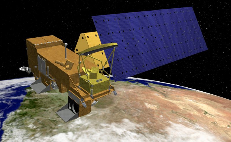
VERITAS spacecraft. Image Credit: NASA

Using its spectrometer, VERITAS would determine which rocks recently formed from erupting magma, before interactions with the atmosphere have had time to change their chemical composition. In addition, the spectrometer would search for hotspots from active eruptions, while the radar instrument would search for active faulting, an indication of tectonic activity.

In getting to know Venus' volcanoes and the geophysical processes causing them, scientists could also gauge their impact on the planet's climate and, perhaps, answer another key question: Does the planet's interior still contain large quantities of water like Earth's does?

Making Planets Habitable

Plate tectonics and volcanism don't just affect how a planet takes shape; they are intimately tied to a planet's habitability. Plate tectonics strongly affects Earth's long-term climate by influencing the processes that keep the atmosphere in balance: volcanism, which release volatiles into the atmosphere, and subduction, which recycles volatiles back into the interior. Also, the formation and erosion of Earth's continents have a major influence on the composition of the oceans and atmosphere. Together, these processes provide the nutrients and a habitable climate for life to thrive.

But what is the delicate geodynamic balance that ultimately makes a planet habitable? Considering the discovery of thousands of exoplanets orbiting stars other than our Sun, the answer could inform our understanding of their nature.

"To unwrap the mysteries of Venus we have to look under the hood at Venus' interior; it is the engine for global geologic and atmospheric evolution," said Smrekar. "Are Venus and Earth fundamentally unique worlds? Or are the differences between these 'twins' only cosmetic? Answering this question is key to understanding what makes other rocky planets habitable and, ultimately, emerge with life."

Read more about Discovery Mission proposals selected to develop concept studies here: https://www.jpl.nasa.gov/news/news.php?feature=7597

NASA's Discovery Program: https://www.nasa.gov/planetarymissions/discovery.html

Images (mentioned), Text, Credits: NASA/Grey Hautaluoma/Alana Johnson/JPL/Ian J. O'Neill.

Greetings, Orbiter.ch

Comet NEOWISE Sizzles as It Slides by the Sun, Providing a Treat for Observers


NASA - NEOWISE Mission logo.

July 9, 2020

Catch the comet in the morning sky until July 11, after which you can find it just after sunset until mid-August.

A comet visiting from the most distant parts of our solar system is putting on a spectacular nighttime display. Named Comet C/2020 F3 NEOWISE, the comet made its once-in-our-lifetimes close approach to the Sun on July 3, 2020, and will cross outside Earth's orbit on its way back to the outer parts of the solar system by mid-August.


Image above: Comet C/2020 F3 NEOWISE appears as a string of fuzzy red dots in this composite of several heat-sensitive infrared images taken by NASA's Near-Earth Object Wide-field Infrared Survey Explorer (NEOWISE) mission on March 27, 2020. Image Credits: NASA/JPL-Caltech.

The comet cruised just inside Mercury's orbit on July 3. This very close passage by the Sun is cooking the comet's outermost layers, causing gas and dust to erupt off the icy surface and creating a large tail of debris. And yet the comet has managed to survive this intense roasting.

Observers all over the world are racing to see the natural fireworks display before the comet speeds away into the depths of space. Even the astronauts aboard the International Space Station spotted it from their vantage point high above Earth's atmosphere.

People wishing to catch a glimpse of the glowing comet can spot it as it swings through the inner solar system, but its nearness to the Sun creates some observing challenges.

For the next few days it will be visible about an hour before sunrise, close to the horizon in the northeastern sky in the United States. Observers might be able to see the comet's central core, or nucleus, with the naked eye in dark skies; using binoculars will give viewers a good look at the fuzzy comet and its long, streaky tail. As it speeds away from the Sun, Comet NEOWISE will begin to make its appearance in the evening sky shortly after sunset on July 11.


Image above: Comet NEOWISE captured on July 6, 2020, above the northeast horizon just before sunrise in Tucson. Image Credit: Vishnu Reddy.

NASA's Near-Earth Object Wide-field Infrared Survey Explorer (NEOWISE) mission discovered the icy visitor on March 27, 2020, using its two infrared channels, which are sensitive to the heat signatures given off by the object as the Sun started to turn up the heat.

The spacecraft was launched in December 2009 and was originally named the Wide-Field Infrared Survey Explorer (WISE). WISE was not designed to study asteroids and comets and is now long past its expected lifetime of 7 months. Although incapable of discovering large numbers of near-Earth asteroids and comets, the spacecraft has provided information on their numbers and sizes based on a sample of them and was repurposed for this use in 2013 by what is now known as NASA's Planetary Defense Coordination Office.

"In its discovery images, Comet NEOWISE appeared as a glowing, fuzzy dot moving across the sky even when it was still pretty far away," said Amy Mainzer, NEOWISE principal investigator at the University of Arizona. "As soon as we saw how close it would come to the Sun, we had hopes that it would put on a good show."

The search for asteroids or comets that could potentially impact Earth also expands the science of these primitive solar system bodies. In this case, Comet NEOWISE will pass by Earth at a harmless distance of 64 million miles (103 million kilometers) while giving astronomers the opportunity to learn more about its composition and structure. The NEOWISE mission's infrared data complements images taken at visible-light wavelengths by observers on the ground.

"From its infrared signature, we can tell that it is about 5 kilometers [3 miles] across, and by combining the infrared data with visible-light images, we can tell that the comet's nucleus is covered with sooty, dark particles left over from its formation near the birth of our solar system 4.6 billion years ago," said Joseph Masiero, NEOWISE deputy principal investigator at NASA's Jet Propulsion Laboratory in Southern California.

Near-Earth Object Wide-field Infrared Survey Explorer (NEOWISE). Image Credit: NASA

The NEOWISE mission is not expected to last much longer due to natural orbital precession and will eventually harmlessly re-enter Earth's atmosphere. The University of Arizona and JPL are now working on developing a highly capable next-generation space-based telescopic survey called the Near-Earth Object Surveillance Mission (NEOSM). If fully funded, NEOSM would greatly expand NASA's ability to identify, track, and characterize asteroids and comets that could potentially impact Earth. This would help the agency reach a near-Earth asteroid discovery goal set before it by Congress, and would complement existing and planned ground-based efforts.

NEOSM would optimize the NEOWISE mission's architecture for the study of near-Earth objects, improving it by using next-generation infrared sensors and strategic operations that would allow it to search a much larger swath of space around Earth's orbit.

NEOWISE is a project of JPL, a division of Caltech, and the University of Arizona, supported by NASA's Planetary Defense Coordination Office.

For more information about NEOWISE, visit:

https://www.nasa.gov/neowise

http://neowise.ipac.caltech.edu/

For more information about NASA's Planetary Defense Coordination Office, visit:

https://www.nasa.gov/planetarydefense

Images (mentioned), Text, Credits: NASA/Joshua Handal/University Communications, The University of Arizona/Written by Mikayla Mace/JPL/Ian J. O'Neill.

Greetings, Orbiter.ch