samedi 31 octobre 2015

United Launch Alliance Successfully Launches GPS IIF-11 Satellite for U.S. Air Force


ULA - Atlas 5 / GPS IIF-11 Launch poster.

Oct. 31, 2015

Atlas V GPS IIF-11 Launch

A United Launch Alliance (ULA) Atlas V rocket carrying the Global Positioning System (GPS) IIF-11 satellite for the U.S. Air Force lifted off from Space Launch Complex-41 Oct. 31 at 12:13 p.m. EDT.

GPS IIF-11 is one of the next-generation GPS satellites that incorporate numerous improvements to provide greater accuracy, increased signals and enhanced performance for users.

Atlas V GPS IIF-11 Launch Highlights

“Congratulations to the entire team on today’s successful launch of the GPS IIF-11 satellite! Today’s launch was made possible by the exceptional performance and teamwork exhibited by the entire team, including the men and women of ULA, our many mission partners, and our U.S. Air Force customer,” said Jim Sponnick, ULA vice president, Atlas and Delta Programs. “GPS is omnipresent in our everyday lives and the system provides a critical service to the all of those serving in our military around the world. All of the operational GPS satellites have been launched on Atlas and Delta rockets and the U.S. Air Force does an outstanding job of operating this essential system.”

This mission was ULA’s 11th launch in 2015 and the 102nd  successful launch since the company was formed in December 2006. This mission was launched aboard an Atlas V Evolved Expendable Launch Vehicle (EELV) 401 configuration vehicle, which includes a 4-meter-diameter payload fairing. The Atlas booster for this mission was powered by the RD AMROSS RD-180 engine and the Centaur upper stage was powered by the Aerojet Rocketdyne RL10C-1 engine.

Global Positioning System satellite or GPS

GPS IIF-11 will join the GPS worldwide timing and navigation system utilizing 24 satellites in six different planes, with a minimum of four satellites per plane positioned in orbit approximately 11,000 nautical miles above the Earth’s surface. The GPS IIF series provides improved accuracy and enhanced performance for GPS users.

ULA's next launch is the Atlas V OA-4 capsule for Orbital ATK scheduled for Dec. 3 from Space Launch Complex-41 from Cape Canaveral Air Force Station, Florida.

The EELV program was established by the U.S. Air Force to provide assured access to space for Department of Defense and other government payloads. The commercially developed EELV program supports the full range of government mission requirements, while delivering on schedule and providing significant cost savings over the heritage launch systems.

With more than a century of combined heritage, United Launch Alliance is the most experienced and reliable launch service provider. ULA has successfully delivered more than 100 satellites to orbit that provide critical capabilities for troops in the field, aid meteorologists in tracking severe weather, enable personal device-based GPS navigation and unlock the mysteries of our solar system.

For more information on ULA, visit the ULA website at http://www.ulalaunch.com

Join the conversation at http://www.facebook.com/ulalaunch, http://twitter.com/ulalaunch

Images, Video, Text, Credits: United Launch Alliance (ULA)/USAF.

Greetings, Orbiter.ch

vendredi 30 octobre 2015

Sun - Active Regions Blossoming


NASA - Solar Dynamics Observatory (SDO) patch.

Oct. 30, 2015

Active Regions Blossoming

As a pair of active regions began to rotate into view, their towering magnetic field lines above them bloomed into a dazzling display of twisting arches (Oct. 27-28, 2015).

Solar Dynamics Observatory (SDO) satellite. Image Credit: NASA

Some of the lines reached over and connected with the neighboring active region. Active regions are usually the source of solar storms. The images were taken in a wavelength of extreme ultraviolet light.

For more information about Solar Dynamics Observatory (SDO), visit: http://sdo.gsfc.nasa.gov/

Image, Video, Credits: Solar Dynamics Observatory (SDO)/NASA.

Cheers, Orbiter.ch

Snowing in Space?


ESA / NASA - SOHO Mission patch.

Oct. 30, 2015

The flurry of what looks like snow in this video is actually a barrage of energetic particles. This is what's known as a solar radiation storm, hitting an instrument onboard ESA/NASA’s Solar and Heliospheric Observatory, or SOHO, on Oct. 29, 2015. These bursts of incredibly fast-moving protons and electrons are fairly common, but this particular event was interesting because they came from an unusual source: a low-level solar flare and two relatively slow coronal mass ejections, as opposed to the fast, strong eruptions that normally produce them.

Animation above: Credits: ESA/NASA/SOHO

Most energetic particles detected by our satellites—SOHO and NOAA’s Geostationary Operational Environmental Satellite, or GOES—are accelerated by coronal mass ejections, or CMEs, which are clouds of solar material hurtling out from the sun, and from extremely strong solar flares. When CMEs plow through space, they sweep up the particles in front of them, accelerating them up to incredible speeds.

In short, we expect strong particle storms from large and fast events.  But in this case, the particles that flowed over SOHO in this image were accelerated by fairly slow CMEs, as well as a solar flare on the sun.

“Events on the sun can accelerate high-energy particles to very high speeds,” said Yari Collado-Vega, a space physicist at NASA’s Goddard Space Flight Center in Greenbelt, Maryland. “These solar-accelerated particles can get up to 80 percent of the speed of light.”

Solar and Heliospheric Observatory (SOHO) satellite. Image Credits: ESA/NASA

That these relatively small events caused such fast particles has to do, in part, with the fact that the active region that produced the flare on Oct. 28 is on the right side of the sun’s disk, an area that has an almost direct magnetic connection to Earth – due to the fact that the sun's magnetic field lines curve as they extend away from the sun in conjunction with the sun's rotation.

The result? A barrage of fast-moving particles aimed directly at Earth. This radiation cannot pass through Earth's magnetic field and atmosphere to physically affect humans on the ground, however it does makes for a fascinating fireworks show seen by our sun-watching SOHO.

For more information about Solar and Heliospheric Observatory (SOHO), visit: http://www.nasa.gov/mission_pages/soho/index.html and http://sci.esa.int/soho/

Image (mentioned), Animation (mentioned), Text, Credits: NASA/Rob Garner/Goddard Space Flight Center/Sarah Frazier.

Greetings, Orbiter.ch

Finding New Worlds with a Play of Light and Shadow


NASA - Kepler Space Telescope patch.

Oct. 30, 2015

Astronomers have used many different methods to discover planets beyond the solar system, but the most successful by far is transit photometry, which measures changes in a star's brightness caused by a mini-eclipse. When a planet crosses in front of its star along our line of sight, it blocks some of the star's light. If the dimming lasts for a set amount of time and occurs at regular intervals, it likely means an exoplanet is passing in front of, or transiting, the star once every orbital period.

Looking for the Shadows of New Worlds

Video above: NASA Goddard astrophysicist Daniel Angerhausen discusses how astronomers may be able to maximize transit photometry to find planets like those in our solar system around other stars -- and possibly moons, rings, and asteroid groups as well. Video Credits: NASA's Goddard Space Flight Center.

NASA’s Kepler Space Telescope has used this technique to become the most successful planet-hunting spacecraft to date, with more than a thousand established discoveries and many more awaiting confirmation. Missions carrying improved technology are now planned, but how much more can they tell us about alien planetary systems similar to our own?

A great deal, according to recently published studies by Michael Hippke at the Institute for Data Analysis in Neukirchen-Vluyn, Germany, and Daniel Angerhausen, a postdoctoral researcher at NASA's Goddard Space Flight Center in Greenbelt, Maryland. They show that in the best-case scenarios upcoming missions could uncover planetary moons, ringed worlds similar to Saturn, and even large collections of asteroids.

"We expect a flood of discoveries from these new missions, so we want to get a feel for the possibilities so scientists can make the most of the data," Angerhausen said.

Exoplanet passes in front of its sun. Image Credits: NASA/GSFC

Both NASA and the European Space Agency (ESA) are building on Kepler's success. NASA's Transiting Exoplanet Survey Satellite (TESS), scheduled to launch no later than 2018, will be the first-ever spaceborne all-sky transit survey. Over the course of two years, TESS will monitor some 200,000 nearby stars for telltale transits. ESA's Planetary Transits and Oscillations of stars (PLATO) satellite, which is expected to begin a six-year mission in 2024, will search for planets around roughly a million stars spread over half the sky.

The amount of stellar dimming caused by a transiting planet tells astronomers how big the planet is in proportion to its star, while recurring events can tell us how long it takes for the object to orbit its star. Additional transits increase confidence the dimming isn't caused by another cosmic object (such as a faint star), dark sunspot-like regions on the host star, or noise in the detector. Over the operational lifetime of a satellite, the strongest signals always come from larger planets orbiting close to their stars because they produce both a deeper dimming and more frequent transits.

ESA's Planetary Transits and Oscillations of stars (PLATO) satellite. Image Credit: ESA

"Planets with sizes and orbits similar to Mars or Mercury will remain out of reach, even when six years of PLATO data are combined," said Hippke. "But worlds similar to Venus and Earth will show up readily." Kepler has demonstrated the presence of planets smaller than Earth in very close orbits around stars smaller than the sun, but these sweltering worlds are unlikely to support life. TESS and PLATO will reveal Earth-sized worlds in Earth-like orbits around stars similar to the sun. Orbiting within the star’s habitable zone, these planets may possess pools of liquid water, thought to be a prerequisite for the development of life as we know it.

Jupiter and Saturn each take more than a decade to orbit the sun. Similar worlds may only transit once during the TESS and PLATO missions but will produce a strong event. If, like Jupiter, the planet has a few large moons, their transits could show up in the data too. "We wouldn't have a clear detection, and we wouldn't be able to say whether the planet had a single large moon or a set of small ones, but the observation would provide a strong moon candidate for follow-up by other future facilities," explained Angerhausen.

NASA's Transiting Exoplanet Survey Satellite (TESS) satellite. Image Credit: NASA

Today, rings have been detected around only one exoplanet, called J1407b. The ring system is more than 200 times larger than Saturn's. Considering how a more Saturn-like planet would appear to PLATO, the researchers show that the transiting ring system produces a clear signal that precedes and follows the planet's passage across its star. These findings were published in the Sept. 1 issue of The Astrophysical Journal: http://iopscience.iop.org/article/10.1088/0004-637X/810/1/29/meta

In a second study, published in the Sept. 20 issue of the same journal, the researchers explored the possibility of detecting asteroids trapped in stable orbital zones called Lagrange points, locations where a planet's gravitational pull balances its sun's. These areas lead and follow the planet in its orbit by about 60 degrees. In our solar system, the most prominent example occurs near Jupiter, where at least 6,000 known objects have gathered in two groups collectively called the Trojan asteroids. Less well known is that Earth, Mars, Uranus and Neptune similarly have captured one or more asteroids along their orbits, and astronomers now refer to all objects trapped in this way as Trojan bodies. http://iopscience.iop.org/article/10.1088/0004-637X/811/1/1/meta  

The same phenomenon will occur in other planetary systems, so Hippke and Angerhausen combined Kepler observations of more than 1,000 planet-hosting stars to hunt for an average dip in starlight that would indicate transits by Trojan bodies. They turned up a subtle signal corresponding to the expected locations of objects trapped in two Lagrange points.

"As good as the Kepler data are, we're really pushing them to the limit, so this is a very preliminary result," Hippke said. "We've shown somewhat cautiously that it's possible to detect Trojan asteroids, but we'll have to wait for better data from TESS, PLATO and other missions to really nail that down."

Related links:

NASA’s Kepler Space Telescope: http://kepler.nasa.gov/

NASA's Transiting Exoplanet Survey Satellite (TESS): http://tess.gsfc.nasa.gov/

ESA's Planetary Transits and Oscillations of stars (PLATO): http://sci.esa.int/plato/

Distant Planets: http://www.nasa.gov/subject/6889/distant-planets

Images (mentioned), Video (mentioned), Text, Credits: NASA's Goddard Space Flight Center/Francis Reddy/Ashley Morrow.

Greetings, Orbiter.ch

Halloween Skies to Include Dead Comet Flyby


Asteroid Watch logo.

Oct. 30, 2015

The large space rock that will zip past Earth this Halloween is most likely a dead comet that, fittingly, bears an eerie resemblance to a skull.


Animation above: This animated GIF was generated using radar data collected by the National Science Foundation's 1,000-foot (305-meter) Arecibo Observatory in Puerto Rico. The six radar images used in the animation were taken on Oct. 30, 2015, and the image resolution is 25 feet (7.5 meters) per pixel. Animation Credits: NAIC-Arecibo/NSF.

Scientists observing asteroid 2015 TB145 with NASA's Infrared Telescope Facility (IRTF) on Mauna Kea, Hawaii, have determined that the celestial object is more than likely a dead comet that has shed its volatiles after numerous passes around the sun.

The belated comet has also been observed by optical and radar observatories around the world, providing even more data, including our first close-up views of its surface. Asteroid 2015 TB145 will safely fly by our planet at just under 1.3 lunar distances, or about 302,000 miles (486,000 kilometers), on Halloween (Oct. 31) at 1 p.m. EDT (10 a.m. PDT, 17:00 UTC).

The first radar images of the dead comet were generated by the National Science Foundation's 305-meter (1,000-foot) Arecibo Observatory in Puerto Rico. The radar images from Arecibo indicate the object is spherical in shape and approximately 2,000 feet (600 meters) in diameter and completes a rotation about once every five hours.  


Image above: This image of asteroid 2015 TB145, a dead comet, was generated using radar data collected by the National Science Foundation's 1,000-foot (305-meter) Arecibo Observatory in Puerto Rico. The radar image was taken on Oct. 30, 2015, and the image resolution is 25 feet (7.5 meters) per pixel. Image Credits: NAIC-Arecibo/NSF.

"The IRTF data may indicate that the object might be a dead comet, but in the Arecibo images it appears to have donned a skull costume for its Halloween flyby," said Kelly Fast, IRTF program scientist at NASA Headquarters and acting program manager for NASA's NEO Observations Program.

Managed by the University of Hawaii for NASA, the IRTF's 3-meter (10 foot) telescope collected infrared data on the object. The data may finally put to rest the debate over whether 2015 TB145, with its unusual orbit, is an asteroid or is of cometary origin.

(Click on the image for enlarge)

Images above: These first radar images from the National Science Foundation's 1,000-foot (305-meter) Arecibo Observatory in Puerto Rico, indicate the near-Earth object is spherical in shape and approximately 2,000 feet (600 meters) in diameter. The radar images were taken on Oct. 30, 2015, and the image resolution is 25 feet (7.5 meters) per pixel. Images Credits: NAIC-Arecibo/NSF.

"We found that the object reflects about six percent of the light it receives from the sun," said Vishnu Reddy, a research scientist at the Planetary Science Institute, Tucson, Arizona. "That is similar to fresh asphalt, and while here on Earth we think that is pretty dark, it is brighter than a typical comet which reflects only 3 to 5 percent of the light. That suggests it could be cometary in origin –- but as there is no coma evident, the conclusion is it is a dead comet.”

Radar images generated by the Arecibo team are available at: 

https://www.facebook.com/notes/national-astronomy-and-ionosphere-center-arecibo-observatory/near-earth-asteroid-2015-tb145-passes-by-without-a-fright/1082765941733673

Asteroid 2015 TB145 was discovered on Oct. 10, 2015, by the University of Hawaii's Pan-STARRS-1 (Panoramic Survey Telescope and Rapid Response System) on Haleakala, Maui, part of the NASA-funded Near-Earth Object Observations (NEOO) Program. The next time the asteroid will be in Earth's neighborhood will be in September 2018, when it will make a distant pass at about 24 million miles (38 million kilometers), or about a quarter the distance between Earth and the sun.

Radar is a powerful technique for studying an asteroid's size, shape, rotation, surface features and surface roughness, and for improving the calculation of asteroid orbits. Radar measurements of asteroid distances and velocities often enable computation of asteroid orbits much further into the future than would be possible otherwise.

NASA places a high priority on tracking asteroids and protecting our home planet from them. In fact, the U.S. has the most robust and productive survey and detection program for discovering near-Earth objects (NEOs). To date, U.S.-funded assets have discovered over 98 percent of the known NEOs.

In addition to the resources NASA puts into understanding asteroids, it also partners with other U.S. government agencies, university-based astronomers, and space science institutes across the country, often with grants, interagency transfers and other contracts from NASA, and also with international space agencies and institutions that are working to track and better understand these objects. In addition, NASA values the work of numerous highly skilled amateur astronomers, whose accurate observational data helps improve asteroid orbits after they are found.

NASA's Jet Propulsion Laboratory, Pasadena, California, hosts the Center for Near-Earth Object Studies for NASA's Near-Earth Object Observations Program within the agency's Science Mission Directorate.

More information about asteroids and near-Earth objects is at these websites:

http://neo.jpl.nasa.gov

http://www.jpl.nasa.gov/asteroidwatch

Images (mentioned), Animation (mentioned), Text, Credits: NASA/Tony Greicius/JPL/DC Agle.

Best regards, Orbiter.ch

15 Ways the International Space Station is Benefiting Earth


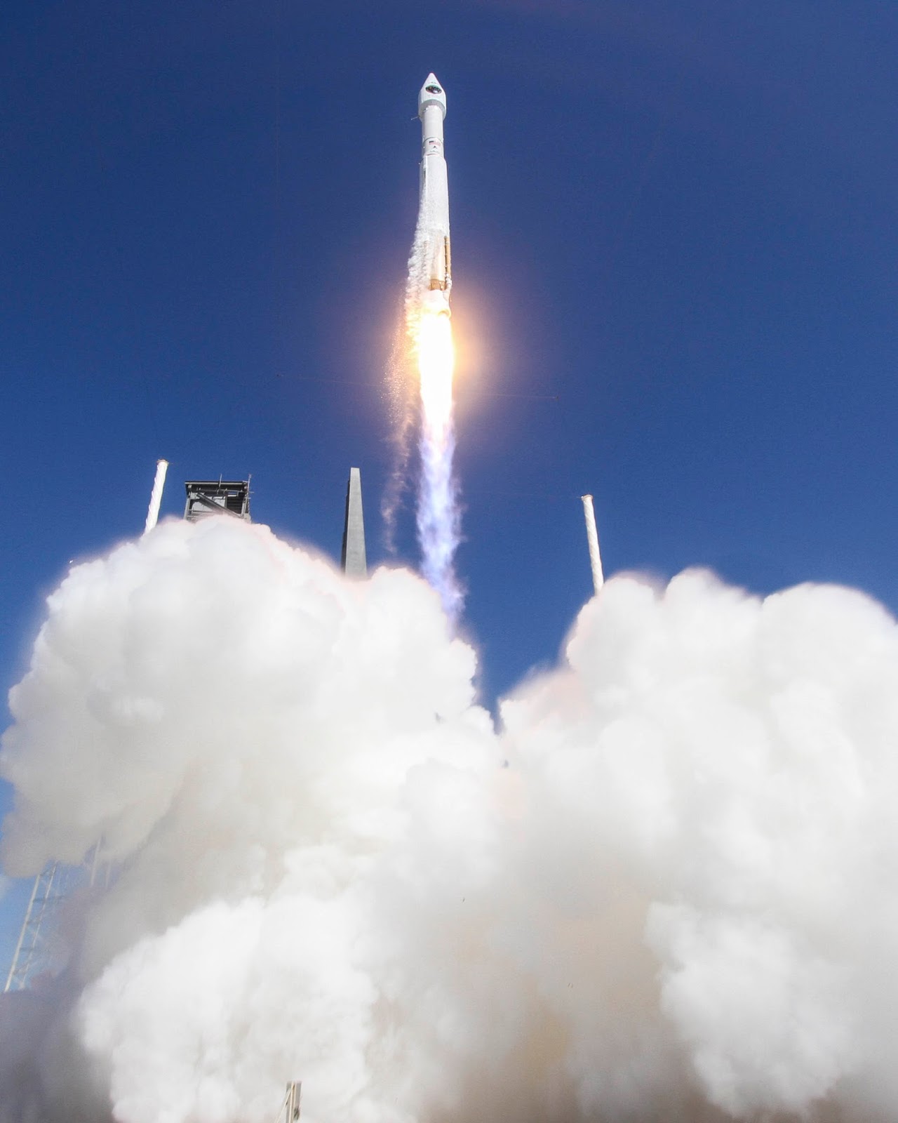
ISS - International Space Station patch.

Oct. 30, 2015

International Space Station 15 Years

 International Space Station (ISS)

With astronauts living and working aboard the International Space Station, NASA is learning a great deal about creating and testing critical systems, maintaining efficient communications and protecting the human body during a deep space mission. While these are critical to our journey to Mars, it is important to also note all the ways in which research conducted and technology tested aboard the orbiting laboratory help us here on Earth.

Here are 15 ways the space station is benefiting life on Earth:

Commercializing low-Earth orbit


An exciting new commercial pathway is revolutionizing and opening access to space, fostering America’s new space economy in low-Earth orbit. For the first time, the market is expressing what research can and should be done aboard the microgravity laboratory without direct government funding. A significant portion of the commercial research taking place aboard the station is made possible by NanoRacks hardware. The company has invested privately and raised capital to provide laboratory facilities for small payloads, including CubeSats deployed from the space station, that make research faster and more affordable. NASA’s move to purchase commercial cargo resupply and crew transportation to the space station enables U.S. businesses to develop a competitive capability they also can sell as a service to others while freeing NASA resources for deep space exploration. Private sector participation provides a new model for moving forward in partnership with the government.

Supporting water purification efforts worldwide 


Whether in the confines of the International Space Station or a tiny hut village in sub-Saharan Africa, drinkable water is vital for human survival. Unfortunately, many people around the world lack access to clean water. Using technology developed for the space station, at-risk areas can gain access to advanced water filtration and purification systems, making a life-saving difference in these communities. Joint collaborations between aid organizations and NASA technology show just how effectively space research can adapt to contribute answers to global problems. The commercialization of this station-related technology has provided aid and disaster relief for communities worldwide. The Water Security Corporation, in collaboration with other organizations, has deployed systems using NASA water-processing technology around the world.

Growing high-quality protein crystals


There are more than 100,000 proteins in the human body and as many as 10 billion in nature. Every structure is different, and each protein holds important information related to our health and to the global environment. The perfect environment in which to study these structures is space. Microgravity allows for optimal growth of the unique and complicated crystal structures of proteins leading to the development of medical treatments. An example of a protein that was successfully crystallized in space is hematopoietic prostaglandin D synthase (H-PGDS), which may hold the key to developing useful drugs for treating muscular dystrophy. This particular experiment is an example of how understanding a protein’s structure can lead to better drug designs. Further research is ongoing.

Bringing space station ultrasound to the ends of the Earth 


Fast, efficient and readily available medical attention is key to survival in a health emergency. For those without medical facilities within easy reach, it can mean the difference between life and death. For astronauts in orbit about 250 miles above Earth aboard the International Space Station, that problem was addressed through the Advanced Diagnostic Ultrasound in Microgravity (ADUM) investigation. In partnership with the World Interactive Network Focused on Critical Ultrasound (WINFO-CUS), ADUM principal investigator Scott Dulchavsky, M.D., is taking techniques originally developed for space station astronauts and adapting them for use in Earth’s farthest corners by developing protocols for performing complex procedures rapidly with remote expert guidance and training. Medical care has become more accessible in remote regions by use of small ultrasound units, tele-medicine, and remote guidance techniques, just like those used for people living aboard the space station.

Improving eye surgery with space hardware


Laser surgery to correct eyesight is a common practice, and technology developed for use in space is now commonly used on Earth to track a patient’s eye and precisely direct the laser scalpel. The Eye Tracking Device experiment gave researchers insight into how humans’ frames of reference, balance and the overall control of eye movement are affected by weightlessness. In parallel with its use on the space station, the engineers realized the device had potential for applications on Earth. Tracking the eye’s position without interfering with the surgeon’s work is essential in laser surgery. The space technology proved ideal, and the Eye Tracking Device equipment is now being used in a large proportion of corrective laser surgeries throughout the world.

Making inoperable tumors operable with a robotic arm


The delicate touch that successfully removed an egg-shaped tumor from Paige Nickason’s brain got a helping hand from a world-renowned arm—a robotic arm, that is. The technology that went into developing neuroArm, the world’s first robot capable of performing surgery inside magnetic resonance machines, was born of the Canadarm (developed in collaboration with engineers at MacDonald, Dettwiler, and Associates, Ltd. [MDA] for the U.S. Space Shuttle Program) as well as Canadarm2 and Dextre, the Canadian Space Agency’s family of space robots performing the heavy lifting and maintenance aboard the International Space Station. Since Nickason’s surgery in 2008, neuroArm has been used in initial clinical experience with 35 patients who were otherwise inoperable.

Preventing bone loss through diet and exercise


In the early days of the space station, astronauts were losing about one-and-a-half percent of their total bone mass density per month. Researchers discovered an opportunity to identify the mechanisms that control bones at a cellular level. These scientists discovered that high-intensity resistive exercise, dietary supplementation for vitamin D and specific caloric intake can remedy loss of bone mass in space. The research also is applicable to vulnerable populations on Earth, like older adults, and is important for continuous crew member residency aboard the space station and for deep space exploration to an asteroid placed in lunar orbit and on the journey to Mars.

Understanding the mechanisms of osteoporosis


While most people will never experience life in space, the benefits of studying bone and muscle loss aboard the station has the potential to touch lives here on the ground. Model organisms are non-human species with characteristics that allow them easily to be reproduced and studied in a laboratory. Scientists conducted a study of mice in orbit to understand mechanisms of osteoporosis. This research led to availability of a pharmaceutical on Earth called Prolia® to treat people with osteoporosis, a direct benefit of pharmaceutical companies using the spaceflight opportunity available via the national lab to improve health on Earth.

Developing improved vaccines


Ground research indicated that certain bacteria, in particular Salmonella, might become more pathogenic (more able to cause disease) during spaceflight. Salmonella infections result in thousands of hospitalizations and hundreds of deaths annually in the United States. While studying them in space, scientists found a pathway for bacterial pathogens to become virulent. Researchers identified the genetic pathway activating in Salmonella bacteria, allowing the increased likelihood to spread in microgravity. This research on the space station led to new studies of microbial vaccine development.

Providing students opportunities to conduct their own science in space 


From the YouTube Space Lab competition, the Student Spaceflight Experiments Program, and SPHERES Zero Robotics, space station educational activities inspire more than 43 million students across the globe. These tyFrom the YouTube Space Lab competition, the Student Spaceflight Experiments Program, and SPHERES Zero Robotics, space station educational activities inspire more than 43 million students across the globe. These types of inquiry-based projects allow students to be involved in human space exploration with the goal of stimulating their studies of science, technology, engineering and mathematics. It is understood that when students test a hypothesis on their own or compare work in a lab to what’s going on aboard the space station, they are more motivated towards math and science.

Breast cancer detection and treatment technology


A surgical instrument inspired by the Canadian Space Agency’s heavy-lifting and maneuvering robotic arms on the space station is in clinical trials for use in patients with breast cancer. The Image-Guided Autonomous Robot (IGAR) works inside an MRI machine to help accurately identify the size and location of a tumor. Using IGAR, surgeons also will be able to perform highly dexterous, precise movements during biopsies.

Monitoring water quality from space


Though it completed its mission in 2015, the Hyperspectral Imager for the Coastal Ocean (HICO) was an imaging sensor that helped detect water quality parameters such as water clarity, phytoplankton concentrations, light absorption and the distribution of cyanobacteria. HICO was first designed and built by the U.S. Naval Research Laboratory for the Office of Naval Research to assess water quality in the coastal ocean. Researchers at the U.S. Environmental Protection Agency (EPA) took the data from HICO and developed a smartphone application to help determine hazardous concentrations of contaminants in water. With the space station’s regular addition of new instruments to provide a continuous platform for Earth observation, researchers will continue to build proactive environmental protection applications that benefit all life on Earth.

Monitoring natural disasters from space 


An imaging system aboard the station, ISS SERVIR Environmental Research and Visualization System (ISERV), captured photographs of Earth from space for use in developing countries affected by natural disasters. A broader joint endeavor by NASA and the U.S. Agency for International Development, known as SERVIR, works with developing nations around the world to use satellites for environmental decision-making. Images from orbit can help with rapid response efforts to floods, fires, volcanic eruptions, deforestation, harmful algal blooms and other types of natural events. Since the station passes over more than 90 percent of the Earth’s populated areas every 24 hours, the ISERV system was available to provide imagery to developing nations quickly, collecting up to 1,000 images per day. Though ISERV successfully completed its mission, the space station continues to prove to be a valuable platform for Earth observation during times of disaster

Describing the behavior of fluids to improve medical devices 


Capillary Flow Experiments (CFE) aboard the space station study the movement of a liquid along surfaces, similar to the way fluid wicks along a paper towel. These investigations produce space-based models that describe fluid behavior in microgravity, which has led to a new medical testing device on Earth. This new device could improve diagnosis of HIV/AIDS in remote areas, thanks in part to knowledge gained from the experiments.

Improving indoor air quality


Solutions for growing crops in space now translates to solutions for mold prevention in wine cellars, homes and medical facilities, as well as other industries around the world. NASA is studying crop growth aboard the space station to develop the capability for astronauts to grow their own food as part of the agency’s journey to Mars. Scientists working on this investigation noticed that a buildup of a naturally-occurring plant hormone called ethylene was destroying plants within the confined plant growth chambers. Researchers developed and successfully tested an ethylene removal system in space, called Advanced Astroculture (ADVASC). It helped to keep the plants alive by removing viruses, bacteria and mold from the plant growth chamber. Scientists adapted the ADVASC system for use in air purification. Now this technology is used to prolong the shelf-life of fruits and vegetables in the grocery store, and winemakers are using it in their storage cellars.

Related links:

15 Years on Station: http://www.nasa.gov/station15

International Space Station (ISS): http://www.nasa.gov/mission_pages/station/main/index.html

Space Station Research and Technology: http://www.nasa.gov/mission_pages/station/research/index.html

America’s new space economy in low-Earth orbit: https://www.nasa.gov/feature/iss-commercial-economic-opportunities/

NASA water-processing technology: http://www.nasa.gov/content/benefits-for-humanity-water-for-the-world/

Advanced Diagnostic Ultrasound in Microgravity (ADUM): http://www.nasa.gov/mission_pages/station/research/benefits/ultrasound.html

Eye Tracking Device experiment: http://www.nasa.gov/mission_pages/station/research/experiments/179.html

SPHERES Zero Robotics: http://www.nasa.gov/mission_pages/station/research/experiments/690.html

Image-Guided Autonomous Robot (IGAR): http://www.nasa.gov/station/research/news/igar/

Hyperspectral Imager for the Coastal Ocean (HICO): http://www.nasa.gov/mission_pages/station/research/benefits/HREP_HICO.html

ISS SERVIR Environmental Research and Visualization System (ISERV): http://www.nasa.gov/mission_pages/station/research/benefits/HREP_HICO.html

Capillary Flow Experiments (CFE): http://www.nasa.gov/mission_pages/station/research/news/cap_flow/

Advanced Astroculture (ADVASC): http://www.nasa.gov/mission_pages/station/research/news/ADVASC/

Animations, Images, Text, Credits: NASA/Kristine Rainey.

Best regards, Orbiter.ch

Saturn's Geyser Moon Shines in Close Flyby Views


NASA - Cassini Mission to Saturn patch.

Oct. 30, 2015


Image above: This unprocessed view of Saturn's moon Enceladus was acquired by NASA's Cassini spacecraft during a close flyby of the icy moon on Oct. 28, 2015. Image Credits: NASA/JPL-Caltech/Space Science Institute.

NASA's Cassini spacecraft has begun transmitting its latest images of Saturn's icy, geologically active moon Enceladus, acquired during the dramatic Oct. 28 flyby in which the probe passed about 30 miles (49 kilometers) above the moon's south polar region. The spacecraft will continue transmitting its data from the encounter for the next several days.


Image above: NASA's Cassini spacecraft captured this view as it neared icy Enceladus for its closest-ever dive past the moon's active south polar region. Image Credits: NASA/JPL-Caltech/Space Science Institute.

"Cassini's stunning images are providing us a quick look at Enceladus from this ultra-close flyby, but some of the most exciting science is yet to come," said Linda Spilker, the mission's project scientist at NASA's Jet Propulsion Laboratory in Pasadena, California.


Image above: The south polar region of Saturn's active, icy moon Enceladus awaits NASA's Cassini spacecraft in this view, acquired on approach to the mission's deepest-ever dive through the moon's plume of icy spray. Image Credits: NASA/JPL-Caltech/Space Science Institute.

Researchers will soon begin studying data from Cassini's gas analyzer and dust detector instruments, which directly sampled the moon's plume of gas and dust-sized icy particles during the flyby. Those analyses are likely to take several weeks, but should provide important insights about the composition of the global ocean beneath Enceladus' surface and any hydrothermal activity occurring on the ocean floor. The potential for such activity in this small ocean world has made Enceladus a prime target for future exploration in search of habitable environments in the solar system beyond Earth.


Image above: Following a successful close flyby of Enceladus, NASA's Cassini spacecraft captured this artful composition of the icy moon with Saturn's rings beyond. Image Credits: NASA/JPL-Caltech/Space Science Institute.

In addition to the processed images, unprocessed, or "raw," images appear on my last article:

http://orbiterchspacenews.blogspot.ch/2015/10/close-view-of-saturns-moon-enceladus.html

Cassini's next and final close Enceladus flyby will take place on Dec. 19, when the spacecraft will measure the amount of heat coming from the moon's interior. The flyby will be at an altitude of 3,106 miles (4,999 kilometers).


Image above: During its closest ever dive past the active south polar region of Saturn's moon Enceladus. Image Credits: NASA/JPL-Caltech/Space Science Institute.

Additional information and multimedia products for Cassini's final Enceladus flybys are available at:

http://solarsystem.nasa.gov/finalflybys

The Cassini-Huygens mission is a cooperative project of NASA, ESA (European Space Agency) and the Italian Space Agency. NASA's Jet Propulsion Laboratory in Pasadena, California, manages the mission for the agency's Science Mission Directorate in Washington. JPL is a division of the California Institute of Technology in Pasadena. The Cassini imaging operations center is based at the Space Science Institute in Boulder, Colorado.

For more information about Cassini, visit:

http://www.nasa.gov/cassini

http://saturn.jpl.nasa.gov

http://www.esa.int/Our_Activities/Space_Science/Cassini-Huygens

Images (mentioned), Text, Credits: NASA/Dwayne Brown/Laurie Cantillo/JPL/Preston Dyches/Tony Greicius.

Greetings, Orbiter.ch

Close View of Saturn's Moon Enceladus From Oct. 28 Flyby


NASA - Cassini International logo.

Oct. 30, 2015


This unprocessed "raw" image of Saturn's icy, geologically active moon Enceladus was acquired by NASA's Cassini spacecraft during its dramatic Oct. 28, 2015 flyby in which the probe passed about 30 miles (49 kilometers) above the moon's south polar region. The spacecraft will continue transmitting its data from the Enceladus encounter for the next several days. Cassini's next and final close Enceladus flyby will take place on Dec. 19, when the spacecraft will measure the amount of heat coming from the moon's interior.

Researchers will soon begin studying data from Cassini's gas analyzer and dust detector instruments, which directly sampled the moon's plume of gas and dust-sized icy particles during the flyby. Those analyses are likely to take several weeks, but should provide important insights about the composition of the global ocean beneath Enceladus' surface and any hydrothermal activity occurring on the ocean floor. The potential for such activity in this small ocean world has made Enceladus a prime target for future exploration in search of habitable environments in the solar system beyond Earth.

Related articles:

Deepest-Ever Dive Through Enceladus Plume Completed: http://orbiterchspacenews.blogspot.ch/2015/10/deepest-ever-dive-through-enceladus.html

Seven Key Facts About Cassini's Oct. 28 'Plume Dive':
http://orbiterchspacenews.blogspot.ch/2015/10/seven-key-facts-about-cassinis-oct-28.html

For more information about Cassini, visit:

http://www.nasa.gov/cassini

http://saturn.jpl.nasa.gov

http://www.esa.int/Our_Activities/Space_Science/Cassini-Huygens

Image, Text, Credits: NASA/JPL-Caltech/Space Science Institute/Sarah Loff.

Voyager 1 Helps Solve Interstellar Medium Mystery


NASA - Voyager 1 & 2 Mission patch.

October 30, 2015

NASA's Voyager 1 spacecraft made history in 2012 by entering interstellar space, leaving the planets and the solar wind behind. But observations from the pioneering probe were puzzling with regard to the magnetic field around it, as they differed from what scientists derived from observations by other spacecraft.

A new study offers fresh insights into this mystery. Writing in the Astrophysical Journal Letters, Nathan Schwadron of the University of New Hampshire, Durham, and colleagues reanalyzed magnetic field data from Voyager 1 and found that the direction of the magnetic field has been slowly turning ever since the spacecraft crossed into interstellar space. They believe this is an effect of the nearby boundary of the solar wind, a stream of charged particles that comes from the sun.

"This study provides very strong evidence that Voyager 1 is in a region where the magnetic field is being deflected by the solar wind," said Schwadron, lead author of the study.

Researchers predict that in 10 years Voyager 1 will reach a more "pristine" region of the interstellar medium where the solar wind does not significantly influence the magnetic field.


Image above: This artist's concept shows NASA's Voyager spacecraft against a backdrop of stars. Image credit: NASA/JPL-Caltech.

Voyager 1's crossing into interstellar space meant it had left the heliosphere -- the bubble of solar wind surrounding our sun and the planets. Observations from Voyager's instruments found that the particle density was 40 times greater outside this boundary than inside, confirming that it had indeed left the heliosphere.

But so far, Voyager 1's observation of the direction of the local interstellar magnetic field is more than 40 degrees off from what other spacecraft have determined. The new study suggests this discrepancy exists because Voyager 1 is in a more distorted magnetic field just outside the heliopause, which is the boundary between the solar wind and the interstellar medium.

"If you think of the magnetic field as a rubber band stretched around a beach ball, that band is being deflected around the heliopause," Schwadron said.

In 2009, NASA's Interstellar Boundary Explorer (IBEX) discovered a "ribbon" of energetic neutral atoms that is thought to hold clues to the direction of the pristine interstellar magnetic field. The so-called "IBEX ribbon," which forms a circular arc in the sky, remains mysterious, but scientists believe it is produced by a flow of neutral hydrogen atoms from the solar wind that were re-ionized in nearby interstellar space and then picked up electrons to become neutral again.

The new study uses multiple data sets to confirm that the magnetic field direction at the center of the IBEX ribbon is the same direction as the magnetic field in the pristine interstellar medium. Observations from the NASA/ESA Ulysses and SOHO spacecraft also support the new findings.

"All of these different data sets that have been collected over the last 25 years have been pointing toward the same meeting point in the field," Schwadron said.

Over time, the study suggests, at increasing distances from the heliosphere, the magnetic field will be oriented more and more toward "true north," as defined by the IBEX ribbon. By 2025, if the field around Voyager 1 continues to steadily turn, Voyager 1 will observe the same magnetic field direction as IBEX. That would signal Voyager 1's arrival in a less distorted region of the interstellar medium.

"It's an interesting way to look at the data. It gives a prediction of how long we'll have to go before Voyager 1 is in the medium that's no longer strongly perturbed," said Ed Stone, Voyager project scientist, based at the California Institute of Technology in Pasadena, who was not involved in this study.

While Voyager 1 will continue delivering insights about interstellar space, its twin probe Voyager 2 is also expected to cross into the interstellar medium within the next few years. Voyager 2 will make additional observations of the magnetic field in interstellar space and help scientists refine their estimates.

Voyager 1 and Voyager 2 were launched 16 days apart in 1977. Both spacecraft flew by Jupiter and Saturn. Voyager 2 also flew by Uranus and Neptune. Voyager 2, launched before Voyager 1, is the longest continuously operated spacecraft. Voyager 1 is the most distant object touched by human hands.

JPL, a division of Caltech, built the twin Voyager spacecraft and operates them for the Heliophysics Division within NASA's Science Mission Directorate in Washington.

For more information about Voyager, visit: http://voyager.jpl.nasa.gov

Image (mentioned), Text, Credits: NASA/JPL/Elizabeth Landau.

Greetings, Orbiter.ch

jeudi 29 octobre 2015

Annual Antarctic Ozone Hole Larger and Formed Later in 2015


NASA - Suomi-National Polar-orbiting Partnership satellite (S-NPP) logo.

Oct. 29, 2015

The 2015 Antarctic ozone hole area was larger and formed later than in recent years, said scientists from NASA and the National Oceanic and Atmospheric Administration (NOAA).

On Oct. 2, 2015, the ozone hole expanded to its peak of 28.2 million square kilometers (10.9 million square miles), an area larger than the continent of North America. Throughout October, the hole remained large and set many area daily records. Unusually cold temperature and weak dynamics in the Antarctic stratosphere this year resulted in this larger ozone hole. In comparison, last year the ozone hole peaked at 24.1 million square kilometers (9.3 million square miles) on Sept. 11, 2014. Compared to the 1991-2014 period, the 2015 ozone hole average area was the fourth largest.


Image above: This false-color image shows ozone concentrations above Antarctica on Oct. 2, 2015. Image Credits: NASA/Goddard Space Flight Center.

“While the current ozone hole is larger than in recent years, the area occupied by this year’s hole is consistent with our understanding of ozone depletion chemistry and consistent with colder than average weather conditions in Earth’s stratosphere, which help drive ozone depletion,” said Paul A. Newman, chief scientist for Earth Sciences at NASA's Goddard Space Flight Center in Greenbelt, Maryland.

The ozone hole is a severe depletion of the ozone layer above Antarctica that was first detected in the 1980s. The Antarctic ozone hole forms and expands during the Southern Hemisphere spring (August and September) because of the high levels of chemically active forms of chlorine and bromine in the stratosphere. These chlorine- and bromine-containing molecules are largely derived from man-made chemicals that steadily increased in Earth’s atmosphere up through the early 1990s.

“This year, our balloon-borne instruments measured nearly 100 percent ozone depletion in the layer above South Pole Station, Antarctica, that was 14 to 19 kilometers (9 to 12 miles) above Earth’s surface,” said Bryan Johnson, a researcher at NOAA’s Earth System Research Laboratory in Boulder, Colorado. “During September we typically see a rapid ozone decline, ending with about 95 percent depletion in that layer by October 1. This year the depletion held on an extra two weeks resulting in nearly 100 percent depletion by October 15."

The ozone layer helps shield Earth from potentially harmful ultraviolet radiation that can cause skin cancer, cataracts, and suppress immune systems, as well as damage plants. The large size of this year’s ozone hole will likely result in increases of harmful ultraviolet rays at Earth’s surface, particularly in Antarctica and the Southern Hemisphere in the coming months.

Ozone depletion is primarily caused by man-made compounds that release chlorine and bromine gases in the stratosphere. Beginning in 1987, the internationally agreed-upon Montreal Protocol on Substances that Deplete the Ozone Layer has regulated these ozone-depleting compounds, such as chlorine-containing chlorofluorocarbons used in refrigerants and bromine-containing halon gases used as fire suppressants. Because of the Protocol, atmospheric levels of these ozone depleting compounds are slowly declining. The ozone hole is expected to recover back to 1980 levels in approximately 2070.

This year, scientists recorded the minimum thickness of the ozone layer at 101 Dobson units on October 4, 2015, as compared to 250-350 Dobson units during the 1960s, before the Antarctic ozone hole occurred. Dobson units are a measure of the overhead amount of atmospheric ozone.

The satellite ozone data come from the Dutch-Finnish Ozone Monitoring Instrument on NASA’s Aura satellite, launched in 2004, and the Ozone Monitoring and Profiler Suite instrument on the NASA-NOAA Suomi National Polar-orbiting Partnership satellite, launched in 2011. NOAA scientists at the South Pole station monitor the ozone layer above that location by using a Dobson spectrophotometer and regular ozone-sonde balloon launches that record the thickness of the ozone layer and its vertical distribution. Chlorine amounts are estimated using NOAA and NASA ground measurements and observations from the Microwave Limb Sounder aboard NASA’s Aura satellite. These satellites continue a data record dating back to the early 1970s.

Related Links:

- Related announcement from NOAA: http://research.noaa.gov/News/NewsArchive/LatestNews/TabId/684/ArtMID/1768/ArticleID/11409/Annual-Antarctic-Ozone-Hole-Larger-and-Formed-Later-in-2015.aspx

- NASA’s Ozone Hole website: http://ozonewatch.gsfc.nasa.gov/

- Meteorological Conditions and Ozone in the Polar Stratosphere: http://www.cpc.ncep.noaa.gov/products/stratosphere/polar/polar.shtml

- Stratosphere-Troposphere Monitoring: http://www.cpc.ncep.noaa.gov/products/stratosphere/polar/polar.shtml

- NOAA South Pole Ozone Research: http://www.esrl.noaa.gov/gmd/dv/spo_oz/

- Most recent Suomi NPP OMPS total ozone images: http://www.cpc.ncep.noaa.gov/products/stratosphere/omps/omps_latest_tc.shtml

- VIDEO: On Ozone Depletion by Cooperative Institute for Research in Environmental Sciences: https://www.youtube.com/watch?v=RS0Q3WIdosE&feature=youtu.be

- NOAA children's poster: Ozone in the Atmosphere: http://www.esrl.noaa.gov/gmd/dv/spo_oz/OzonePoster.jpg

-  Suomi NPP (National Polar-orbiting Partnership): http://www.nasa.gov/mission_pages/NPP/main/index.html

Image (mentioned), Text, Credits: NASA's Goddard Space Flight Center/Audrey Haar/ Karl Hille/NOAA Office of Oceanic & Atmospheric Research/Monica Allen.

Greetings, Orbiter.ch

A Full View of Pluto’s Stunning Crescent & The Youngest Crater on Charon?


NASA - New Horizons Mission logo.

Oct. 29, 2015


In September, the New Horizons team released a stunning but incomplete image of Pluto’s crescent. Thanks to new processing work by the science team, New Horizons is releasing the entire, breathtaking image of Pluto. Image Credits: NASA/JHUAPL/SwRI.

This image was made just 15 minutes after New Horizons’ closest approach to Pluto on July 14, 2015, as the spacecraft looked back at Pluto toward the sun. The wide-angle perspective of this view shows the deep haze layers of Pluto's atmosphere extending all the way around Pluto, revealing the silhouetted profiles of rugged plateaus on the night (left) side. The shadow of Pluto cast on its atmospheric hazes can also be seen at the uppermost part of the disk. On the sunlit side of Pluto (right), the smooth expanse of the informally named icy plain Sputnik Planum is flanked to the west (above, in this orientation) by rugged mountains up to 11,000 feet (3,500 meters) high, including the informally named Norgay Montes in the foreground and Hillary Montes on the skyline.  Below (east) of Sputnik, rougher terrain is cut by apparent glaciers.

The backlighting highlights more than a dozen high-altitude layers of haze in Pluto’s tenuous atmosphere. The horizontal streaks in the sky beyond Pluto are stars, smeared out by the motion of the camera as it tracked Pluto.  The image was taken with New Horizons' Multi-spectral Visible Imaging Camera (MVIC) from a distance of 11,000 miles (18,000 kilometers) to Pluto. The resolution is 700 meters (0.4 miles).

The Youngest Crater on Charon?

New Horizons scientists have discovered a striking contrast between one of the fresh craters on Pluto’s largest moon Charon and a neighboring crater dotting the moon’s Pluto-facing hemisphere.


Image above: Charon’s Young Ammonia Crater. The informally named Organa crater (shown in green) is rich in frozen ammonia and – so far – appears to be unique on Pluto’s largest moon. Image Credits: NASA/JHUAPL/SwRI.

The crater, informally named Organa, caught scientists’ attention as they were studying the highest-resolution infrared compositional scan of Charon. Organa and portions of the surrounding material ejected from it show infrared absorption at wavelengths of about 2.2 microns, indicating that the crater is rich in frozen ammonia – and, from what scientists have seen so far, unique on Pluto’s largest moon. The infrared spectrum of nearby Skywalker crater, for example, is similar to the rest of Charon's craters and surface, with features dominated by ordinary water ice.


Image above: This composite image is based on observations from the New Horizons Ralph/LEISA instrument made at 10:25 UT (6:25 a.m. EDT) on July 14, 2015, when New Horizons was 50,000 miles (81,000 kilometers) from Charon. The spatial resolution is 3 miles (5 kilometers) per pixel. The LEISA data were downlinked Oct. 1-4, 2015, and processed into a map of Charon's 2.2 micron ammonia-ice absorption band. Long Range Reconnaissance Imager (LORRI) panchromatic images used as the background in this composite were taken about 8:33 UT (4:33 a.m. EDT) July 14 at a resolution of 0.6 miles (0.9 kilometers) per pixel and downlinked Oct. 5-6. The ammonia absorption map from LEISA is shown in green on the LORRI image. The region covered by the yellow box is 174 miles across (280 kilometers). Image Credits: NASA/JHUAPL/SwRI.

Using telescopes, scientists first observed ammonia absorption on Charon in 2000, but the concentrations of ammonia around this crater are unprecedented.

"Why are these two similar-looking and similar-sized craters, so near to each other, so compositionally distinct?" asked Will Grundy, New Horizons Composition team lead from Lowell Observatory in Flagstaff, Arizona. "We have various ideas when it comes to the ammonia in Organa. The crater could be younger, or perhaps the impact that created it hit a pocket of ammonia-rich subsurface ice.  Alternatively, maybe Organa’s impactor delivered its own ammonia."

Both craters are about the same size – roughly 5 kilometers [3 miles] in diameter – with similar appearances, including bright wisps or rays of ejected material, or ejecta. One apparent difference is that Organa has a central region of darker ejecta, though from the map created with data from New Horizons’ Ralph/LEISA instrument, it appears that the ammonia-rich material extends beyond this dark area.

“This is a fantastic discovery,” said Bill McKinnon, deputy lead for the New Horizons Geology, Geophysics and Imaging team from Washington University in St. Louis. “Concentrated ammonia is a powerful antifreeze on icy worlds, and if the ammonia really is from Charon’s interior, it could help explain the formation of Charon’s surface by cryovolcanism, via the eruption of cold, ammonia-water magmas.”

For more information about New Horizons mission, visit: http://www.nasa.gov/mission_pages/newhorizons/main/index.html

Images (mentioned), Text, Credits: NASA/Tricia Talbert.

Best regards, Orbiter.ch

Rewrite of Onboard Memory Planned for NASA Mars Orbiter


NASA - Mars Reconnaissance Orbiter (MRO) patch.

Oct. 29, 2015

Mission Status Report

Tables stored in flash memory aboard NASA's Mars Reconnaissance Orbiter (MRO) tell locations of Earth and the sun for the past 10 years, but not their locations next year. That needs to be changed. Carefully.

The long-lived orbiter relies on these tables to recover in the event of an unplanned computer shutdown. When the spacecraft computer reboots, it checks to see where it should position the antenna for communication and, even more critically, where it should position the solar arrays for power. Flash memory is "nonvolatile" -- meaning that it retains information even while the power is off -- so it works well for this backup role.

The tables were loaded before the spacecraft's Aug. 12, 2005, launch and they cover location information through July 12, 2016. To be safe, the mission team plans to begin updating them next week. Doing so will require intentionally rebooting the onboard computer during a one-week suspension of MRO's science observations and communication relay duty. Both of NASA's active Mars rovers will use a different NASA Mars orbiter, Odyssey, for relaying their data to Earth while MRO is out of service.


Image above: This artist's concept shows NASA's Mars Reconnaissance Orbiter mission over the red planet. Image Credits: NASA/JPL-Caltech.

Sixteen times since launch, MRO has experienced unplanned reboots that relied on the stored tables for recovery of the spacecraft. Managers anticipate that such events will continue to happen in coming years.

"Updating what's in the memory is essential for spacecraft safety and for extending the mission," said MRO Project Manager Dan Johnston at NASA's Jet Propulsion Laboratory, Pasadena, California.

To update the location tables, engineers will rewrite the entire content of the nonvolatile memory on the spacecraft. The orbiter has two identical computers for redundancy, with only one of them active at a time. Each computer has its own nonvolatile memory unavailable to the other, so the rewrite needs to be done twice. The "Side B" computer has been active since an unplanned side swap in April 2015. The plan is to rewrite that computer's nonvolatile memory starting on Nov. 2. The procedure for "Side A" will follow in early 2016.

The contents of each computer's 256 megabytes of nonvolatile memory include backup copies of vital computer-operation files. "It's the fundamental operating system of the spacecraft. That's what adds risk," Johnston said. "Just like with your home computer: If you mess with the operating system, the computer won't work."

Since MRO launched, the mission team has rewritten the nonvolatile memory just once, in 2009. The Side B rewrite next week will follow procedures similar to those used successfully in 2009, but with an added safeguard. After a partial rewrite, an intentional reboot will be commanded, to confirm that the newly recorded information is usable. If it is not, sufficient information from the 2009 rewrite would still be still available as backup for a successful reboot. After confirmation that the partial rewrite is successful, the rest of the memory contents will be replaced.

Though it is already in its fourth mission extension, MRO could remain a cornerstone of NASA's Mars Exploration Program fleet for years to come. The longevity of the mission has given researchers tools to study seasonal and longer-term changes on Mars, including recently discovered seasonal activity of salty liquid water. Among other current activities, the orbiter is examining possible landing sites for future missions to Mars and relaying communications to Earth from Mars rovers.

JPL, a division of the California Institute of Technology in Pasadena, manages the MRO Project for NASA's Science Mission Directorate, Washington. Lockheed Martin Space Systems in Denver built the orbiter and supports its operations. For more information about MRO, visit:

http://www.nasa.gov/mro

http://mars.nasa.gov/mro

Image (mentioned), Text, Credits: NASA/Dwayne Brown/Laurie Cantillo/JPL/Guy Webster/Tony Greicius.

Greetings, Orbiter.ch