mercredi 29 mars 2017

NASA Laser Communications to Provide Orion Faster Connections


NASA - Orion Crew Vehicle patch.

March 29, 2017

NASA is working to forever change the way astronauts communicate to and from space using an advanced laser communications system called LEMNOS, which will enable exponentially faster connections than ever before.

Imagine being able to watch 4K ultra-high-definition (UHD) video as humans take their first steps on another planet. Or imagine astronauts picking up a cell phone and video-conferencing their family and friends from 34 million miles away, just the same as they might on Earth. LEMNOS, Laser-Enhanced Mission and Navigation Operational Services, may make these capabilities and more a reality in the near future. The project was named for the island, Lemnos, where the mythical hero Orion regained his sight, according to Greek lore. Similarly, LEMNOS will provide sight for NASA’s next-generation Orion spacecraft.


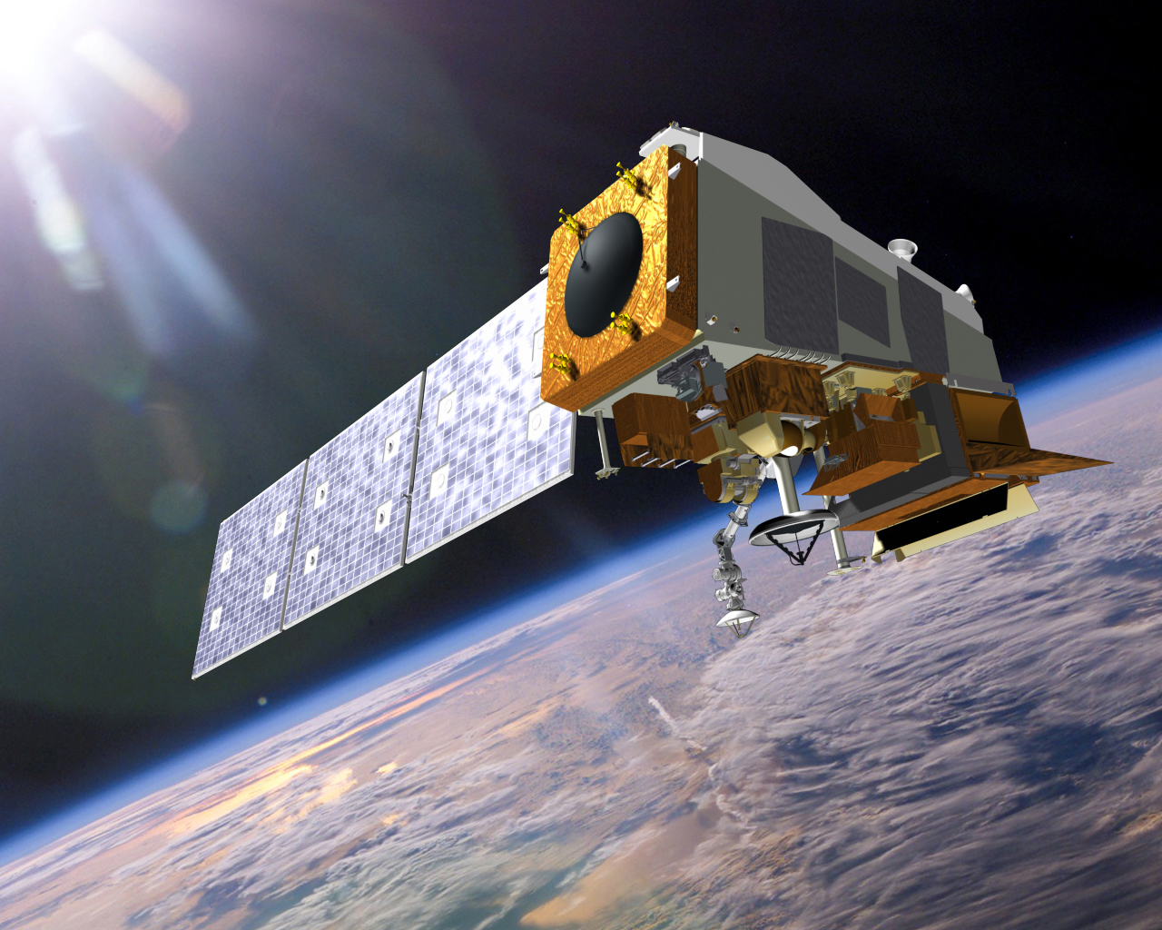
Image above: The LEMNOS project will provide laser communications services to NASA’s Orion vehicle, show in this artist concept. Image Credit: NASA.

“Laser communications will revolutionize data return from destinations beyond low-Earth orbit, enhance outreach opportunities from outer space and improve astronauts’ quality of life on long space missions,” said Don Cornwell, director of the Advanced Communication and Navigation division at the Space Communications and Navigation program office at NASA Headquarters. “As we strive to put humans on Mars for the first time, it’s imperative that we develop a communications system to support these activities at the highest level possible.”

Laser communications, also known as optical communications, is the latest space communications technology, able to provide data rates as much as a hundred times higher than current systems. This means, for example, that astronauts could send and receive ultra-high-definition video from the surface of Mars. No mission to Mars has yet had that capability. Something that basic could have wide-reaching applications, allowing the American public to “ride along” as our astronauts explore deep space while also enabling scientific discoveries with much higher resolution images and data.

The Exploration and Space Communications (ESC) projects division at NASA’s Goddard Space Flight Center in Greenbelt, Maryland, has been tapped to build LEMNOS in collaboration with the MIT Lincoln Laboratory in Lexington, Massachusetts. They worked with other NASA centers to determine specific needs the system can fulfill.

“As we started thinking about the possibility of laser communications on Orion, I spoke with the flight controllers at Johnson Space Center who are developing the communications plan for Orion’s deep space missions. They were talking about enabling communications capabilities that we take for granted, but that are so foreign in space, from streaming scientific data and video in real time, to allowing astronauts to watch the Super Bowl or keep up with an election,” said Mark Brumfield, deputy program manager of implementation for ESC. “Being able to connect with society could have great impacts to astronauts’ mental health during the mission. Right now, they wouldn’t be able to make those connections in a meaningful way, but optical communications will give us that capability.”

In the nearly 50 years between the Apollo program and the Lunar Reconnaissance Orbiter mission, data return vastly improved, as evidenced by the difference between Apollo 8’s and LRO’s earthrise images, which were relayed to Earth via a much higher-rate system. While Apollo’s communications system supported 51 kilobytes of data per second, LEMNOS will be able to support communications at rates of at least 80 megabytes per second.


Images above: The difference in image quality between the Apollo 8 Earthrise image, first and the Lunar Reconnaissance Orbiter’s Earthrise image, secondly is due, in part, to the much higher data rate available for LRO’s communications. LEMNOS will provide another order of magnitude improvement over current data rates. Images Credit: NASA.

The project just got underway at Goddard, with a goal to test LEMNOS for the first time on the second flight of Orion beyond the moon. Scheduled for one week with the option to extend for a longer mission, it will be the perfect opportunity to test the laser communications system, operating it continuously for up to an hour a day.

After the initial mission, Brumfield speculates NASA could add more laser communications terminals on future Orion exploration missions. This would increase communications capability because of the line-of-sight requirement for LEMNOS. He says it would be an evolutionary change to the way NASA does space communications.

The Space Communication and Navigation program office at NASA Headquarters provides programmatic oversight to the project. The communications team at Goddard has been tapped to build and implement the system in collaboration with MIT Lincoln Laboratory.

Related article:

NASA Taking First Steps Toward High-speed Space ‘Internet’
http://orbiterchspacenews.blogspot.ch/2017/03/nasa-taking-first-steps-toward-high.html

For more information about LEMNOS:

NASA Interns Name New Orion Communications System: https://www.nasa.gov/image-feature/goddard/2017/nasa-interns-name-new-orion-communications-system

LEMNOS webpage: https://esc.gsfc.nasa.gov/lemnos

Orion Spacecraft: https://www.nasa.gov/exploration/systems/orion/index.html

SCaN (Space Communications and Navigation), https://www.nasa.gov/directorates/heo/scan/index.html

Images (mentioned), Text, Credits: NASA’s Goddard Space Flight Center, by Ashley Hume/Rob Garner.

Greetings, Orbiter.ch

Deep Space Gateway to Open Opportunities for Distant Destinations


NASA logo.

March 29, 2017

NASA is leading the next steps into deep space near the moon, where astronauts will build and begin testing the systems needed for challenging missions to deep space destinations including Mars. The area of space near the moon offers a true deep space environment to gain experience for human missions that push farther into the solar system, access the lunar surface for robotic missions but with the ability to return to Earth if needed in days rather than weeks or months.

The period of exploration in the vicinity of the moon will begin with the first integrated mission of the Space Launch System (SLS) rocket and the Orion spacecraft, and will continue as we explore further. NASA aims to begin a cadence of one flight per year after the second mission, and the agency has established an initial set of integrated human exploration objectives combining the efforts aboard the International Space Station, SLS and Orion, and other capabilities needed to support human missions to explore deep space.

Flight hardware for SLS and Orion is currently in production for the first and second missions, life support and related technologies are being tested on ISS, and habitation and propulsion development activities are also underway. NASA is working with domestic and international partners to solve the great challenges of deep space exploration. Missions in the vicinity of the moon will span multiple phases as part of NASA’s framework to build a flexible, reusable and sustainable infrastructure that will last multiple decades and support missions of increasing complexity.

Deep Space Gateway

This first phase of exploration near the moon will use current technologies and allow us to gain experience with extended operations farther from Earth than previously completed. These missions enable NASA to develop new techniques and apply innovative approaches to solving problems in preparation for longer-duration missions far from Earth.

In addition to demonstrating the safe operation of the integrated SLS rocket and Orion spacecraft, the agency is also looking to build a crew tended spaceport in lunar orbit within the first few missions that would serve as a gateway to deep space and the lunar surface. This deep space gateway would have a power bus, a small habitat to extend crew time, docking capability, an airlock, and serviced by logistics modules to enable research. The propulsion system on the gateway mainly uses high power electric propulsion for station keeping and the ability to transfer among a family of orbits in the lunar vicinity. The three primary elements of the gateway, the power and propulsion bus and habitat module, and a small logistics module(s), would take advantage of the cargo capacity of SLS and crewed deep space capability of Orion. An airlock can further augment the capabilities of the gateway and can fly on a subsequent exploration mission, Building the deep space gateway will allow engineers to develop new skills and test new technologies that have evolved since the assembly of the International Space Station. The gateway will be developed, serviced, and utilized in collaboration with commercial and international partners.

 Lunar Space Station

“I envision different partners, both international and commercial, contributing to the gateway and using it in a variety of ways with a system that can move to different orbits to enable a variety of missions,” said William Gerstenmaier, associate administrator for Human Exploration and Operations at NASA Headquarters in Washington. “The gateway could move to support robotic or partner missions to the surface of the moon, or to a high lunar orbit to support missions departing from the gateway to other destinations in the solar system.”

Deep Space Transport

The second phase of missions will confirm that the agency’s capabilities built for humans can perform long duration missions beyond the moon. For those destinations farther into the solar system, including Mars, NASA envisions a deep space transport spacecraft. This spacecraft would be a reusable vehicle that uses electric and chemical propulsion and would be specifically designed for crewed missions to destinations such as Mars. The transport would take crew out to their destination, return them back to the gateway, where it can be serviced and sent out again. The transport would take full advantage of the large volumes and mass that can be launched by the SLS rocket, as well as advanced exploration technologies being developed now and demonstrated on the ground and aboard the International Space Station.

This second phase will culminate at the end of the 2020s with a one year mission in the lunar vicinity to validate the readiness of the system to travel beyond the Earth-moon system to Mars and other destinations, and build confidence that long-duration, distant human missions can be safely conducted with independence from Earth. Through the efforts to build this deep space infrastructure, this phase will enable explorers to identify and pioneer innovative solutions to technical and human challenges discovered or engineered in deep space.

To achieve the agency’s goal to extend humanity’s presence in the solar system will require the best research, technologies and capabilities from international partners and the private sector. NASA will look to partners for potential contributions of spaceflight hardware and the delivery of supplemental resources. The gateway and transport could potentially support mission after mission as a hub of activity in deep space near the moon, representing multiple countries and agencies with partners from both government and private industry. NASA is open to new ideas of both a technical and programmatic nature suggestions as we develop, mature and implement this plan.

Related links:

Journey to Mars: https://www.nasa.gov/topics/journeytomars/index.html

Orion Spacecraft: https://www.nasa.gov/exploration/systems/orion/index.html

Space Launch System (SLS): https://www.nasa.gov/exploration/systems/sls/index.html

Image, Text, Credits: NASA/Kathryn Hambleton.

Greetings, Orbiter.ch

mardi 28 mars 2017

NASA Sees Tropical Cyclone Debbie Make Landfall in Queensland


NASA - S-NPP Mission logo / NASA - EOS Aqua Mission logo.

March 28, 2017

Debbie (was 91P- Southern Pacific Ocean)

Tropical Cyclone Debbie made landfall in Queensland bringing heavy rainfall, hurricane-force winds, rough seas, and flooding. NASA-NOAA's Suomi NPP satellite provided a visible look at the storm from space while NASA's Aqua satellite analyzed cloud temperatures to determine the location of the strongest storms within.


Image above: On March 28 at 03:42 UTC (1:42 p.m. AEST Queensland local time /Mar. 27 at 11:42 p.m. EST) NASA-NOAA's Suomi NPP satellite captured this visible image of Tropical Cyclone Debbie over eastern Australia. Image Credits: NASA/NOAA.

Before Debbie made landfall, NASA's Aqua satellite analyzed the temperatures in the storm on Mar. 27 at 0347 UTC (Mar. 26 at 11:47 pm. EST). The infrared imagery showed a large area of cloud top temperatures in thunderstorms around Debbie's eye as cold as near minus 63.1 degrees Celsius or minus 81.6 degrees Fahrenheit. Cloud top temperatures that cold have been shown to produce heavy rainfall.

 Suomi NPP satellite. Image Credit: NASA

Cyclone Debbie made landfall north of Proserpine at Airlie Beach on March 28, shortly after noon AEST/Queensland local time (0200 UTC/March 27 at 10 p.m. EST). The Australian Bureau of Meteorology noted wind gusts stronger than 160 mph (260 kph) were recorded near landfall.

The strong winds downed trees and powerlines. Power losses occurred in a large area between the towns of Bowen and Mackay, according to Ergon Energy. The Townsville airport and ocean ports were closed.

Shortly after Debbie's 30-mile-wide (50 km) eye made landfall, the VIIRS instrument aboard NASA-NOAA's Suomi NPP satellite captured a visible image of the storm at 03:42 UTC (1:42 p.m. AEST Queensland local time /Mar. 27 at 11:42 p.m. EST). The image showed a thick band of powerful thunderstorms wrapped around the cloud-filled eye.


Image above: This infrared image from NASA's Aqua satellite was taken on Mar. 27 at 0347 UTC (Mar. 26 at 11:47 pm. EST) and showed a large area of cloud top temperatures of thunderstorms around Debbie's eye as cold as near -63.1C or -81.6F. Image Credits: NASA/JPL.

At 11:58 p.m. AEST/Queensland local time (9:58 a.m. EST/U.S.), the Australian Bureau of Meteorology (ABM) noted that the Warning Zone extended from Bowen to St Lawrence, including Mackay and the Whitsunday Islands, and extending inland to Mount Coolon and Moranbah.

Aqua satellite. Image Credit: NASA

At that time, ABM noted that maximum sustained winds near Debbie's center were near 52.8 mph (85 kph) with higher gusts. Debbie was centered near 20.8 degrees south latitude and 147.5 degrees east longitude, about 71.4 miles (115 kilometers) west southwest of Proserpine and 24.8 miles (40 kilometers) southwest of Collinsville. Debbie continued to move inland in a west-southwesterly direction at (9.3 mph) 15 kph.

ABM noted "Tropical cyclone Debbie is expected to weaken further to a tropical low during the next few hours. During the day today, this remnant low will curve from the current southwesterly motion to a more southerly track over inland Queensland.

Although the peak winds near Debbie's center are weakening rapidly tonight, heavy rainfall is expected to continue across the region for the next 12 to 24 hours, gradually contracting southwards with the system."

For additional updates from ABM, visit: http://www.bom.gov.au/cyclone/index.shtml.

Cyclone Debbie was the most powerful storm to make landfall in Queensland since Cyclone Yasi in 2011.

Suomi NPP (National Polar-orbiting Partnership): http://www.nasa.gov/mission_pages/NPP/main/index.html

Aqua Satellite: https://www.nasa.gov/mission_pages/aqua/index.html

Images (mentioned), Text, Credits: NASA's Goddard Space Flight Center/Rob Gutro.

Greetings, Orbiter.ch

Cosmic collisions at the LHCb experiment


CERN - European Organization for Nuclear Research logo.

March 28, 2017

Last week at the 52nd Rencontres de Moriond EW in La Thuile, Italy, the LHCb experiment presented the results of an unprecedented and unusual study. Instead of the usual proton-proton collisions, this time the LHCb detector registered collisions between protons and helium nuclei, which were injected near the interaction point of the experiment. This type of collision can usually only be seen far above the Earth’s atmosphere, where cosmic-ray particles – highly energetic particles from outside the Solar System – hit interstellar “dust” primarily made up of hydrogen and helium, and are detected by satellite-based experiments. Scientists want to better understand this process and, in particular, are trying to understand how many antiprotons are created when the highly-energetic cosmic-ray protons hit the helium nuclei of the interstellar medium.


Image above: An example of a fully reconstructed proton-helium collision event in the LHCb detector. The particle identified as an antiproton is shown in pink. (Image: LHCb collaboration).

The ultimate reason for this relates to the search for dark matter signals. Dark matter is an invisible type of matter – i.e. it doesn’t emit any type of electromagnetic radiation – which makes up one quarter of the matter-energy content of our universe, but its origin is as yet unknown. If dark matter is made of some kind of (as yet undiscovered) stable particles, whose existence is foreseen in many extensions of the Standard Model of particle physics, these dark matter particles might collide and produce ordinary particles and antiparticles, notably including antiprotons.

However, antiprotons can also be created via the collision of cosmic-ray protons with hydrogen and helium nuclei in the interstellar medium. Therefore, a potential sign of the presence of dark matter could be the observation of a number of antiprotons exceeding that expected from “standard” processes. And indeed, the PAMELA and AMS-02 space-based experiments found exactly such an intriguing excess of antiprotons compared to protons in cosmic-ray measurements, with an impressive level of precision.

Eureka? Unfortunately not yet, as our theoretical understanding of antiproton production from cosmic-ray collisions is still affected by large uncertainties, especially regarding the probability of antiproton production in proton-helium collisions (the so-called “cross-section”). A precise determination of the expected number of antiprotons from cosmic rays has been impossible so far, thus preventing a straightforward interpretation of the satellite experiments’ results.

Here is where the LHCb experiment came in. The idea of injecting noble gasses – such as neon, helium and argon – into the beam pipe near the interaction region was proposed for various reasons related to proton-beam luminosity measurements. But its potential was quickly recognised by the LHCb physicists and their colleagues working in astroparticle physics: the gas-injection technique could also be used to simulate the cosmic environment and measure, for the first time, the production cross-section of antiprotons in proton-helium collisions.

The proton-helium collision data used in this analysis were recorded in early May 2016. Thanks to its specialised capabilities in identifying various particles, in particular antiprotons, the LHCb experiment was also able to measure the antiproton production cross-section in a large range of relevant energies, achieving an overall precision of around 10%. This measurement significantly shrinks the uncertainty on the values of the antimatter production cross-section in proton-helium collisions that have been used so far in theoretical cosmic-ray models (see the image below).


Image above: Antiproton production cross-section in the collisions of LHC protons with helium nuclei as a function of the antiproton energy in different energy ranges. Some of the most popular models used in cosmic-ray physics are represented by the coloured solid lines, and the LHCb results are the data points superimposed. The spread amongst model predictions indicate the large uncertainty on the value of the antimatter production cross-section in proton-helium collisions prior to the LHCb measurement. It must be noted that the the vertical scale is logarithmic, hence a small vertical displacement (of the data points) corresponds to an actual large difference with respect to the theoretical models, represented by the couloured lines. (Image: LHCb collaboration).

The LHCb result will have a considerable impact on the predictions for the number of antiprotons expected from cosmic-ray collisions with the interstellar medium, and the astrophysics community is now busy incorporating it into their calculations. This work will enable the interpretation of PAMELA and AMS-02 data on the antiproton flux from space to become more constrained, shedding light on its possible dark-matter origin.

More information on this result can be found on the LHCb website: http://lhcb-public.web.cern.ch/lhcb-public/Welcome.html#pHe

Note:

CERN, the European Organization for Nuclear Research, is one of the world’s largest and most respected centres for scientific research. Its business is fundamental physics, finding out what the Universe is made of and how it works. At CERN, the world’s largest and most complex scientific instruments are used to study the basic constituents of matter — the fundamental particles. By studying what happens when these particles collide, physicists learn about the laws of Nature.

The instruments used at CERN are particle accelerators and detectors. Accelerators boost beams of particles to high energies before they are made to collide with each other or with stationary targets. Detectors observe and record the results of these collisions.

Founded in 1954, the CERN Laboratory sits astride the Franco–Swiss border near Geneva. It was one of Europe’s first joint ventures and now has 22 Member States.

Related article:

Extending Science in the Search for the Origin of the Cosmos
http://orbiterchspacenews.blogspot.ch/2017/03/extending-science-in-search-for-origin.html

Related links:

52nd Rencontres de Moriond EW: https://indico.in2p3.fr/event/13763/

Standard Model: https://home.cern/about/physics/standard-model

PAMELA: http://pamela.roma2.infn.it/index.php

AMS-02: http://home.cern/about/experiments/ams

Dark matter: https://home.cern/about/physics/dark-matter

For more information about European Organization for Nuclear Research (CERN), Visit: http://home.cern/

Images (mentioned), Text, Credits: CERN/Stefania Pandolfi.

Best regards, Orbiter.ch

Expedition 50 Spacewalks Prepare Station for Arrival of Commercial Crew Spacecraft


ISS - Expedition 50 Mission patch.

March 28, 2017


Flight Engineer Thomas Pesquet of ESA (European Space Agency) is seen floating outside the International Space Station during a spacewalk. Pesquet and Expedition 50 Commander Shane Kimbrough of NASA conducted the six-hour-and-34-minute spacewalk on March 24, 2017. The two astronauts successfully disconnected cables and electrical connections on the Pressurized Mating Adapter-3 (PMA-3) to prepare for its robotic move on Sunday, March 26. PMA-3 will be moved from the port side of the Tranquility module to the space-facing side of the Harmony module, where it will become home for the station's second International Docking Adapter, which will be delivered on a future flight of a SpaceX Dragon cargo spacecraft. They also lubricated the latching end effector on the Special Purpose Dexterous Manipulator "extension" for the Canadarm2 robotic arm, inspected a radiator valve and replaced cameras on the Japanese segment of the outpost.

A second spacewalk is scheduled for Thursday, March 30 at 8 a.m. EDT. Kimbrough and Flight Engineer Peggy Whitson of NASA will complete the PMA-3 attachment work on the Harmony module’s space-facing port. The duo will also install computer relay boxes containing software upgrades to enable future commercial crew vehicle dockings at the space station.

Fluid Physics and Human Research Before Second Spacewalk

The crew researched the effects of living in space and set up a specialized microscope for a physics experiment today. Two astronauts are also getting ready for a Thursday spacewalk to continue setting up the International Space Station for commercial crew vehicles.

Flight Engineers Peggy Whitson and Thomas Pesquet used a tape measure this morning and measured their arms, legs, hips, waist and chest. Researchers are studying how microgravity impacts body size and shape and are comparing crew measurements before, during and after a space mission.


Image above: The Pressurized Mating Adapter-3 is in the grip of the Canadarm2 robotic arm during its relocation and attachment to the Harmony module on March 26,2017.

Whitson later began setting up gear for the ACE-T-1 (Advanced Colloids Experiment Temperature Control-1) physics study. She opened up the Fluids Integrated Rack and reconfigured the Light Microscopy Module to research tiny suspended particles designed by scientists and observe how they form organized structures within water.

Commander Shane Kimbrough is getting ready for another spacewalk on Thursday at 8 a.m. EDT. This time he’ll go outside with Whitson to finish cable connections at the Harmony module where the Pressurized Mating Adapter-3 (PMA-3) was robotically attached on Sunday. The PMA-3 relocation gets the adapter ready for the new International Docking Adapter-3 set to be delivered on a future cargo mission.

Related links:

ACE-T-1 (Advanced Colloids Experiment Temperature Control-1) physics study: https://www.nasa.gov/mission_pages/station/research/experiments/2033.html

Fluids Integrated Rack: https://www.nasa.gov/mission_pages/station/research/experiments/360.html

Light Microscopy Module: https://www.nasa.gov/mission_pages/station/research/experiments/541.html

Expedition 50: https://www.nasa.gov/mission_pages/station/expeditions/expedition50/index.html

International Docking Adapter: https://www.nasa.gov/feature/meet-the-international-docking-adapter

International Space Station (ISS): https://www.nasa.gov/mission_pages/station/main/index.html

Images, Text, Credits: NASA/Sarah Loff/Mark Garcia.

Best regards, Orbiter.ch

The Splitting of the Dunes


NASA - Mars Reconnaissance Orbiter (MRO) patch.

March 28, 2017


The mound in the center of this image appears to have blocked the path of the dunes as they marched south (north is to the left in this image) across the scene. Many of these transverse dunes have slipfaces that face south, although in some cases, it's hard to tell for certain. Smaller dunes run perpendicular to some of the larger-scale dunes, probably indicating a shift in wind directions in this area.

Although it might be hard to tell, this group of dunes is very near the central pit of a 35-kilometer-wide impact crater. Data from other instruments indicate the presence of clay-like materials in the rock exposed in the central pit.

This is a stereo pair with http://www.uahirise.org/ESP_013319_1685

The map is projected here at a scale of 50 centimeters (9.8 inches) per pixel. [The original image scale is 52 centimeters (20.5 inches) per pixel (with 2 x 2 binning); objects on the order of 156 centimeters (61.4 inches) across are resolved.] North is up.

The University of Arizona, Tucson, operates HiRISE, which was built by Ball Aerospace & Technologies Corp., Boulder, Colo. NASA's Jet Propulsion Laboratory, a division of Caltech in Pasadena, California, manages the Mars Reconnaissance Orbiter Project for NASA's Science Mission Directorate, Washington.

 Mars Reconnaissance Orbiter (MRO): http://www.nasa.gov/mission_pages/MRO/main/index.html

Image, Text, Credits: NASA/JPL/Martin Perez.

Greetings, Orbiter.ch

Final two ExoMars landing sites chosen


ESA - ExoMars Mission logo.

28 March 2017

Two ancient sites on Mars that hosted an abundance of water in the planet’s early history have been recommended as the final candidates for the landing site of the 2020 ExoMars rover and surface science platform: Oxia Planum and Mawrth Vallis.

A primary technical constraint is that the landing site be at a suitably low level, so that there is sufficient atmosphere to help slow the landing module’s parachute descent.

ExoMars rover

Then, the 120 x 19 km landing ellipse should not contain features that could endanger the landing, the deployment of the surface platform ramps for the rover to exit, and driving of the rover. This means scrutinising the region for steep slopes, loose material and large rocks.

Oxia Planum was selected in 2015 for further detailed evaluation. Although not yet complete, the investigation so far indicates that the region would meet the various constraints. In addition, one other site had to be chosen from Aram Dorsum and Mawrth Vallis.

After a two-day meeting with experts from the Mars science community, industry, and ExoMars project, during which the scientific merits of the three sites were presented alongside the preliminary compliance status with the engineering constraints, it was concluded that Mawrth Vallis will be the second site to be evaluated in more detail.

Around a year before launch, the final decision will be taken on which site will become the ExoMars 2020 landing target.

Oxia Planum texture map

All of the sites lie just north of the equator, in a region with many channels cutting through from the southern highlands to the northern highlands. As such, they preserve a rich record of geological history from the planet’s wetter past billions of years ago, and are prime targets for missions like ExoMars that are searching for signatures of past life on Mars.

Oxia Planum lies at a boundary where many channels emptied into the vast lowland plains and exhibits layers of clay-rich minerals that were formed in wet conditions some 3.9 billion years ago.

Observations from orbit show that the minerals in Oxia Planum are representative of those found in a wide area around this region, and so would provide insight into the conditions experienced at a global scale during this epoch of martian history.

Mawrth Vallis martian mosaic

Mawrth Vallis is a large outflow channel a few hundred kilometres away from Oxia Planum. The proposed landing ellipse is just to the south of the channel. The entire region exhibits extensively layered, clay-rich sedimentary deposits, and a diversity of minerals that suggests a sustained presence of water over a period of several hundred million years, perhaps including localised ponds.

In addition, light-toned fractures containing ‘veins’ of water-altered minerals point to interactions between rocks and liquid in subsurface aquifers, and possible hydrothermal activity that may have been beneficial to any ancient life forms.

Mawrth Vallis offers a window into a large period of martian history that could probe the early evolution of the planet’s environment over time.

“While all three sites under discussion would give us excellent opportunities to look for signatures of ancient biomarkers and gain new insights into the planet’s wetter past, we can only carry two sites forward for further detailed analysis,” says Jorge Vago, ESA’s ExoMars rover project scientist.

"Thus, after an intense meeting, which focused primarily on the scientific merits of the sites, the Landing Site Selection Working Group has recommended that Mawrth Vallis join Oxia Planum as one of the final two candidates for the ExoMars 2020 mission.

“Both candidate sites would explore a period of ancient martian history that hasn’t been studied by previous missions.”

ExoMars rover 360

Efforts will now focus on understanding these two sites in the greatest possible detail. On the science side, this includes identifying specific sites where the rover could use its drill to retrieve samples from below the surface, and to define possible traverses it could make covering up to 5 km from its touchdown point in order to reach the maximum number of interesting sites.

On the engineering side, teams will continue to map the distribution and sizes of rocks and craters, and to document the angles of local slopes and the coverage of soft ‘sand’, to ensure the landing and traverses across the planet are as safe as possible. A detailed study will now begin for Mawrth Vallis.

The rover and stationary surface science platform contain suites of instruments that will conduct a thorough analysis of the landing site and its surroundings. While the rover will drive to different locations to analyse the surface and subsurface in search of clues for past life, the stationary platform will provide context imaging at the landing site, and long-term climate monitoring and atmospheric investigations.

ExoMars, a joint endeavour between ESA and Roscosmos, is a two part mission: the Trace Gas Orbiter arrived at Mars in late 2016, and in addition to its own science mission analysing the atmosphere for rare gases that may be related to biological or geological activity, it will also act as a data relay for the 2020 mission. 

Notes for Editors:

Explore ExoMars landing sites with the interactive tool Where on Mars: http://whereonmars.co/

Detailed descriptions of the three sites considered in the latest meeting are available here:

Aram Dorsum: http://exploration.esa.int/mars/54722-aram-dorsum/

Mawrth Vallis: http://exploration.esa.int/mars/54721-mawrth-vallis/

Oxia Planum: http://exploration.esa.int/mars/54724-oxia-planum/

More information about the Landing Site Selection Working Group is available here: http://exploration.esa.int/mars/53454-exomars-2018-landing-site-selection-working-group/

Related links: 

ExoMars: http://www.esa.int/Our_Activities/Space_Science/ExoMars

Roscosmos: http://en.federalspace.ru/

ExoMars at IKI: http://exomars.cosmos.ru/

Thales Alenia Space: https://www.thalesgroup.com/en/worldwide/space/space

NASA In 2016 ExoMars orbiter (Electra radio): http://mars.nasa.gov/programmissions/missions/future/exomarsorbiter2016/

Where on Mars?: http://whereonmars.co/

ExoMars for broadcasters: http://www.esa.int/esatv/Transmissions/2016/10/ExoMars_at_Mars_live_coverage

Images, Video, Text, Credits: ESA/Markus Bauer/Jorge Vago/ATG medialab/Base map: NASA/JPL-Caltech/Arizona State University; analysis: IRSPS/TAS-I/DLR/FU Berlin, CC BY-SA 3.0 IGO.

Best regards, Orbiter.ch