

NASA - ARTEMIS Program logo.
Mar 25, 2021
Space communications and navigation engineers at NASA are evaluating the navigation needs for the Artemis program, including identifying the precision navigation capabilities needed to establish the first sustained presence on the lunar surface.
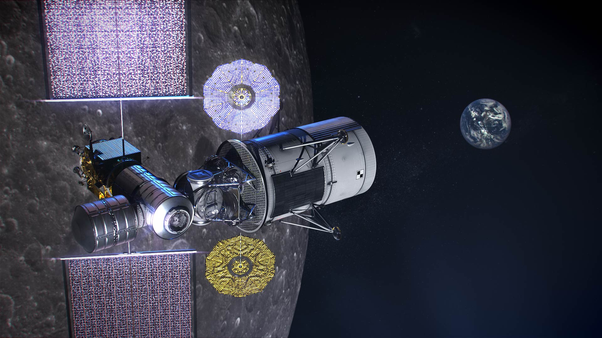
Image above: Illustration of NASA's lunar-orbiting Gateway and a human landing system in orbit around the Moon. Image Credit: NASA.
“Artemis engages us to apply creative navigation solutions, choosing the right combination of capabilities for each mission,” said Cheryl Gramling, associate chief for technology in the Mission Engineering and Systems Analysis Division at Goddard Space Flight Center in Greenbelt, Maryland. “NASA has a multitude of navigation tools at its disposal, and Goddard has a half-century of experience navigating space exploration missions in lunar orbit.”
Alongside proven navigation capabilities, NASA will use innovative navigation technologies during the upcoming Artemis missions.
"Lunar missions provide the opportunity to test and refine novel space navigation techniques," said Ben Ashman, a navigation engineer at Goddard. "The Moon is a fascinating place to explore and can serve as a proving ground that expands our navigation toolkit for more distant destinations like Mars."
Ultimately, exploration missions need a robust combination of capabilities to provide the availability, resiliency, and integrity required from an in-situ navigation system. Some of the navigation techniques being analyzed for Artemis include:
Radiometrics, Optimetrics and Laser Altimetry
Radiometrics, optimetrics, and laser altimetry measure distances and velocity using the properties of electromagnetic transmissions. Engineers measure the time it takes for a transmission to reach a spacecraft and divide by the transmission's rate of travel — the speed of light.

Image above: The Lunar Orbiter Laser Altimeter (LOLA) aboard the Lunar Reconnaissance Orbiter (LRO) sends laser pulses down to the surface of the Moon from the orbiting spacecraft. These pulses bounce off of the Moon and return to LRO, providing scientists with measurements of the distance from the spacecraft to the lunar surface. As LRO orbits the Moon, LOLA measures the shape of the lunar surface, which includes information about the Moon's surface elevations and slopes. This image shows the slopes found near the South Pole of the Moon. Image Credits: NASA/LRO.
These accurate measurements have been the foundation of space navigation since the launch of the first satellite, giving an accurate and reliable measurement of the distance between the transmitter and spacecraft’s receiver. Simultaneously, the rate of change in the spacecraft’s velocity between the transmitter and spacecraft can be observed due to the Doppler effect.
Radiometrics and optimetrics measure the distances and velocity between a spacecraft and ground antennas or other spacecraft using their radio links and infrared optical communications links, respectively. In laser altimetry and space laser ranging, a spacecraft or ground telescope reflects lasers off the surface of a celestial body or a specially designated reflector to judge distances.
Optical Navigation
Optical navigation techniques rely on images from cameras on a spacecraft. There are three main branches of optical navigation.
- Star-based optical navigation uses bright celestial objects such as stars, moons, and planets for navigation. Instruments use these objects to determine a spacecrafts’ orientation and can define their distance from the objects using the angles between them.
- As a spacecraft approaches a celestial body, the object begins to fill the field of view of the camera. Navigation engineers then derive a spacecraft’s distance from the body using its limb — the apparent edge of the body — and centroid, or geometric center.
- At a spacecraft’s closest approach, Terrain Relative Navigation uses camera images and computer processing to identify known surface features and calculate a spacecraft’s course based on the location of those features in reference models or images.
Weak-Signal GPS and GNSS
Illustration of of Firefly Aerospace’s Blue Ghost lander on the lunar surface
Illustration of Firefly Aerospace’s Blue Ghost lander on the lunar surface. The lander will carry a suite of 10 science investigations and technology demonstrations to the Moon in 2023 as part of NASA's Commercial Lunar Payload Services (CLPS) initiative.
Credits: Firefly Aerospace
NASA is developing capabilities that will allow missions at the Moon to leverage signals from Global Navigation Satellite System (GNSS) constellations like the U.S. GPS. These signals — already used on many Earth-orbiting spacecraft — will improve timing, enhance positioning accuracy, and assist autonomous navigation systems in cislunar and lunar space.

Image above: Illustration of Firefly Aerospace’s Blue Ghost lander on the lunar surface. The lander will carry a suite of 10 science investigations and technology demonstrations to the Moon in 2023 as part of NASA's Commercial Lunar Payload Services (CLPS) initiative. Image Credit: Firefly Aerospace.
In 2023, the Lunar GNSS Receiver Experiment (LuGRE), developed in partnership with the Italian Space Agency, will demonstrate and refine this capability on the Moon’s Mare Crisium basin. LuGRE will fly on a Commercial Lunar Payload Services mission delivered by Firefly Aerospace of Cedar Park, Texas. NASA will use data gathered from LuGRE to refine operational lunar GNSS systems for future missions.
Autonomous Navigation
Autonomous navigation software leverages measurements like radiometrics, celestial navigation, altimetry, terrain-relative navigation, and GNSS to perform navigation onboard without contact with operators or assets on Earth, enabling spacecraft to maneuver independently of terrestrial mission controllers. This level of autonomy enables responsiveness to the dynamic space environment.
Autonomous navigation can be particularly useful for deep space exploration, where the communications delay can hamper in-situ navigation. For example, missions at Mars must wait eight to 48 minutes for round trip communications with Earth depending on orbital dynamics. During critical maneuvers, spacecraft need the immediate decision-making that autonomous software can provide.
LunaNet Navigation Services
LunaNet is a unique communications and navigation architecture developed by NASA’s Space Communications and Navigation (SCaN) program. LunaNet’s common standards, protocols, and interface requirements will extend internetworking to the Moon, offering unprecedented flexibility and access to data.

Image above: Artist's conceptualization of Artemis astronauts using LunaNet services on the Moon. a unique approach to lunar communications and navigation. The LunaNet communications and navigation architecture will enable the precision navigation required for crewed missions to the Moon and place our astronauts closer to scientifically significant lunar sites, enhancing the our missions’ scientific output. Image Credits: NASA/Resse Patillo.
For navigation, the LunaNet approach offers operational independence and increased precision by combining many of the methods above into a seamless architecture. LunaNet will provide missions with access to key measurements for precision navigation in lunar space.
Learn more about NASA’s Space Communication and Navigation program here: https://www.nasa.gov/SCaN/
Related links:
LunaNet: https://esc.gsfc.nasa.gov/projects/TEMPO?tab=lunanet
Lunar GNSS Receiver Experiment (LuGRE): https://www.nasa.gov/feature/nasa-enlists-commercial-partners-to-fly-payloads-to-moon
Commercial Lunar Payload Services: https://www.nasa.gov/content/commercial-lunar-payload-services
Artemis: http://www.nasa.gov/artemis
Images (mentioned), Text, Credits: NASA/Daniel Baird/GSFC/By Danny Baird.
Greetings, Orbiter.ch